Mountain Rendezvous 2013 – Part One
After having to skip Desert Rendezvous and Overland Expo earlier this year, it was a relief to be able to attend Mountain Rendezvous 2013 (MR13), hosted by American Adventurist. Like last year, it was held at Camp Taquitz, a short distance south of Big Bear in southern California. I really look forward to these events: checking out the vehicles, talking shop, sitting around the campfire with some bourbon in a titanium mug, and seeing old friends and making new ones.
This year I’d be taking part in the Dutch Oven cook-off too. I’m a real noob at it, but baking Carrie’s wonderful French bread recipe seems to be something I can pull off. So I was packing two large packs of pre-made dough in my cooler, my Dutch Oven and accessories, and I had my fingers crossed for the best.
MR13 is a long drive from my home in San Jose, being well over 400 miles and with a drive time of about 6-1/2 hours, not including any stops or side trips. Last year I drove down on Friday, recovered in camp on Saturday, and drove back on Sunday. Determined not to be quite so dumb this time, I had decided to head down on Thursday and camp out overnight in the San Bernadino National Forest. On Friday morning I would drive the Big Pine Flats trail, ending up in Big Bear City for gas and some food before making the last 30-minnute drive to MR13.
Originally I had planned to convoy down with Anthony & Astrid (@overlandnomads) as we had the previous year, but they had to bail out this time around. I made my solo drive plans, and then friends Gianni and Raquel decided to join me, although they would be following a few hours behind me on the first day.
I made the long and boring drive down and into the mountains, where things finally get interesting. I drove past the trail exit so that I could visit the ranger station and visitor center on the north shore of Big Bear Lake, in the oddly-named town of Fawnskin. I wasn’t sure if I would need a National Forest “Adventure Pass” for dispersed camping that night, but the rangers assured me that the pass was only needed if you used any of the added infrastructure, e.g. those places with paved parking areas and restrooms and the like. They also familiarized me with the various rules for dispersed camping in the area.
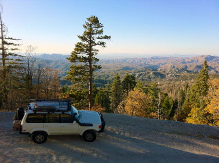
I drove back west and turned north off the highway to get to the trailhead, and where the dirt started. My plan was to find someplace to camp pretty quickly, before it got dark and cold. I noticed that I still had a data signal, so I pulled over to the side to text Gianni and let him know my plans. The next thing I knew, a 70-series Land Cruiser appeared, beeped and the occupants waved as they drove past me. I ended up catching up to Bente and Hans (www.offroad-travel.net) a short while later. They were a German couple who had been overlanding for the past several years. I had assumed that they must be there for Mountain Rendezvous as I was, but no… It was just pure coincidence. They had no idea MR was going on starting the next day, just a short distance away.
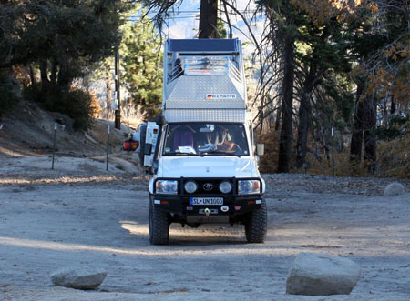
I explained the event and they sounded interested, so I gave them the coordinates. They’d been to OX13 earlier in the year and their sweet turbo-diesel pop-top 70 was one of the featured vehicles there. After we chatted some more, they’d picked out their camping spot for the night and I bid them farewell as I continued on a ways.
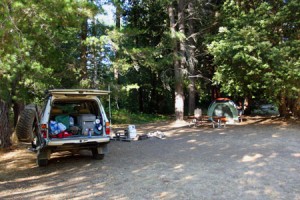
Reaching the water crossing on the trail I found my way blocked. There was a tree down across the water crossing path, and two pickup trucks were in the way on the path to go around it. One of the pickups was stuck up on some small stumps, and they had a chainsaw out, which perhaps explained the fallen tree. In any case I wasn’t going to get through with these guys in the way, by myself, and with darkness coming soon, so I opted to backtrack. I ended up finding a spot back near Bente & Hans, and there would be room for Gianni and Raquel as well, so I texted them my coordinates and settled in.
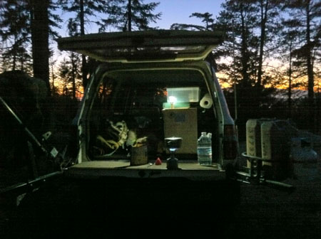
Sometime after dark the guys in the pickups passed by, having finally managed to make it through. I settled in on my tailgate with my backpacking stove, with a dehydrated bag of chili mac for dinner, along with a nice cold can of Boddington’s. Gianni & Raquel (and their microscopic old dog Dmitri) arrived an hour later and set up their tent. It was cold out but not terribly so, particularly as I’d put on my base layers and bundled up. Still, after chatting for a while we went to bed early. We’d done a few miles of the Big Pine Flat trail but the majority would come tomorrow, and then we’d head over to MR13.
Catching Up
Well, its been too long since my last post so its time to catch up on things. I’ll start with the Land Cruiser, since Mountain Rendezvous 2013 is coming up in just a few weeks.
Like many 80-series owners, I had the common P0401 error code show up. Fortunately, this is a pretty minor thing but it can take some effort to square away. There are a lot of threads (like this one) on ih8mud about this code and how to go about correcting it, so doing that research was my first step.
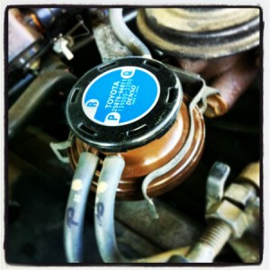
So in the Land Cruiser’s exhaust recirculation system is something called an EGR control. valve, Because it uses a thin rubber membrane to keep carbon dust and such from entering the engine, and because of its location in one of the hotter spots in the engine bay, the rubber membrane will tear and fail over time. Carbon passes through and can cause a number of issues, including blocking the gas port it passes through, or jamming the VSV valve in the open position.
In my case, I cleaned out a couple of small air hoses and replaced the EGR valve with the current replacement, which is apparently the style used on the 60 series trucks. This version doesn’t fail like the 80 series version, apparently. So far so good and the error code has not come up again. I’m hoping that’s all there is to it. If it does come up again, I’ll probably need to take off the upper intake plenum (no I didn’t just make that up!) and clean out any carbon build-up.
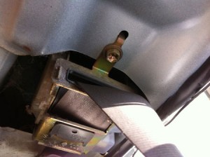
Moving on, the driver seat belt had frayed in one spot. Not too badly but I don’t like frayed webbing. As a precaution, I swapped it out for a replacement belt assembly. I was able to do it myself pretty easily. It would have gone quicker if I’d taken more photos when I took the original assembly out, but luckily I had the passenger=side assembly to refer to. Overall a simple job and being a safety system, I was sure to torque everything to exact factory specs and verify proper function. It’s a good feeling to know the job was done just right.
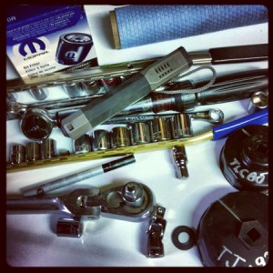
I did my first oil change on the 80 as well. Previous oil changes I’d had done at the shop. It’s a little trickier than on the Jeep but not much. I found that marking a witness line on the filter was a good idea, since the method of correctly tightening the filter is to make contact with the engine body and then tighten a further 3/4th turn.
I had the tires rotated and balanced, and had the alignment done. Now at about 225,000 miles, the front wheel bearings need to be repacked, so that’s next on the list.
The vaunted compressor on my Engel MT45 freezer/fridge appears to have died. That was the conclusion of the Engel USA rep I spoke to about the problem. It’s pricey to replace, unfortunately, and Engel USA was out of stock when we spoke. They’re supposed to call and/or email when they are available again.
I think that pretty much covers all the maintenance and other issues for the past several months. Other than the fridge (which is probably beyond my limited budget for the moment), hopefully everything will be in order and ready for MR13.
Drive #8: Kings Peak Road
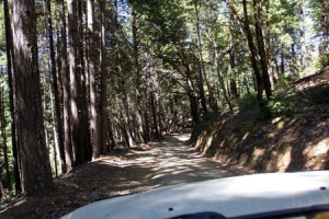
Kings Peak Road
Date Driven: 8/11/12
Length: Kings Peak Road to AW Way Park, 27.7 miles. 17 miles of dirt.
My drive time: 1 hour, 32 minutes
Start: intersection of Kings Peak Rd and Shelter Cove Road, N40º 02.330′ W124º 01.955′
End: A.W. Way County Park campground, N40º 16.145′ W124º 13.918′
GPS Track: GPX or KMZ format. (right click -> Save As)
Source(s): Tour 11 in California Coastal Byways (Tony Huegel), and listed under trail section 4 in the Guide to Northern California Backroads & 4-Wheel Drive Trails (Wells).
Summary: This drive is a little north of Usal Road and presents a nice opportunity for more dirt road driving on Northern California’s Lost Coast. This drive ends at the A.W. Way County Park alongside the Mattole River.
This drive is a natural extension of Drive #5: Usal Road – Southern End to Usal Beach and Drive #6: Usal Road – Usal Beach to Shelter Cove.
Description: Beginning at its southern end, Kings Peak Road is a wide, well-graded dirt road. We made excellent time, while keeping our speeds moderate due to the occasional oncoming traffic. We passed a few park/recreational areas along the way, but little else. Eventually the road tightens up and there are some forks to select, and the road gets rougher and wilder.
Passing a few runoff streams, we eventually reached a large bridge and then began a long, steep climb via a series of hairpin switchbacks.
Eventually we topped out and shortly after reached pavement at Wilder Ridge Road, which we took to Mattole Road at the town of Honeydew. From there it took about a half hour to drive the 8.3 miles to our destination for the day, the A.W. Way (Humboldt) County Park next to the Mattole River. I had read that this park rarely seemed busy, but it certainly was packed when we were there! We lucked into campsite #9 which was right by the river and in a semi-secluded corner compared to most of the other sites. The river was calm and scenic, and we swam and lounged in the slow-moving water which provided welcome relief from the hot afternoon sun.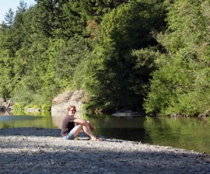
As with Usal Road, we had virtually no AT&T cell coverage on this drive.
The next day we continued our trip by visiting the coast, Eureka and Ferndale to the north. My full Lost Coast road trip report including photo galleries can be found in three earlier blog posts: Part One, Part Two, and Part Three.
I’ve cleaned up the track for this drive just a bit, to get rid of the driving around the park we did before settling on our campsite.
Disclaimer – This information is provided from the best of my recollection and is necessarily subjective. GPS data is from a personal device inside my vehicle, so coordinates will not be exact. Use of any of this information is at your own risk and responsibility – period. Conditions change (especially in winter), vehicles and driver skills vary, etc. and I have no control over these things. Don’t let anything written here override your own personal common sense or safety.
Drive #7: South Coast Ridge Road
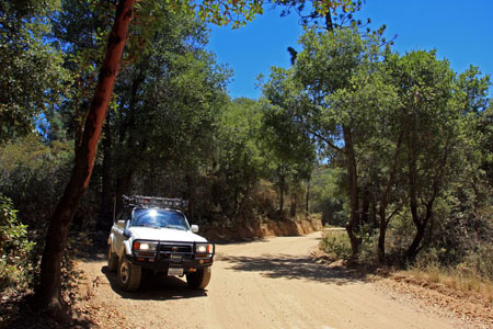
South Coast Ridge Road
Dates Driven: 11/18/07 and 7/5-7/13
Length: NW end of SCRR to Highway 1 at the SW end of Los Burros Rd., 23.2 miles. almost all dirt.
My drive time: 1 hour, 50 minutes
Start: intersection of Nacimiento-Furgusson Rd and South Coast Ridge Road, N36º 00.587′ W121º 27.149′
End: Intersection of Los Burros Rd. and Highway 1, N35º 53.146′ W121º 27.518′
GPS Track: GPX or KMZ format. (right click -> Save As) Please note these have been edited to combine the tracks from both days. It also includes our side trip to/from Alder Creek campground, which adds 2.7 miles and 23 minutes to the drive info shown above.
Source(s): Tour 21 in California Coastal Byways (Tony Huegel), and trail #52 in the Guide to Northern California Backroads & 4-Wheel Drive Trails (Wells). Both cover pretty much the same route that I chose. The length of SCRR (only) is covered in Backcountry Adventures – Southern California (Massey) as trail CM49.
Summary: This drive covers 15 miles of the 25-mile long South Coast Ridge Road (SCRR) before turning onto Los Burros Rd. and driving to our Independence day weekend camp site. From there we visited the Alder Creek campsite down a rougher side trail, before heading back and down Los Burros Rd. to Highway 1.
Description: Beginning at its northwest end, SCRR is a well-graded dirt road. Its often wide enough for vehicles to easily pass each other, but in some places it narrows to a single vehicle width. We made excellent time, while keeping our speeds moderate in case of oncoming traffic on blind crests and corners. As it turned out, we encountered no other traffic on this, our second visit. SCRR got a bit rougher in places as we neared the southern portion of our drive on it. Los Burros Road and the spur road to our camp were also recently graded. The side trail to Alder Creek camp was rougher and included large ruts to navigate.
There are numerous intersections and side trails, so good maps are recommended. There are no services or facilities along this drive, and our cell service was very sparse.
For a description of our overnight camping trip here and related information, check out this post.
Disclaimer – This information is provided from the best of my recollection and is necessarily subjective. GPS data is from a personal device inside my vehicle, so coordinates will not be exact. Use of any of this information is at your own risk and responsibility – period. Conditions change (especially in winter), vehicles and driver skills vary, etc. and I have no control over these things. Don’t let anything written here override your own personal common sense or safety.
