Drive #6: Usal Road – Usal Beach to Shelter Cove

Date Driven: 8/11/12
Length: 30 miles
My drive time: 2 hours, 24 minutes
Start: Usal Beach campground intersection, N39º 450.107′ W123º 50.650′
End: Shelter Cove, N40º 01.391′ W124º 04.118′
GPS Track: GPX or KMZ format. (right click -> Save As)
Source(s): See my earlier Usal Beach post for a list of references, including links.
Summary: Picking up from where Drive #5 ends at the Usal beach campground area, we head north along the Lost Coast. After 18.8 more miles of Usal Road, we arrive at the northern end at Four Corners. We regretfully say goodbye to the dirt – for now – and continue on pavement north and then west down to Shelter Cover.
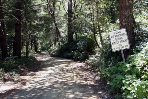
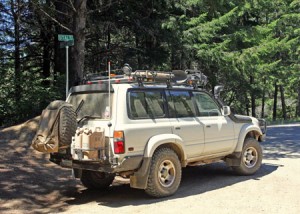
Description: Leaving the Usal beach campgrounds, we continued north on Usal Road. After a few miles we can tell it has been longer since the dirt road has last been graded, and there are more ruts and rocks. But since it is dry, it’s still an easy drive in the Land Cruiser. Passing through the thick woods and foliage, we encounter only a single bicyclist and two motorcycles before reaching pavement at Four Corners.
From there we’re back on pavement for the most part. When we reach Shelter Cove Road, we turn west towards the Pacific and begin a steep downhill descent. We stop at the market/gas station for a few supplies before heading down into Shelter Cove for lunch at the deli/cafe to conclude this drive. We had lunch out on the large deck area, and there here are public restrooms there across the street from the deli.
After lunch, we drove back up the hill to begin Drive #7, Kings Peak Road to the AW Way county park where we camped for the night.
My full Lost Coast road trip report including photo galleries can be found in three earlier blog posts: Part One, Part Two, and Part Three. We had a great trip!
As with Drive #5, I’ve cleaned up the track for this drive just a bit, this time to remove a turn we missed along Usal Road.
Disclaimer – This information is provided from the best of my recollection and is necessarily subjective. GPS data is from a personal device inside my vehicle, so coordinates will not be exact. Use of any of this information is at your own risk and responsibility – period. Conditions change (especially in winter), vehicles and driver skills vary, etc. and I have no control over these things. Don’t let anything written here override your own personal common sense or safety.