The Lost Coast, Part Three
When I left off in Part One and Part Two, we’d just completed Usal Road and arrived back at pavement at Four Corners. From there we drove north on Chemise Mountain Road, which was much like a (mostly) paved version of Usal Road. Before long we reached Shelter Cove Road and began the big downhill drive to Shelter Cove.
On the way we stopped at the Shelter Cover General Store for some supplies. They have a gas pump there but it was very expensive if I remember correctly. Fortunately, we were fine on fuel so that wasn’t an issue. There’s a Porta-Potty here too but you’re better off using the public restroom in Shelter Cover near the lighthouse and deli.
We drove into Shelter Cove and thought about eating at the Tea House but that wasn’t really our thing and we weren’t looking to spend a ton of money on lunch. Also, the place was deserted even on a Saturday afternoon. I have read that they’re retiring and closing in another week, which is unfortunate, because options are always good.
We ate instead at the nearby RV campground deli, and ate out on the patio with a dozen other people who mostly appeared to be locals. They smoked, fed the seagulls, and a guy with NRA stickers on his UTV drove it up and past each trash can where he fished out bottles for recycling. The town had a really weird vibe for us, but perhaps that’s to be expected in this very remote part of the state. Lunch was just what the doctor ordered!
After lunch we drove back up the hill out of town and turned north onto Kings Peak Road, our next stretch of dirt road which ran about 17 miles. It started off very well-graded and wider than Usal Road, so we made better time. We passed a few other vehicles and a couple of recreation area trailheads. We saw a ranger truck parked at one of those. The road gradually tightening up and became rougher, and there was no other traffic seen on those sections. At one point we reached a bridge and from there climbed up up up, and along a series of hairpin switchbacks.
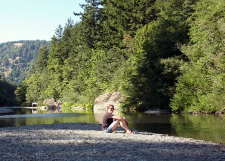
Eventually we again reached pavement at Wilder Ridge Road which we took to Mattole Road at the town of Honeydew, and from there it took a half hour to drive the 8.3 miles to our destination for the day, the A.W. Way (Humboldt) County Park next to the Mattole River. I had read that this park rarely seemed busy, but it certainly seemed crowded & busy to us! We lucked into campsite #9 which was right by the river and in a semi-secluded corner compared to most of the other sites. The site was very nice and the river was fantastic, and we splashed around its waters to get relief from the hot afternoon weather.
The crowds at the park left something to be desired, with people shouting and making nose well past (and before) the designated “quiet time”. Also the #1 rule for the park was that all pets must be on leash as a “common courtesy”, but few were, because their owners suck. 🙂 We expect this sort of thing at drive-up campgrounds though, based on previous experiences, so we can’t complain too much. On the plus side, there were good restrooms (until toilets in both men & women’s rooms were clogged and overflowed by other campers) and fresh water spigots at pretty much every site. This was quite the luxury compared to Usal Beach campground.
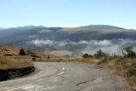
The next day after breakfast we departed and headed north on Mattole Road, up through the Cape Mendocino area, which is the westernmost point in California. The guidebooks speak of the horrors of Mattole Road: it’s narrow, twisty, and covered with suspension-shattering potholes… But of course all of these were nothing compared to Usal or Kings Peak Roads. In fact it was rarely narrow, I think there were no real blind corners, and the Land Cruiser went over the potholes like they weren’t there. We enjoyed the drive along the coast and the views from the coastal hills, and the weather was nice despite the coastal fog.
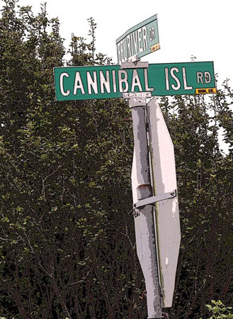
Completing Mattole Road, we continued north, briefly marveling at being on a highway again for a little over a mile. We hadn’t traveled in this sort of luxury for a few days now! We got off to explore the irresistibly-named Cannibal Island Road, and then continued on to the northernmost point of our trip, the Lost Coast Brewery in Eureka. After lunch and sampling the tasty beers we finally stopped for our only gas stop of the 683-mile trip, and drove back to Ferndale for the night.
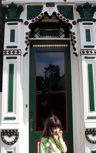
Ferndale is a very pretty town. In fact it’s the 11th-prettiest in the country, if Forbes is to be believed. We were inclined to agree, with the many charming Victorian-style buildings and more. There are lots of snapshots of them in the gallery. We explored the downtown for an hour or more, and bought a few things at The Blacksmith Shop and Golden Gait Mercantile, before settling in at the charming old Ivanhoe Hotel for the night. After chillaxin’ on the porch with a beer, we had a good dinner across the corner at The VI Restaurant in the Victorian Inn. We stuffed ourselves and waddled back to our room for the night.
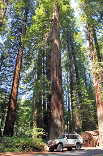
After breakfast at Poppa Joe’s a few doors down the street, we started the journey home. It didn’t take long to reach the northern end of the Avenue of the Giants Highway, which we drove the length of on our way south. We stopped at a touristy gift shop, the Humboldt Redwoods State Park visitors center, and at a random spot among the amazing redwoods to enjoy the place.
From there it was a long slog south back to San Jose, with just a pit stop at my usual convenience store in Novato for snacks, drinks, and a quick bio break. We arrived home a little before 6pm, tired but happy. It had been another excellent road trip, and it was time to start scheming plans for the next one…
I have very fond memories of Shelter Cove. My family had a house there for a number of years. I really liked all of the forested areas and the black sand beach!
October 9th, 2012 at 10:08 amJim, it’s certainly a very pretty area! I’d like to get back and explore more of it. I missed the black sand beach. There’s a really great black sand beach – and a nearby red sand beach – on Maui.
October 9th, 2012 at 10:24 am