Drive #8: Kings Peak Road
Kings Peak Road
Date Driven: 8/11/12
Length: Kings Peak Road to AW Way Park, 27.7 miles. 17 miles of dirt.
My drive time: 1 hour, 32 minutes
Start: intersection of Kings Peak Rd and Shelter Cove Road, N40º 02.330′ W124º 01.955′
End: A.W. Way County Park campground, N40º 16.145′ W124º 13.918′
GPS Track: GPX or KMZ format. (right click -> Save As)
Source(s): Tour 11 in California Coastal Byways (Tony Huegel), and listed under trail section 4 in the Guide to Northern California Backroads & 4-Wheel Drive Trails (Wells).
Summary: This drive is a little north of Usal Road and presents a nice opportunity for more dirt road driving on Northern California’s Lost Coast. This drive ends at the A.W. Way County Park alongside the Mattole River.
This drive is a natural extension of Drive #5: Usal Road – Southern End to Usal Beach and Drive #6: Usal Road – Usal Beach to Shelter Cove.
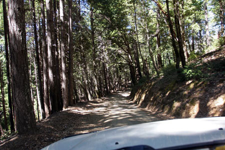
Description: Beginning at its southern end, Kings Peak Road is a wide, well-graded dirt road. We made excellent time, while keeping our speeds moderate due to the occasional oncoming traffic. We passed a few park/recreational areas along the way, but little else. Eventually the road tightens up and there are some forks to select, and the road gets rougher and wilder.
Passing a few runoff streams, we eventually reached a large bridge and then began a long, steep climb via a series of hairpin switchbacks.
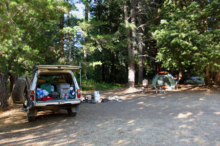
Eventually we topped out and shortly after reached pavement at Wilder Ridge Road, which we took to Mattole Road at the town of Honeydew. From there it took about a half hour to drive the 8.3 miles to our destination for the day, the A.W. Way (Humboldt) County Park next to the Mattole River. I had read that this park rarely seemed busy, but it certainly was packed when we were there! We lucked into campsite #9 which was right by the river and in a semi-secluded corner compared to most of the other sites. The river was calm and scenic, and we swam and lounged in the slow-moving water which provided welcome relief from the hot afternoon sun.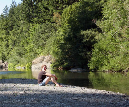
As with Usal Road, we had virtually no AT&T cell coverage on this drive.
The next day we continued our trip by visiting the coast, Eureka and Ferndale to the north. My full Lost Coast road trip report including photo galleries can be found in three earlier blog posts: Part One, Part Two, and Part Three.
I’ve cleaned up the track for this drive just a bit, to get rid of the driving around the park we did before settling on our campsite.
Disclaimer – This information is provided from the best of my recollection and is necessarily subjective. GPS data is from a personal device inside my vehicle, so coordinates will not be exact. Use of any of this information is at your own risk and responsibility – period. Conditions change (especially in winter), vehicles and driver skills vary, etc. and I have no control over these things. Don’t let anything written here override your own personal common sense or safety.