The Lost Coast, Part One
The Lost Coast
The Lost Coast really came to my attention when we went on our first group offroading trips back in 2002. I’d heard the term before, and knew from a previous road trip up the California and Oregon coasts that it was an area where the highways went inland, strangely bypassing the far-western cape of California. Like everyone else, we’d followed the major highways north and inland, bypassing it too. That was all I knew about it at the time.
In addition to the Henness Pass and Cisco Butte trips we took in ’02, the CA4WDC group at the time also offered an SUV trip in this enticingly-named area. I read the brief description in the club newsletter. We liked the northern California coast and redwoods, so we knew right away that we wanted to do this trip too.
We could have gone the following year, but we had a newborn baby to deal with. An offroading trip with camping was not really in the cards! Unfortunately, at some point soon after, they stopped offering this annual trip. I don’t know why.
I still thought about it now and again over the years, and it was on my lengthy “You know, I really want to check out this area….” list. Somehow, it stayed on that list for a full decade. Until now. It was time to finally check this one off the list. So I did my research (books and the internet) and planned it as a four-day trip, Friday through Monday.
The Plan
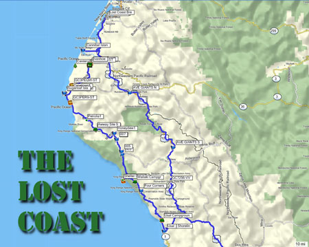
FRIDAY Drive from San Jose to the southern end of Usal Road off highway 1, then on to Usal Beach and the campground there in the Sinkyone Wilderness.
SATURDAY Drive the rest of Usal Rd. north to Four Corners, then on to Shelter Cove for lunch. Continue north on King’s Peak road (17mi more dirt = fun), then on to the AW Way park campground next to the Mattole River.
SUNDAY Continue north on Mattole Road to Cape Mendocino, Ferndale, Cannibal Island Road, then up to Eureka and the Lost Coast Brewery for lunch. Return to Ferndale and stay at the old Ivanhoe Hotel.
MONDAY The long drive home. Drive the entire Avenue of the Giants Highway along the way, stopping for the sights here and there.
My main goal was to drive Usal Road, a coastal dirt road with a big reputation among backpackers and others who ventured into the area. Whenever people wrote about Usal Road, it always had some sort of epic feel to it. Usal Road was an itch that needed a long-overdue scratching.
Let’s Get Going Already!
Plans made, maps studied, waypoints marked, and Land Cruiser packed, we departed San Jose on Friday morning at 0800. Our northward direction of travel helped us to avoid most of the Bay Area morning commute traffic, and I was able to drive an entire hour before being asked to make a restroom stop! We made good time up highway 101, then cut west on Highway 1 to the southern end of Usal Road, where the real fun would start.
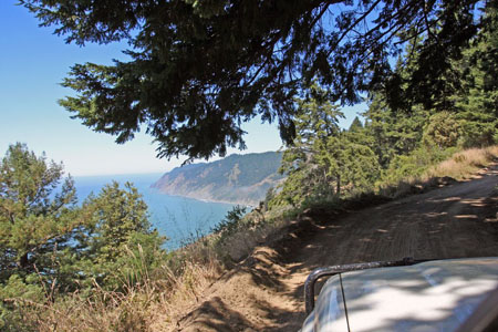
During the dry summer season, Usal Road is an easy, well-graded dirt coastal road. It’s pretty narrow for the most part, but we encountered only one oncoming vehicle on the drive out to Usal Beach. You could drive this part of the road in just about any car. In the Land Cruiser, I just had to watch for other vehicles and the occasional pothole or rock. The road climbs up along the coastal range and every so often offers up an enticing overlook of the pristine coastline.

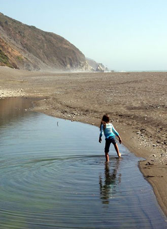
Starting Usal Road at 1:15pm, we made good time over the next 9-1/2 miles and had arrived at the campground and selected a promising-looking site by 1:40. We put up the tent, tossed in the sleeping gear, and then drove to the beach which was about 600 yards from our site. We enjoyed a quick (but possibly illegal) drive on the beach before parking back on solid ground, and then spent the next hour enjoying the beach on foot. We also spotted our first elk who were hanging out among the grass by the beach.

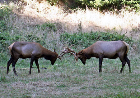
Returning to camp we finished setting up, and more elk grazed just on the other side of the dirt road from us. Before long, two of the bulls started sparring a mere thirty yards from us, as we watched in a state of wonder. The CLACK! of their antlers coming together was almost the only sound of battle, until the older bull got the better of the young challenger, who then made piteous sounds of “Eeeeeeaaaah!” when his head and antlers were getting twisted enough to cause him some obvious pain. We certainly hadn’t expected to be treated to this show of nature, but we’ll remember it for the rest of our lives.

Avoiding the elk, Allison picked ripe blackberries by the dozens from the many nearby bushes, and we ate dinner (spaghetti and sourdough rolls) and dessert (raspberry crumble, and the fresh blackberries) before going to bed early. The local party crowd made noise until around midnight, but we made up for it by sleeping in late the next morning. The weather was perfect too, never uncomfortably hot or cold. After breakfast (crepes, coffee, and bacon!) we packed up and got ready to go.
The elk were back and our campsite neighbors who had arrived after dark were as in awe of them as we had been the previous day. I chatted with Frank, the French-accented father of the family, who told me they were going to be backpacking in the wilderness for the next day. It sounded good to me! Then as were departing, a couple of young local boys had appeared and decided to throw rocks at the elk, so we took them back to their parent’s camp and ratted them out. I hope they got a good talking-to, but who knows. Meanwhile, I also noticed that the hard-partying young locals had left their campsite fire unattended, to the dismay of myself and their camp neighbor, a heck of a nice guy who they’d kept awake half the night.
We finally left the campground, driving north the rest of the way on Usal Road, covering the remaining 19+ miles in an hour and 22 minutes. The road was still well-graded for several miles, but then it seemed like they’d not graded the rest of the road this season. It still wasn’t bad at all but there were definitely more ruts and bumps. It was a scenic drive through the forests, typically at 10-25mph. The air was fresh and clean and the day warmed up quickly as we drove.
Along the way, we encountered a solo bicyclist – a scruffy, bearded guy in a tie-dye shirt – and then a couple of enthusiastic dirt bikers at the very northern end of the road, but that was all the traffic we saw. We’d reached the Four Corners intersection where Usal Road ended and the pavement began. From there we’d continue on to Shelter Cover for lunch.
Coming Up Next
The trip report will continue in Part Three, but because there’s been a lot of interest in this area of the Lost Coast, Part Two is going to offer as much detail as I can manage to serve up on Usal Road, Usal Beach, and our experiences there. My goal is to provide trip-planning information to those who would like to visit the area. Look for this next post soon.

please assist driving directions for doing the Lost Coast by ordinary vehicle. (camry hybrid 4 door) coming from the east bay.
September 13th, 2019 at 9:19 pmThank you. Joel Kass
jkass37@gmail.com
Joel,
September 13th, 2019 at 9:29 pmYou can use Google maps (or other preferred online directions) to determine ordinary driving directions to the destination along the Lost Coast that you are looking for. You don’t need me to do that for you, nor is it a service that I provide. 🙂 Cheers!