Drive #5: Usal Road – Southern End to Usal Beach

Usal Road – Southern End to Usal Beach
Date Driven: 8/10/12
Length: 8 miles
My drive time: 35 minutes
Start: Southern terminus of Usal Road, N39º 46.829′ W123º 49.892′
End: Usal Beach parking area, N39º 49.924′ W123º 50.975′
GPS Track: GPX or KMZ format. (right click -> Save As)
Source(s): See my earlier Usal Beach post for a list of references, including links.
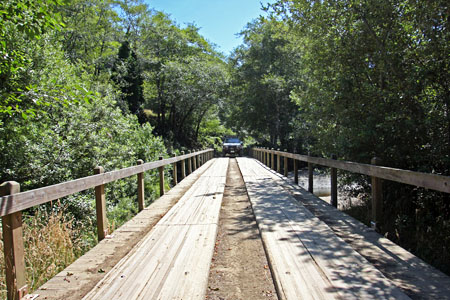
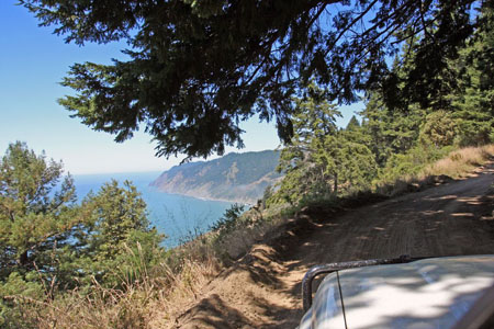
Summary: Starting from its southern end, Usal Road is a graded dirt road that winds along a wooded coastal ridge for several miles before descending to the Usal beach area. I’ve read that the road can be effectively impassible in winter due to mud.
Description: We enjoyed this drive, even though coastal views were scarce. The camping at Usal Beach was the best part of our visit here though, complete with elk fights.
I’ve detailed this drive and the Usal Beach area in a previous post. That should tell you pretty much everything you need to know about the drive, the camping area around Usal Beach, and so on.

If you are driving straight through and not stopping to check out the beach, campsites, blackberry bushes, elk, etc. then this drive will be closer to 5.8 miles. From there you’ll have another 18.8 miles (24.6 mi. total) to Usal Road’s northern terminus at Four Corners. That portion of Usal Road (and more) will be detailed as part of Drive #6.
My full Lost Coast road trip report including photo galleries can be found in three earlier blog posts: Part One, Part Two, and Part Three.
I’ve cleaned up the track for this drive just a bit, but there’s still a lot of time in there where we were stopped and looking at campsites, etc. In fact we spent about an hour poking around and checking things out before we actually drove to the beach from the campsite area. The track data includes the campsite we chose and the nearest portapotty, although there were a couple of other ones in the area.
Disclaimer – This information is provided from the best of my recollection and is necessarily subjective. GPS data is from a personal device inside my vehicle, so coordinates will not be exact. Use of any of this information is at your own risk and responsibility – period. Conditions change (especially in winter), vehicles and driver skills vary, etc. and I have no control over these things. Don’t let anything written here override your own personal common sense or safety.
