South Coast Ridge Road – N35º 52.688′ W121º 24.133′
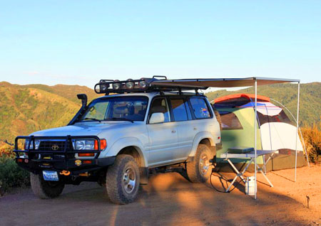
We first explored a portion of South Coast Ridge Road (SCRR) back in November of 2007. Then perhaps two years ago I found myself discussing the area with a couple of “overlanding” buddies. One of them had recently camped there and was enthusiastic about the spot where they had camped, overlooking the Pacific. I duly noted down the coordinates, did a little preliminary research, and filed the info away in my mental “to do” list.
Fast forward to the present, with the long Independence Day weekend fast approaching. Budget and various other of life’s necessities had curtailed a number of road trips I’d recently hoped to do, but happily everything came together for this overnighter since it wasn’t far from home.
We enjoyed the annual July 4th neighborhood fireworks displays at home, got everything packed and ready on Friday, then got our trip underway around 0900 on Saturday morning, making the 130-mile drive south past Big Sur on Highway 1. Arriving at Nacimiento-Fergusson Road, we made our way east to the top of the first coastal ridge where South Coast Ridge Road – and the dirt and the fun – began. » Continue Reading
Hollister Hills GeoBash II
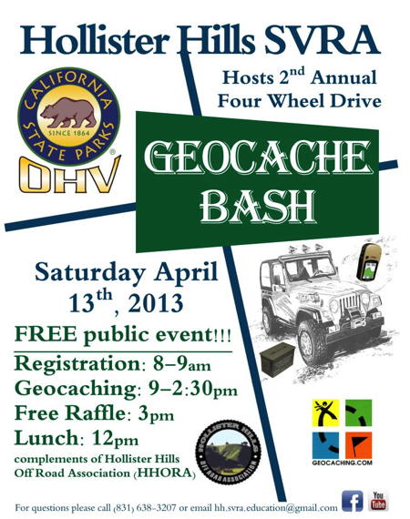
This year’s Hollister Hills GeoBash II was very similar to last year’s event. The main difference being that Sam and I didn’t need to get winched back onto the trails this time.
I’d enjoyed last year’s inaugural event – other than the whole almost-rolling-backwards-down-a-steep-hillside thing – so I’d been looking forward to the sequel event. And so on Saturday morning, April 13th, I again found myself waking up to my alarm far too early for a weekend. By 0720 I’d met up with fellow friends and geocachers Sam and Yvonne at a south San Jose Starbucks, and from there we drove down to Hollister Hills SVRA where we registered before the 0900 briefing.
The attendance looked good again for this year, with maybe twenty vehicles or more lined up adjacent to the Area 5 stage. I noticed that someone had brought a trailer with quads, not understanding that this was strictly a 4×4 event. Also this year a couple of folks seemed to have showed up without having arranged for rides ahead of time, although maybe they were those quad owners. I knew a lot of the geocachers there but definitely not everyone.
The event schedule was much like last year: we’d drive around looking for new geocaches that had been placed in the Upper Ranch and Hudner expansion property areas until lunch, when we’d be fed free hot dogs and chips. After lunch we’d go back out for a few more hours before returning to turn in the info cards we’d found inside the geocaches, and be rewarded with raffle tickets in exchange. The raffle would then be hald and the event would officially be over.
Besides the fun and the raffle, there were two big benefits of this event: each vehicle received a free day-use pass, which you normally have to pay for; and attendees gained access to the Hudner expansion property which is normally not open to the general public. It’s a beautiful area and very different from the usual Upper Ranch trails at Hollister Hills.
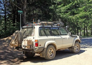
After the briefing, it seems like 3 or 4 groups headed over to the Hudner area, including us. Most of the groups had several vehicles I think, but we just had three: my Land Cruiser, Sam’s FJC, and Rick’s Jeep Patriot. At least I think it’s a Patriot, I’m not too familiar with those.
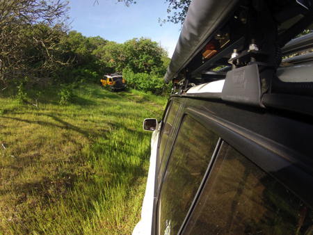
We had a good time and spent a couple of hours on the Hudner trails, picking up a half-dozen or so geocaches along the way. We were led along a few trails we’d not done last year, which was nice. and some were pretty narrow, especially for my big Land Cruiser! Like last year, in the tight spots I found myself wishing for a ’46 Willy’s Jeep! But I squeaked through. We again drove the trail where Sam and I had our incidents last year, but this time with no difficulties whatsoever.
Here’s a sequence of GoPro captures that reduces our two hours of driving around the Hudner expansion to two minutes:
Having completed out tour of the Hudner side, we returned for the free hot dog and chips lunch, chatting with others about their morning experiences, before heading out again. This time we were on more technical trails in the Upper Ranch area, where the terrain was steeper and rockier, and we had some challenging steep hairpin turns that were a little sketchy but fun. Our group was pretty laid-back about the caches and returned in plenty of time to turn in our clue books before the raffle.
Unlike last year when I think I won three or four prizes, I came away empty-handed this time. Despite that, it was still fun and when it was over we spent some more time catching up with friends before heading home.
I’d like to again thank the Hollister Hills staff, HHORA, the raffle sponsors, the geocachers who volunteered, and the attendees for another very fun 4×4 geocaching event. I’m told that the event will continue next year, and I’m looking forward to it. Watch for details on the Hollister Hills SVRA Facebook page, and I’ll see you there!
Drive #6: Usal Road – Usal Beach to Shelter Cove
Date Driven: 8/11/12
Length: 30 miles
My drive time: 2 hours, 24 minutes
Start: Usal Beach campground intersection, N39º 450.107′ W123º 50.650′
End: Shelter Cove, N40º 01.391′ W124º 04.118′
GPS Track: GPX or KMZ format. (right click -> Save As)
Source(s): See my earlier Usal Beach post for a list of references, including links.
Summary: Picking up from where Drive #5 ends at the Usal beach campground area, we head north along the Lost Coast. After 18.8 more miles of Usal Road, we arrive at the northern end at Four Corners. We regretfully say goodbye to the dirt – for now – and continue on pavement north and then west down to Shelter Cover.
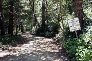
Description: Leaving the Usal beach campgrounds, we continued north on Usal Road. After a few miles we can tell it has been longer since the dirt road has last been graded, and there are more ruts and rocks. But since it is dry, it’s still an easy drive in the Land Cruiser. Passing through the thick woods and foliage, we encounter only a single bicyclist and two motorcycles before reaching pavement at Four Corners.
From there we’re back on pavement for the most part. When we reach Shelter Cove Road, we turn west towards the Pacific and begin a steep downhill descent. We stop at the market/gas station for a few supplies before heading down into Shelter Cove for lunch at the deli/cafe to conclude this drive. We had lunch out on the large deck area, and there here are public restrooms there across the street from the deli.
After lunch, we drove back up the hill to begin Drive #7, Kings Peak Road to the AW Way county park where we camped for the night.
My full Lost Coast road trip report including photo galleries can be found in three earlier blog posts: Part One, Part Two, and Part Three. We had a great trip!
As with Drive #5, I’ve cleaned up the track for this drive just a bit, this time to remove a turn we missed along Usal Road.
Disclaimer – This information is provided from the best of my recollection and is necessarily subjective. GPS data is from a personal device inside my vehicle, so coordinates will not be exact. Use of any of this information is at your own risk and responsibility – period. Conditions change (especially in winter), vehicles and driver skills vary, etc. and I have no control over these things. Don’t let anything written here override your own personal common sense or safety.
Drive #5: Usal Road – Southern End to Usal Beach
Usal Road – Southern End to Usal Beach
Date Driven: 8/10/12
Length: 8 miles
My drive time: 35 minutes
Start: Southern terminus of Usal Road, N39º 46.829′ W123º 49.892′
End: Usal Beach parking area, N39º 49.924′ W123º 50.975′
GPS Track: GPX or KMZ format. (right click -> Save As)
Source(s): See my earlier Usal Beach post for a list of references, including links.
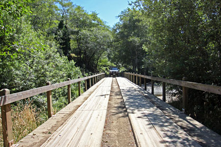
Summary: Starting from its southern end, Usal Road is a graded dirt road that winds along a wooded coastal ridge for several miles before descending to the Usal beach area. I’ve read that the road can be effectively impassible in winter due to mud.
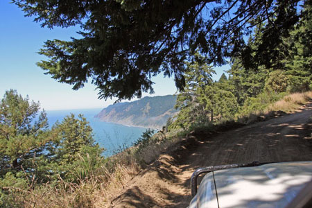
Description: We enjoyed this drive, even though coastal views were scarce. The camping at Usal Beach was the best part of our visit here though, complete with elk fights.
I’ve detailed this drive and the Usal Beach area in a previous post. That should tell you pretty much everything you need to know about the drive, the camping area around Usal Beach, and so on.
If you are driving straight through and not stopping to check out the beach, campsites, blackberry bushes, elk, etc. then this drive will be closer to 5.8 miles. From there you’ll have another 18.8 miles (24.6 mi. total) to Usal Road’s northern terminus at Four Corners. That portion of Usal Road (and more) will be detailed as part of Drive #6.
My full Lost Coast road trip report including photo galleries can be found in three earlier blog posts: Part One, Part Two, and Part Three.
I’ve cleaned up the track for this drive just a bit, but there’s still a lot of time in there where we were stopped and looking at campsites, etc. In fact we spent about an hour poking around and checking things out before we actually drove to the beach from the campsite area. The track data includes the campsite we chose and the nearest portapotty, although there were a couple of other ones in the area.
Disclaimer – This information is provided from the best of my recollection and is necessarily subjective. GPS data is from a personal device inside my vehicle, so coordinates will not be exact. Use of any of this information is at your own risk and responsibility – period. Conditions change (especially in winter), vehicles and driver skills vary, etc. and I have no control over these things. Don’t let anything written here override your own personal common sense or safety.

