Drive #25: Snowslide Road (2N13)

Drive #25: Snowslide Road (2N13)
Date Driven: 9/19/14
Length: 19.6 miles
My Drive Time: 2 hours 10 minutes
Start: N34º 14.836′ W117º 05.203′
End: N34º 14.610′ W117º 03.382′
GPS Track: GPX or KMZ format. (right click -> Save As)
Source(s): A portion of Snowslide Road (2N13) is shown on Trail #36, Butler Peak, in Guide to Southern California Backroads & 4-Wheel Drive Trails. All of our driver here is covered by the Off-Highway Vehicle (OHV) Guide, San Bernardino National Forest map.
Summary: An exploratory drive along the ridge sides south of Holcomb Valley and northwest of Big Bear Lake. NOTE: Usually gated part way in.
Description: This drive begins near the spot where we camped overnight after completing Drive #23: Cleghorn Ridge and Drive #24: Pilot Rock Road. This is where FS road 2N54 begins at Crab Flats Road.
After breakfast that morning, I pulled out my map and examined the Forest Service roads to pick our first drive of the day as we would make our way over to Mountain Rendezvous. I thought I recalled Hans (offroad-travel.net), who I’d met in this spot last year, saying that he and his wife Bente were going to drive these roads the next day.
It occurred to me now that I never did discuss the details with him afterward at MR13, so I didn’t know if they’d actually done it or not. In fact, I now realized that I had no prior intel on this route at all. I’d be going in blind, other than what was on my topo map.
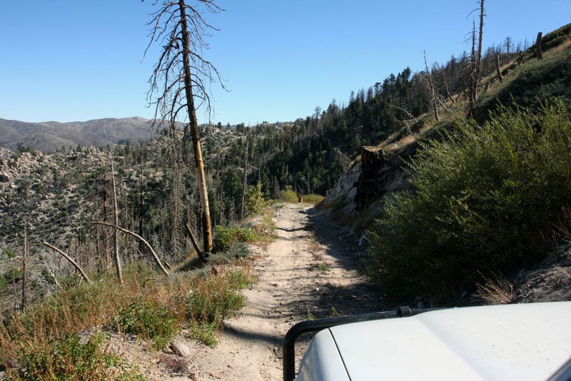
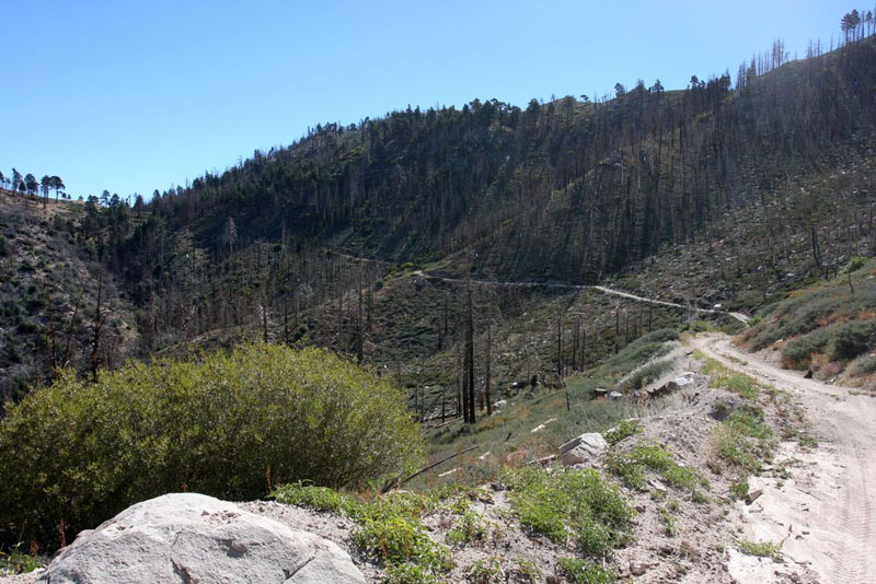
And so it was as we started east on 2N54, and transitioning to 2N13, both comprising Snowslide Road. Things started pretty easily, contouring along the side of a ridge overlooking Holcomb Valley. There were a few uphill sections but nothing challenging – until we rounded a corner. At this point, for the first time on our road trip I was faced with something a little more involved. This was a pretty steep (if short) climb, and it was also covered with decent-sized loose rocks, several rock ledges, and plenty of loose dirt. Low range was clearly in order, and lockers too.
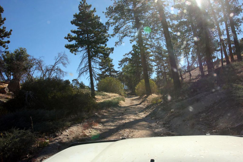
Balancing momentum with prudent speed, I picked my way up this technical section with no trouble. It turned out to be the only part of the drive that was so challenging, although there were plenty of other parts that required my attention. Most of the road was in good shape but at times it did narrow, get rocky, or have encroaching hazards like fallen trees and large rocks.
The trail, which had started along a wooded hillside, quickly turned more open, contorting along the northern side of a ridge. To the north, we were treated to splendid views of Holcomb Valley, which I drove through last year with Raquel and Gianni on our way to MR13.
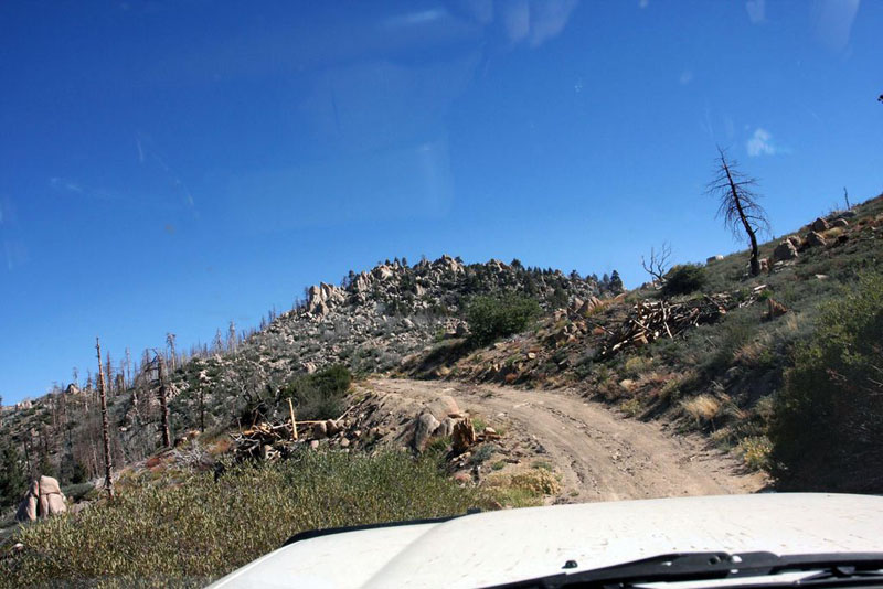
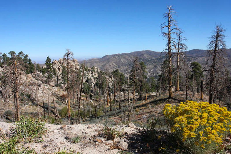
I loved the boulder-topped peaks along he trail.
The fascinating local geology was again on display, with boulder-covered peaks along the route. There was also widespread visible evidence of the Butler II fire that swept through the area in 2007.
As we progressed eastward, it was obvious that this trail didn’t see much use. After a narrow, rocky section, we reached a mellower wooded section that was being logged. We skirted past tree trunks which were stacked up along the trailside like old-fashioned Lincoln Logs.
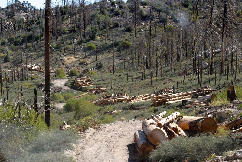
Logged section of the trail
We were closing in on the end of the trail, near the tiny town of Fawnskin on the northern shore of Big Bear Lake, when we encountered the only other vehicle along our drive, an oncoming ranger pickup. We pulled alongside to greet him.
After quick hellos, the ranger informed us that this part of 2N13 was closed, and that we’d passed through an open gate that was supposed to be locked. Someone had reported that it was open, which was why he was out there. Also, the gate at the eastern terminus of 2N13 by Fawnskin – now just two tantalizing miles away – was also locked. No harm, no foul, but we’d need to backtrack to where we came from.
I was bummed. We were so close! But there was nothing to be done. I asked about FS 2N68 which I’d noticed as a possible alternative, but he informed me that it didn’t go through. And despite a strategic pause on my part, he clearly wasn’t going to offer to unlock that nearby gate for us… We’d have to reverse. Damn.
We said our goodbyes and turned around at the next opportunity a few dozen yards down the trail and reluctantly started the long drive back. It was at this point that I realized that our gas supply was lower than I’d have preferred, and so out of caution I switched into fuel conservation driving mode.
We got back to the Green Valley area and there were some alternatives – possible shortcuts – that carried some risk, which I opted to try instead of heading back on 2N54. We headed south on 2N13A and some other trails, one of which looked increasingly disused before dead ending on a hillside above some remote homes.
I backtracked to the preceding fork in the trail and took the right-hand path, where we soon came along a couple who were out hiking in the perfect weather. They confirmed that the trail here went through. Woohoo!
We continued down the hill and soon emerged by some large water tanks and a campsite (waypoint included in the GPX file), and then paved road and housing. The drive here was over, and it had been more eventful than I had planned! From here we continued on paved roads through Green Valley, past restaurants and attractive mountain homes along Green Valley Lake, before making our way to Big Bear for much-needed fuel and lunch.
Because of the situation with the gates here, this was not a typical Drive like most of the others on this site. Until such time when the gates on 2N13 are regularly open, perhaps when logging operations have concluded, it will likely be impossible to drive through as we intended, so be very aware of that. Even then, the trail would likely remain seasonal, I’d expect. On the other hand, I have read that the gates have sometimes been open in the not so distant past, so perhaps luck will be with you if you attempt it. In any case, I wanted to include this drive so that the data is available. Caveat emptor, YMMV, and all of that. And good luck.
The full story and more photos from this drive can be found in the second installment of our Mountain Rendezvous 2014 Road Trip report.
Disclaimer – This information is provided from the best of my recollection and is necessarily subjective. GPS data is from a personal device inside my vehicle, so coordinates will not be exact. Typos are possible. Use of any of this information is at your own risk and responsibility – period. Conditions change (especially in winter), vehicles and driver skills vary, etc. and I have no control over these things. Don’t let anything written here override your own personal common sense or safety.