Drive #24: Pilot Rock Road

Drive #24: Pilot Rock Road
Date Driven: 9/18/14
Length: 11.2 miles
My Drive Time: 1 hour 24 minutes
Start: West end, N34º 18.310′ W117º 18.586′
End: East end, N34º 17.137′ W117º 13.141′
GPS Track: GPX or KMZ format. (right click -> Save As)
Source(s): Pilot Rock Road can be found as Trail #30 in Guide to Southern California Backroads & 4-Wheel Drive Trails, although the route described there is different on the east side. It’s also shown on the Off-Highway Vehicle (OHV) Guide, San Bernardino National Forest map.
Summary: A scenic ridge trail near Silverwood Lake, north of San Bernardino.
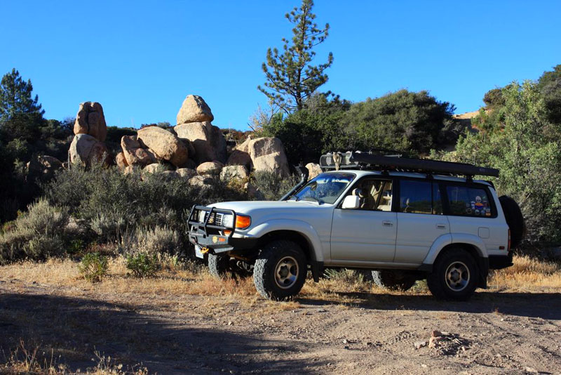
Description: After completing Drive #23: Cleghorn Ridge, it was a quick hop on paved roads over to the Silverwood Lake SRA area where we picked up the start of this trail, Pilot Rock Road.
Some lovely wetland-looking terrain just before starting the trail.
The trail starts climbing right away, mostly with moderate slopes but the trail was definitely rougher than Cleghorn Ridge. Not only was it rockier, but I soon learned that I had to remain vigilant for ever-present whoop-dee-doos. I soon became an expert in spotting these treacherous little dips and getting my foot on the brake as soon as possible. Sometimes I managed to stop the rear of the Land Cruiser from slamming down as much as the front had. It was definitely a time where lashing down the rear cargo contents could be fully appreciated.
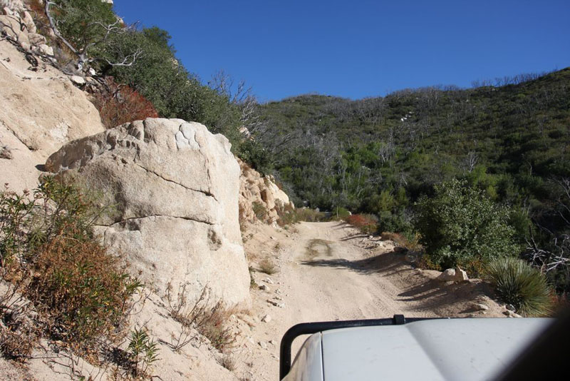
Going up!
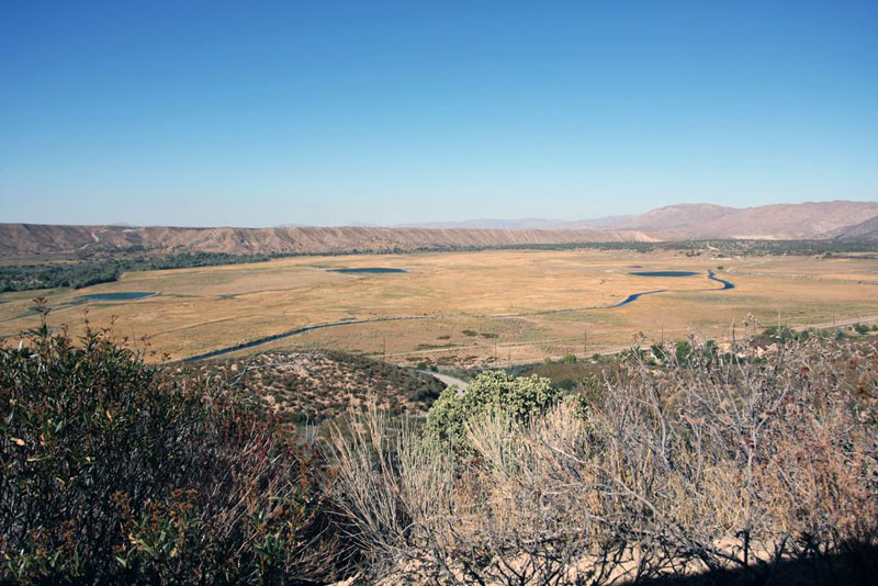
Looking down at Silverwood Lake
That said, the trail was still on the mild end of the spectrum. I did expect it to get smoother at some point like most FS roads do, but it never really did. So it wasn’t really much in the way of technical or challenging, but I had to remain wary. I enjoyed Cleghorn Ridge more because it was a mellower drive, yet offered many fun-looking optional challenges along the way.
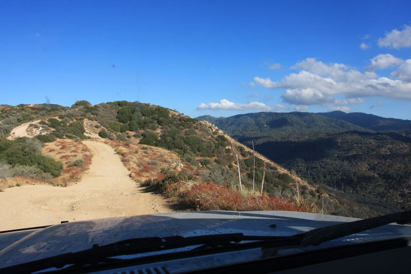
Driving along the top of the ridge.
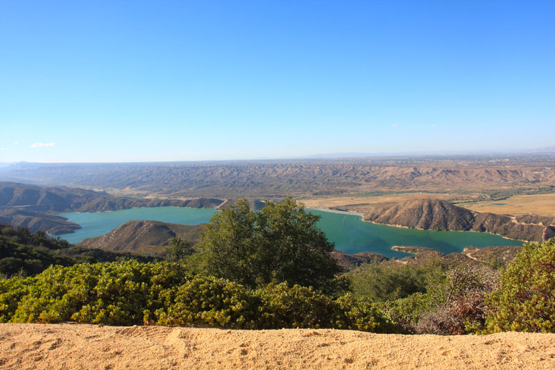
The views along trail were nice, particularly when overlooking the lake on the western side. Most of the ridge runs a bit below 5,000′ in elevation and Pilot Rock itself tops out at 5,253′. The trail changes character at the very eastern end, becoming more like typical California hillsides with oaks and other trees.
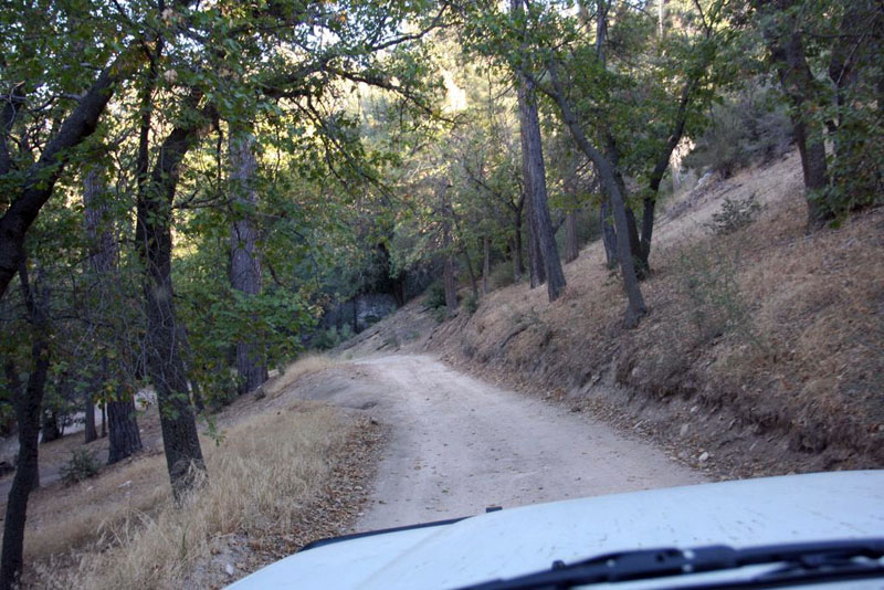
The eastern side of the trail ends among stereotypical California hillsides.
The dirt ended and the pavement started near a tucked-away treatment plant of some kind, the odor appropriately coinciding with the end of our offroading for the day! We dashed off to our “Plan B” campsite and made it just before sunset, wrapping up a very long drive for us, on and off the road.
The full story and more photos from our drive are included in the first installment of our Mountain Rendezvous 2014 Road Trip report.
Disclaimer – This information is provided from the best of my recollection and is necessarily subjective. GPS data is from a personal device inside my vehicle, so coordinates will not be exact. Typos are possible. Use of any of this information is at your own risk and responsibility – period. Conditions change (especially in winter), vehicles and driver skills vary, etc. and I have no control over these things. Don’t let anything written here override your own personal common sense or safety.
Great stuff!
October 24th, 2014 at 5:08 pmThanks, Monty. I don’t know if you saw Drive #17, it’s a section from one of your GBES rallies. 🙂 Good times! Hope you are well.
October 24th, 2014 at 6:31 pm