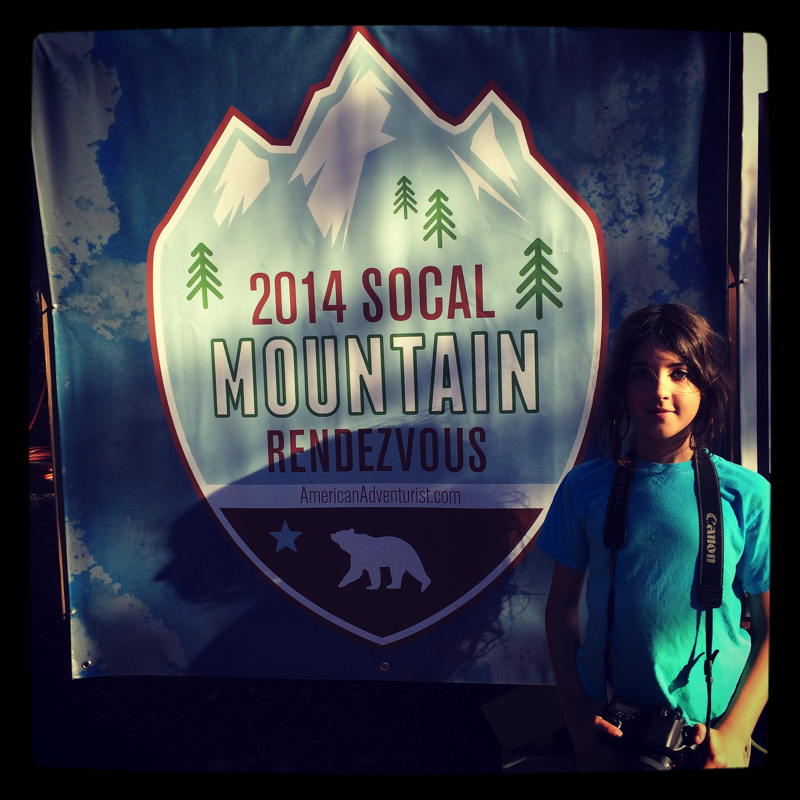
Mountain Rendezvous 2014 Road Trip – Part Two
Early on the second morning of our trip, we slowly stirred in our tent. I heard an occasional vehicle roll past out on the main trail, probably residents from the small cluster of homes just down the trail from us. The morning weather was cool but not cold, and it smelled of the wonderful, fresh mountain air and pines.
Overnight I’d heard something crunching along in the woods across the trail and down the hill from us. It might of been a deer but it sounded heavier, perhaps a bear? It was too far away for even my bright headlamp to illuminate, so I guess I’ll never know. It did take me a little longer to get back to sleep after that late night pee break though!
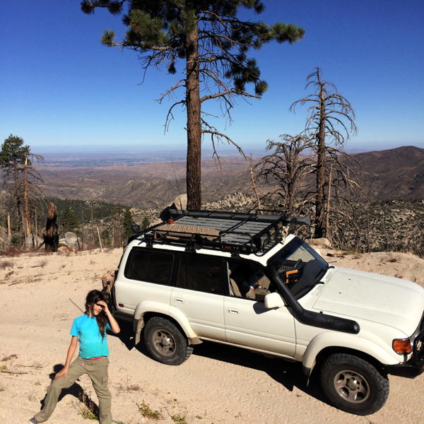
We otherwise had a peaceful night since arriving the previous evening, camping in the same spot as I had the previous year.
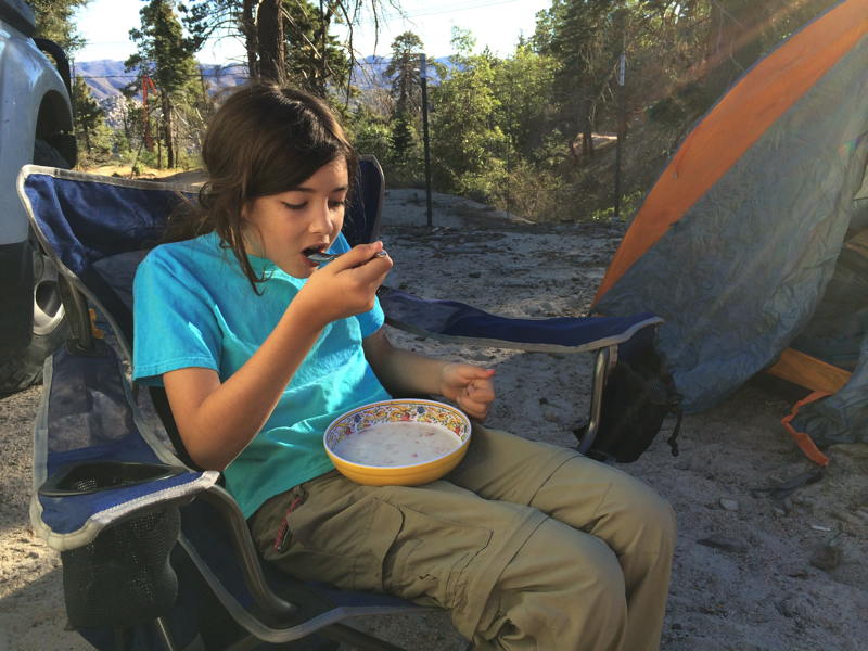
We crawled out of the cozy sleeping bagand took turns getting dressed and I got busy with the first priority of the day – coffee! I used my new GSI Java Mill (as reviewed by Living Overland and Sarah at Exploring Elements) to grind up some fresh beans and make enough for Allison (a little) and I (a lot.) The Java Mill is a proper burr-style grinder and worked well, although the capacity is rather small. To grind enough beans for about 32oz. of coffee required two full loads of beans to be ground. Not a big deal.
I also boiled extra water in my JetBoil for our brekkie, which was the Alpineaire oatmeal with strawberries that we’d been eager to try. It was pretty good, and the warm food and coffee made for a cozy camp breakfast. We relaxed and ate before I started the process of tearing down and packing away our camp in anticipation of the next leg of our trip.
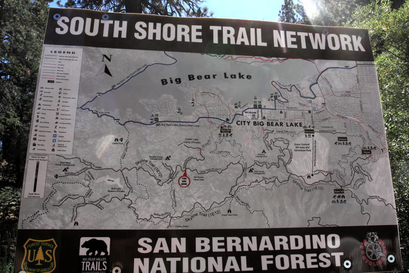
I pulled out my map case and took another look at the trail options for the day. I remembered that last year, Hans had told me they were planning to take a trail east towards Big Bear Lake, which sounded good to me. The map showed FS road 2N13 as a likely choice, starting right by the intersection we were camped by, and heading east until it emerged around the little town of Fawnkskin on the northern shore of Big Bear Lake.
We started rolling down the trail soon after, and it was looking pretty straightforward. As with the previous day’s two trails, I was in High range still, but in low gear as we made our way among the hillside. We hit some steeper hill climbs and then it occurred to me that for the first time on this trip, I really had zero prior intel about this trail. I assumed it was open and manageable, but I had to hard facts to back that up. Fingers figuratively crossed, we proceeded.
My concern was reinforced as we rounded a corner and came upon our first real driving challenge of the trip: a steeper hill climb, complete with rock shelves and plenty of loose rocks and dirt to complicate things. Suddenly, I was staring at a section that called for not just Low range, but lockers too. I stopped the Cruiser and flipped levers and switches, and then started up, carrying as much momentum as I felt was prudent up the hill, picking my line in advance and making adjustments as we progressed. It was a proper driving challenge but we worked our way to the top without incident. Nice!
We continued along the trail, which mostly was shelf road along the ridge that formed the southern end of the Holcomb Valley. The trail became narrow, steep and rocky at a whim, but never again was as challenging as that one climb. I returned to High range, Low gear and we carefully picked our way along, enjoying the rocky hill tops and sweeping views of the valley.
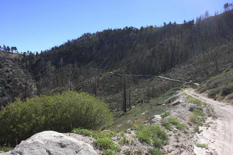
We soon entered an area that had recently been logged, as evidenced by the stacks of felled tree trunks alongside the trail. It felt a little like picking our way among giant Lincoln Logs. Then, as we neared the end of the trail, we were thrown an unexpected curveball.
We encountered an oncoming ranger vehicle and pulled alongside to chat. The friendly ranger informed us that the gate at the end of the trail – where we were heading – was closed and locked. We were only two miles away! He said that one of the gates we’d passed though on the way – probably just before entering the logged area – was open, but was supposed to be closed. I asked about alternative exits on the east side of 2N13, like 2N68, but he said that didn’t go through. We’d have to go back nearly to where we’d started, near Green Valley… Bummer.
We parted ways and I turned around at the next wide spot to begin our long backtrack. It was then that I also realized that our fuel level was lower than I would have liked it to be, which perked up my anxiety level even more, although there was certainly no need for panic just yet. Luckily we only had about 7 or 8 miles to backtrack, and I worked my way along the trail again but now in more of a fuel conserving mode.
Nearing Green Valley the opportunity to exit the trails early arose via several side trails. The obvious choice was gated, but there was another option that looked like it would work. I chose to give it a try, picking my way along what soon was clearly a trail that hadn’t seen any use for a while. It forked here and there, and we wound up at a dead end just abouve some houses on the east side of Green Valley. We backtracked to another for in the trail and as we progressed, we encountered a couple out for a hike. They confirmed that this trail segment went through, so I thanked them and we picked our way down the hill, eventually reaching pavement near several water tanks and some houses. We’d reached civilization again, still had gas in the tank, and had escaped the maze of locked gates and dead ends. Victory!
Back on mercifully smooth pavement, we picked our way through Green Valley, past the small but pretty lakefront area there, and eventually picked up the main road heading east to Big Bear. We cruised into town, still enjoying the fresh mountain air. A sign showed the temperature as 67ºF. I pulled into a parking lot and checked my GasBuddy app, confirming that the first Chevron just ahead of us was too pricey, and that several cheaper options were just beyond, saving us a couple of bucks. I refueled a tank, used the rest room at the nearby airport, and then we picked up some needed food and drink supplies at a small local market and then the Von’s supermarket. We ate lunch – a corn dog for me and a chicken skewer for Allison – as we drove, and I started looking for access to the next leg of our drive, which would hopefully lead us over the hills to Mountain Rendezvous.
The first possible access point on my iPad maps didn’t look likely on my printed trail map, but I took a look anyway. The road ended abruptly in the parking lot of a ski resort, and I doubted they were going to look favorably on me wheeling up their hillside at random. I backtracked some and we continued west to the more likely entrance, which turned out to be some more National Forest land. Winding up the hillside, the trail soon turned to well-graded dirt, and we reached a south shore trail sign that confirmed we were on the right track.
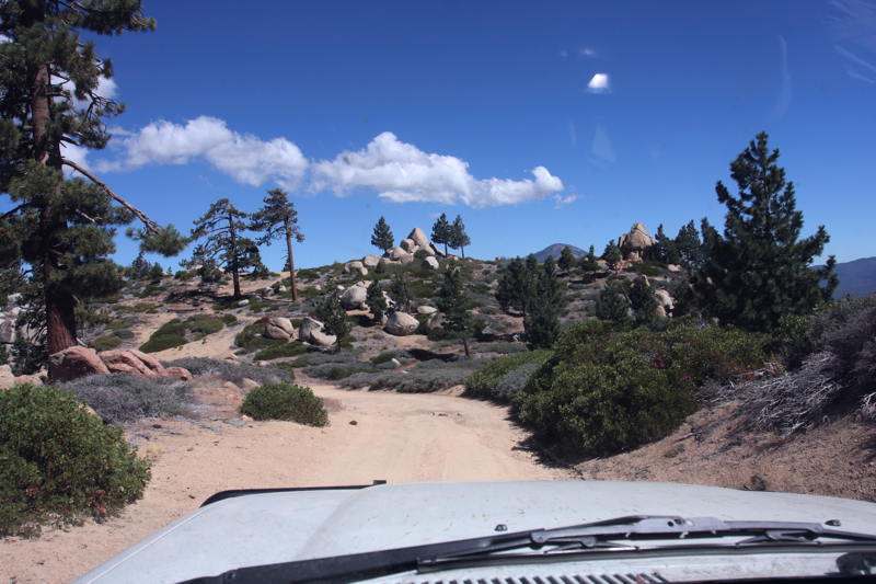
And so we found ourselves heading counter-clockwise on the Skyline Trail loop. It was a well-graded trail, and very pretty with pines and boulders along the way. I enjoyed the drive quite a lot, and Allison was thrilled by the cute little chipmunks that scurried around everywhere. As we met up with what seemed like the turn for the next leg of our drive – the trail of Clark’s Grade – imagine my consternation when we were met by another closed gate!
Muttering under my breath, I scrambled to get my map out again to search for alternatives (and yet another “Plan B”) and took a good look. The best bet looked to be to continue along the Skyline trail until we reached 2N06, which would hopefully also put us in the right place. Again, we’d have to tackle a completely unknown trail, and risk encountering more of the infernal gates.
We forged on. Skyline continued to be a very pleasant, easy trail, and we encountered some occasional oncoming traffic in the form of vehicles, hikers, and mountain bikers. We reached the turnoff to 2N06 which quickly descended, became much rockier and narrower. The rough trail was a different animal than Skyline for sure, but it wasn’t too tough. On the way down we encountered one other vehicle, a Chevy Avalanche I think, filled with four or more guys. I think it was lifted, but the guy was really crawling down the trail at a snail’s pace.
After a while of that, I stopped and we snapped a few photos, then after a bit we got going again and quickly found ourselves behind them again. Happily, after a few more minutes they moved onto a side trail to let us by and we were able to resume a more reasonable pace. And that pace was pretty slow given the trail conditions, but after a while we reached the bottom and passed along some intersections, camp areas and several CDF guys working the trails and trees. We’d reached pavement again, ending our trail runs for this road trip. And none too soon for Allison, who had reached her limit for bouncing along inside the Land Cruiser!
Winding up the hillside on twisty, but wonderfully smooth tarmac, we were able to reach Camp Tahquitz and Mountain Rendezvous is just ten minutes, rolling through the gate right at 3pm. It hand been another long day and we were eager to get settled in and start enjoying MR14… So that’s exactly what we did!