Drive #23: Cleghorn Ridge

Drive #23: Cleghorn Ridge (2N47)
Date Driven: 9/18/14
Length: 14.5 miles
My Drive Time: 1 hour 15 minutes
Start: West end, N34º 17.976′ W117º 27.387′
End: East end, N34º 18.098′ W117º 20.223′
GPS Track: GPX or KMZ format. (right click -> Save As)
Source(s): The Cleghorn Ridge trail, also known as Cleghorn Road or 2N47, can be found as Trail #29 in Guide to Southern California Backroads & 4-Wheel Drive Trails and as trail South Coast #10 in Backcountry Adventures Southern California. It’s also shown on the Off-Highway Vehicle (OHV) Guide, San Bernardino National Forest map.
Summary: A popular offroad ridge trail close to San Bernardino.
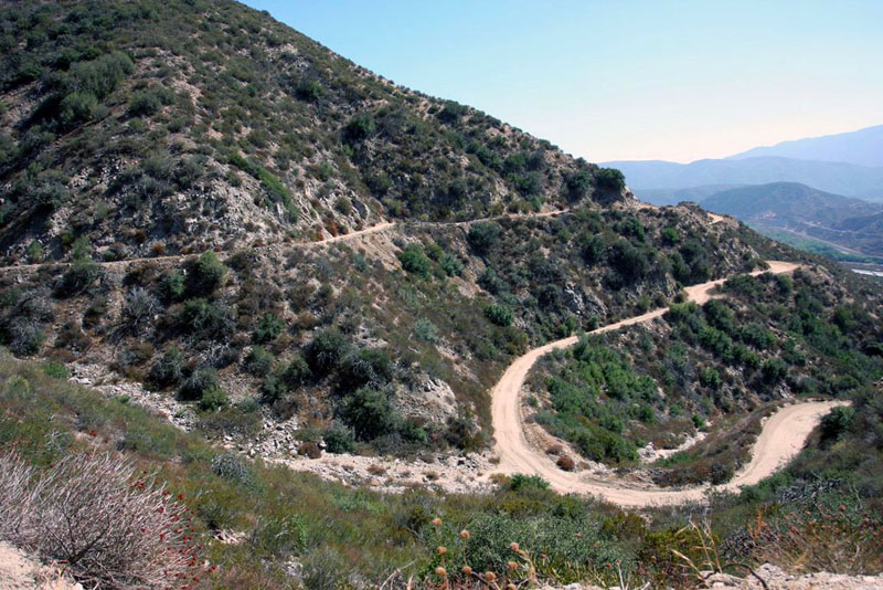
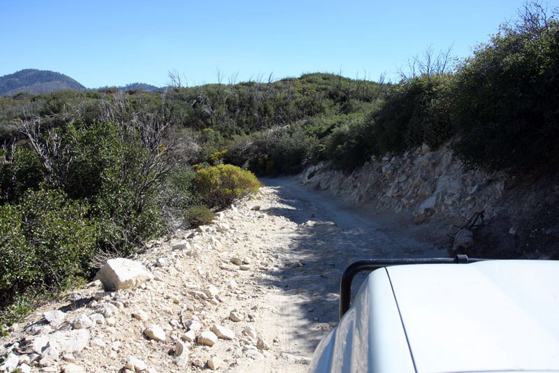
Description: This Drive begins just off of Highway 15, at the Cleghorn Road exit. One minute you’re on a busy southern California highway, and the next instant you’re at pavement’s end, and the start of this trail.
From the start (shown above) we climbed from around 3,100′ in elevation, winding up switchbacks and getting better and better views of the surrounding desert mountains. The trees, sometimes colorful scrub and geology are all interesting, and the trail is generally smooth and wide. We reached the top of the ridge after about about 2,000′ of climb, and continued along it for the rest of the drive. The trail tops out right at 5,300′ along the way.
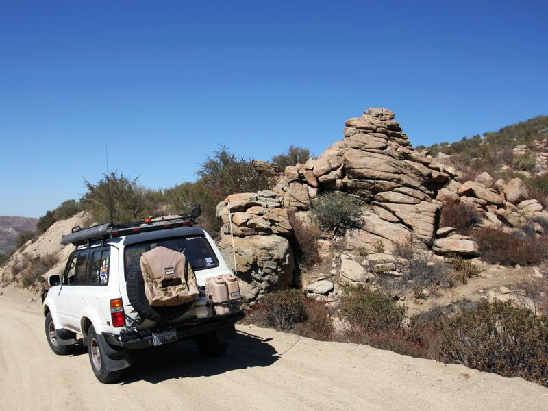
Cool rocks…
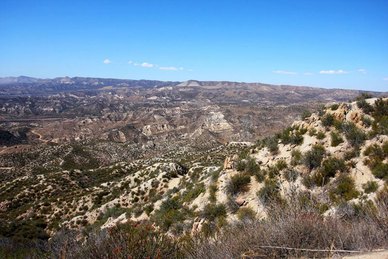
… And cool views. Wow!
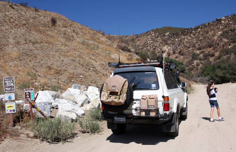
The trail is a little more technical and rocky in spots, but not much. I drove the whole thing in High range, and rarely downshifted out of Drive. One of the nice features of this trail though are the many offshoot trails that wind their way in and out of the main trail. These offer increased challenges: sometimes steep climbs or descents, sometimes technical rutted sections, and some tight squeezes for larger vehicles. With these other trail options, there’s something for everyone. Combine that with the easy access for many, I understand why this is such a popular SoCal trail.
A rocky stretch of trail on the east side.
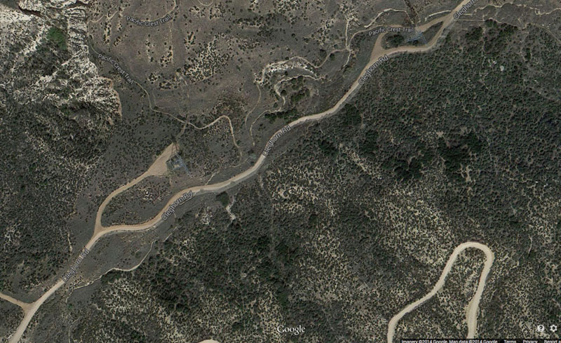
A Google Earth satellite view of just a few of the many side trails that weave in and out of the main one.
We didn’t explore of those numerous side trails – we had about a dozen compelling reasons not to – and so this Drive represents the main Cleghorn Ridge trail. Sometimes the correct turn wasn’t obvious, and where I made a wrong choice along the way I edited that out of the track to clean it up.
The trail ends close to Silverwood Lake, which is where Drive #24: Pilot Rock Trail (coming soon) begins.
I quite enjoyed this trail. The scenic views were pretty cool, particularly along the beginning climb up the ridge, and the drive was a lot of fun. And that’s saying something having already spent 400 miles behind the wheel!
The full story and more photos from our drive are included in the first installment of our Mountain Rendezvous 2014 Road Trip report.
Disclaimer – This information is provided from the best of my recollection and is necessarily subjective. GPS data is from a personal device inside my vehicle, so coordinates will not be exact. Typos are possible. Use of any of this information is at your own risk and responsibility – period. Conditions change (especially in winter), vehicles and driver skills vary, etc. and I have no control over these things. Don’t let anything written here override your own personal common sense or safety.
It looks like some interesting countryside!
October 22nd, 2014 at 1:12 amIt definitely was. Good time of year too, not too hot or cold.
October 22nd, 2014 at 4:48 am[…] Photo Source: Backroad Navigator […]
June 9th, 2016 at 4:13 pm