Drive #19: Titus Canyon
Drive #19: Titus Canyon
Date Driven: 12/28/11
Length: 26.4 miles
My Drive Time: 2 hours 20 minutes (includes stops for lunch, exploring Leadfield, etc.)
Start: Hwy. 374 and Leadfield Rd, N36º 51.553′ W116º 50.766′
End: Titus Canyon Rd. and Scotty’s Castle Road, N36º 47.271′ W117º 11.489′’
GPS Track: GPX or KMZ format. (right click -> Save As)
Source(s): Is there a regional guidebook that doesn’t include Titus Canyon? It’s Tour 15 in California Desert Byways; Trail #1 in Guide to Southern California Backroads & 4-Wheel Drive Trails; Trail D40 in Backcountry Adventures Southern California; Excursion #17 in Death Valley SUV Trails; and Trip Route NC-5 in The Explorer’s Guide to Death Valley National Park. Also shown on the National Geographic map of Death Valley.
Summary: A classic and popular Death Valley offroad drive. Dusty desert roads, twisty and rocky mountain roads and narrow rock canyon. High clearance 4×4 highly recommended.
Description: We reached this Drive from inside Death Valley NP, after topping up our fuel at Stovepipe Wells. From there we drove east, eventually leaving the park and crossing the state line into Nevada. About 6-1/2 miles later, we reached the intersection with (dirt) Leadfield Road, pulled off the highway, and began this drive.
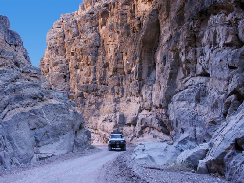
This drive is one-way only, east-to-west. It starts as wide, dusty desert dirt road until it reaches the hills. The road then narrows and gets rocky and rutted. As we rounded multiple blind corners were were suddenly very happy that it was one-way only! Typical to the Death Valley area, we were also surrounded by fantastic geology all around us.
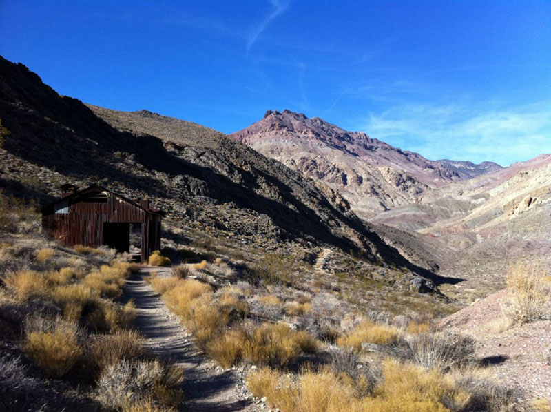
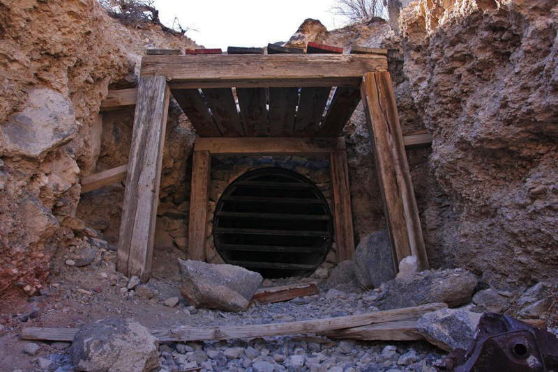
After a time we reached the old ghost town of Leadfield. We explored the town, chatted with some other visitors and had a tailgate lunch break before continuing on. We dropped down into Titus Canyon area which starts off wide, but narrows and narrows until you finally exit the slot canyon on the west side. Here there is a parking area and vault restrooms, if memory serves. There are also hikers coming in from this side, so watch for them.
This being Death Valley, you’ll want to take full precautions here in terms of your vehicle, water, etc. It’s a well-traveled route so that’s a plus.
Here’s the blog post and the associated photo gallery from that day in Death Valley, including this Drive. And here’s a video clip from Titus Canyon:
Disclaimer – This information is provided from the best of my recollection and is necessarily subjective. GPS data is from a personal device inside my vehicle, so coordinates will not be exact. Typos are possible. Use of any of this information is at your own risk and responsibility – period. Conditions change (especially in winter), vehicles and driver skills vary, etc. and I have no control over these things. Don’t let anything written here override your own personal common sense or safety.
Drive #18: La Gloria Road
 <
<
Drive #18: La Gloria Road
Date Driven: 8/17/07
Length: 11.4 miles
My Drive Time: 1 hour 16 minutes
Start: Where western La Gloria Rd. turns to dirt, N36º 30.936′ W121º 20.453′
End: La Gloria Rd. and Hwy. 25, N36º 33.977′ W121º 10.984′’
GPS Track: GPX or KMZ format. (right click -> Save As)
Source(s): This Drive doesn’t appear in any of my guidebooks.
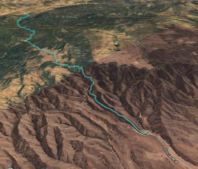
Summary: A rural dirt road drive across the mountains, through high valleys and past remote ranches.
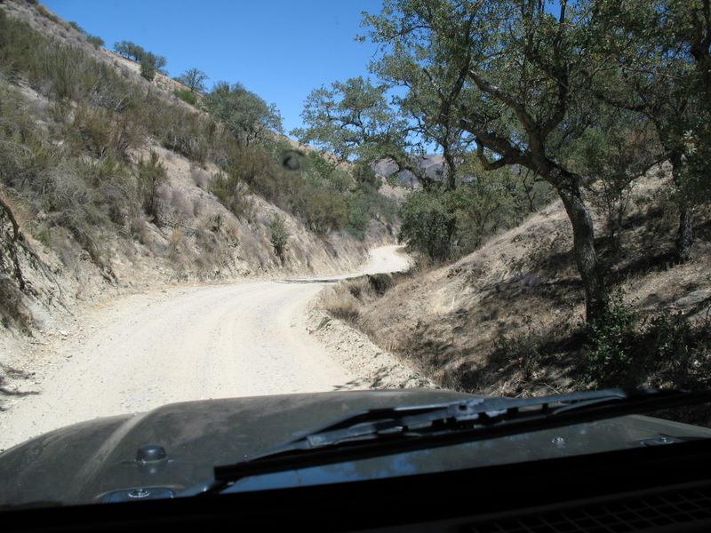
Description: This Drive begins in the small agricultural city of Gonzales. La Gloria Road (shown on some maps as Gloria Road) turns from paved to dirt just past the Swiss Rifle Club at the base of the eastern mountains. It’s a pretty normal fire road as it snakes its way up the mountains, offering some nice views along the way.
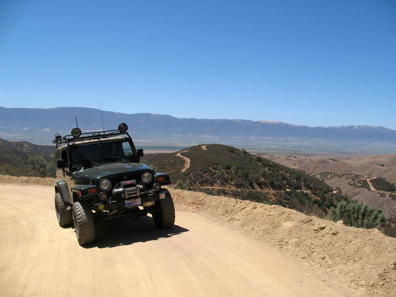
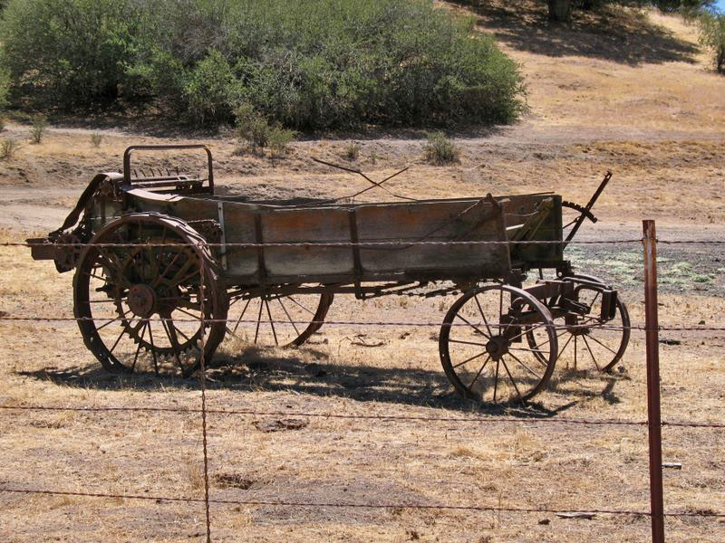
We climbed 1700′ to the top, before beginning the gradual descent to the eastern end of the road. La Gloria narrows some and passes through a few high valleys and ranches ranches. The road is easy (at least it was when I drove it, when it was dry) and scenic. We stopped for a few geocaches along the way and saw some interesting sights, including a tree with barbed wire grown through it – eight feet above ground.
The road ends at Highway 25, which is a popular backroad drive for motorcyclists and people like me. We headed north and passed through some other small but interesting rural communities. If you go south, it’s not far to the eastern entrance to Pinnacles National Park.
Here’s the photo gallery from my drive.
Disclaimer – This information is provided from the best of my recollection and is necessarily subjective. GPS data is from a personal device inside my vehicle, so coordinates will not be exact. Typos are possible. Use of any of this information is at your own risk and responsibility – period. Conditions change (especially in winter), vehicles and driver skills vary, etc. and I have no control over these things. Don’t let anything written here override your own personal common sense or safety.
Drive #17: GBES Pine Nut Mountains Loop
Drive #17: GBES Pine Nut Mountains Loop
Date Driven: 6/17/06
Length: 78 miles
My Drive Time: We were there for 6 hours 50 minutes, but with many stops as part of the rally.
Start: E. Valley Rd. and a dirt road, N38º 58.550′ W119º 42.190′
End: Pinenut Rd. and Hwy. 395,N38º 54.947′ W119º 42.945′
GPS Track: GPX or KMZ format. (right click -> Save As)
Source(s): I have no sources for this route, other than the rally waypoints we were given.
Summary: This is my track from the 2006 GBES Navigational and Geocaching Rally, over and around the Pine Nut Mountain Range. A good, high-clearance 4×4 is needed in several sections.
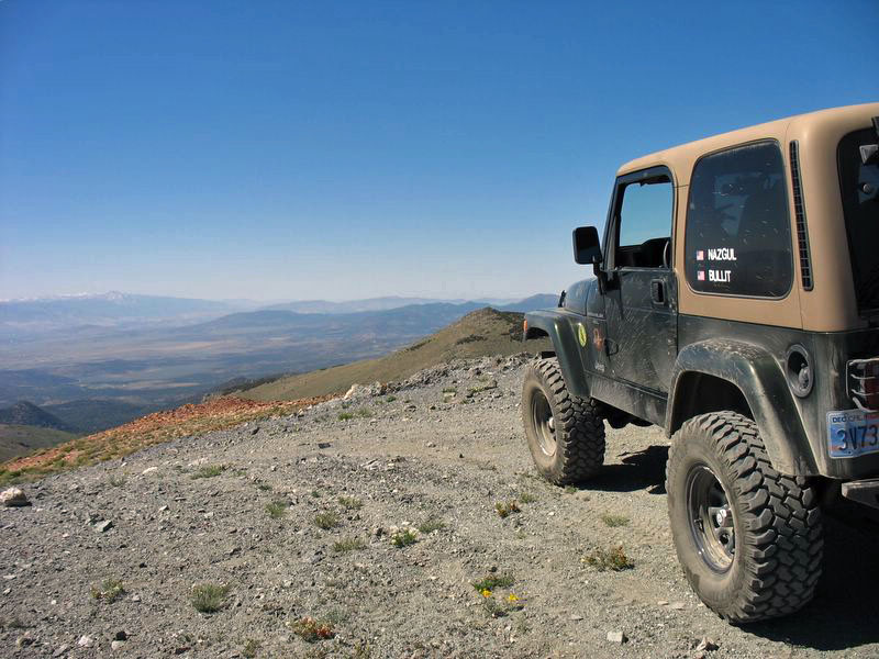
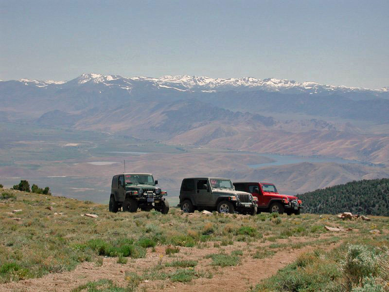
Description: In 2006, my buddy Antony Wilson and I signed up to take part in the GBES (Great Basin & Eastern Sierra, a local geocaching organization) Navigational and Geocaching Rally, which featured a night and a day course offroading on the eastern side of the Carson Valley. The rally featured typical navigation challenges and timed sections, combined with locating geocaches along the way to obtain waypoint codes. These verified your progress along the way and everything combined to give your stage and overall scores.
We were total noobs and really stumbled though the courses, but we had a blast doing it. The following year we returned and did much better, scoring 2nd place overall and just missing out on the win.
We really enjoyed driving in and around this course, and envied the nearby home owners who we saw hopping onto dirt bikes or quads in their driveways and being able to be up on these trails in just a few minutes. There were wide open dirt roads in the flats, and more technical trails – with amazing views – up in the mountains.
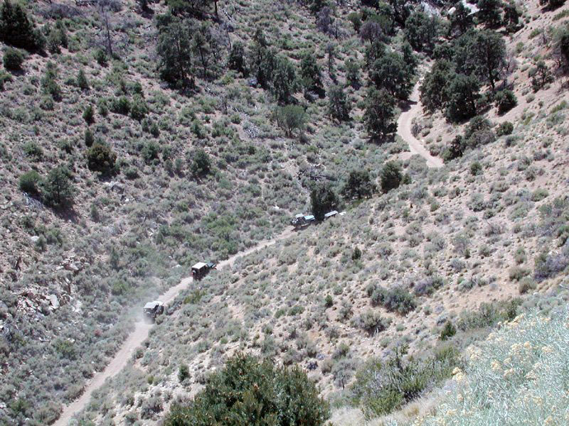
A shot of us making the climb up Rickey Canyon
For the most part the course was typical Nevada desert, but we also encountered a high grove of aspens and a beautiful and lush mountain glade. In the mountains we passed some old mine shafts and other curiosities.
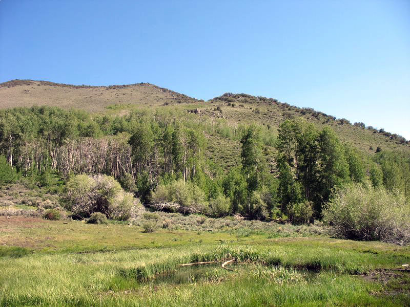
Most of the trails were mild dirt roads, fire roads, etc. but there were some steep sections with loose dirt, big ruts, etc. that required high clearance and/or 4WD. At one big washed-out rut, a Suzuki Samurai was unable to pass on its own power. Also, even in June the upper mountain trails had only just had the snow melt enough to be passable.
I cleaned up the track slightly, to correct an error and the associated backtrack we had to make. I may have deviated from the official course in places, but that’s the nature of these things.
Here’s the photo gallery from the rally.
Disclaimer – This information is provided from the best of my recollection and is necessarily subjective. GPS data is from a personal device inside my vehicle, so coordinates will not be exact. Use of any of this information is at your own risk and responsibility – period. Conditions change (especially in winter), vehicles and driver skills vary, etc. and I have no control over these things. Don’t let anything written here override your own personal common sense or safety.
Drive #16: Knoxville BLM
Drive #16: Knoxville BLM
Date Driven: 12/15/07
Length: 21.2 miles
My Drive Time: We were there for 6.5 hours, but that was mostly geocaching, lunch break, etc.
Start: Southern entrance to Knoxville on Berryessa-Knoxville Rd, N38º 49.479′ W122º 21.277′
End: Northern entrance to Knoxville on Morgan Valley Rd., N38º 51.668′ W122º 24.706′
GPS Track: GPX or KMZ format. (right click -> Save As)
Source(s): Not listed in any of my guidebooks, but a very minimal PDF map can be downloaded from the BLM site.
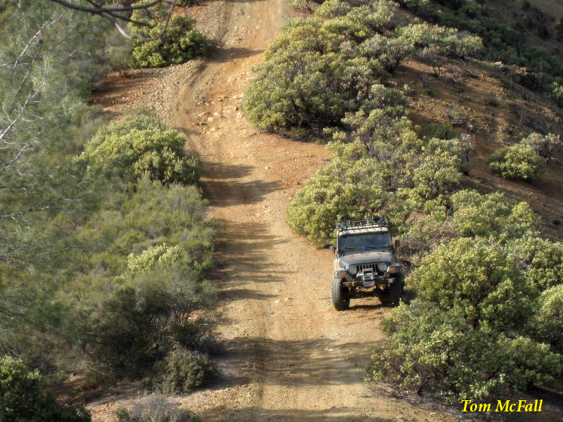
Summary: Offroading in the Knoxville BLM lands. We went with a group and spent the day there, mostly geocaching. Generally easy trails for 4x4s and SUVs.
Description: Officially named the Knoxville Recreation Area, this 17,700-acre BLM-managed land hosts offroaders, mountain bikers, and hunters. There used to be a public shooting range here as well but it’s been closed. There are several first-come, first-served campsites available at the Lower Hunting Creek campground..
Most of the area is comprised of small hills and is covered in scrub brush and some trees.There’s a main trail that runs through it, with side trails of various sizes. The main trail is an easy one, but the side trails can be a little more challenging.
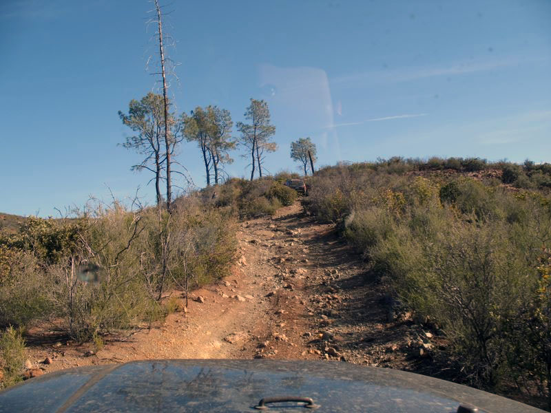
I was there with several other vehicles, and besides driving the trails we were also there to hunt down a bunch of hidden geocaches. We met up just outside the southern entrance, and then spent most of the day driving around, geocaching, and having a good time. The GPX tile of my track includes everywhere we went in vehicles and on foot.
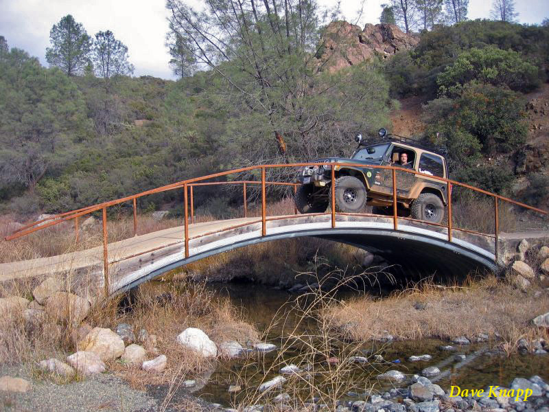
Here’s the photo gallery from our visit.
Disclaimer – This information is provided from the best of my recollection and is necessarily subjective. GPS data is from a personal device inside my vehicle, so coordinates will not be exact. Use of any of this information is at your own risk and responsibility – period. Conditions change (especially in winter), vehicles and driver skills vary, etc. and I have no control over these things. Don’t let anything written here override your own personal common sense or safety.


