Drive #17: GBES Pine Nut Mountains Loop

Drive #17: GBES Pine Nut Mountains Loop
Date Driven: 6/17/06
Length: 78 miles
My Drive Time: We were there for 6 hours 50 minutes, but with many stops as part of the rally.
Start: E. Valley Rd. and a dirt road, N38º 58.550′ W119º 42.190′
End: Pinenut Rd. and Hwy. 395,N38º 54.947′ W119º 42.945′
GPS Track: GPX or KMZ format. (right click -> Save As)
Source(s): I have no sources for this route, other than the rally waypoints we were given.
Summary: This is my track from the 2006 GBES Navigational and Geocaching Rally, over and around the Pine Nut Mountain Range. A good, high-clearance 4×4 is needed in several sections.
Description: In 2006, my buddy Antony Wilson and I signed up to take part in the GBES (Great Basin & Eastern Sierra, a local geocaching organization) Navigational and Geocaching Rally, which featured a night and a day course offroading on the eastern side of the Carson Valley. The rally featured typical navigation challenges and timed sections, combined with locating geocaches along the way to obtain waypoint codes. These verified your progress along the way and everything combined to give your stage and overall scores.
We were total noobs and really stumbled though the courses, but we had a blast doing it. The following year we returned and did much better, scoring 2nd place overall and just missing out on the win.
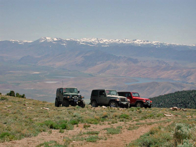
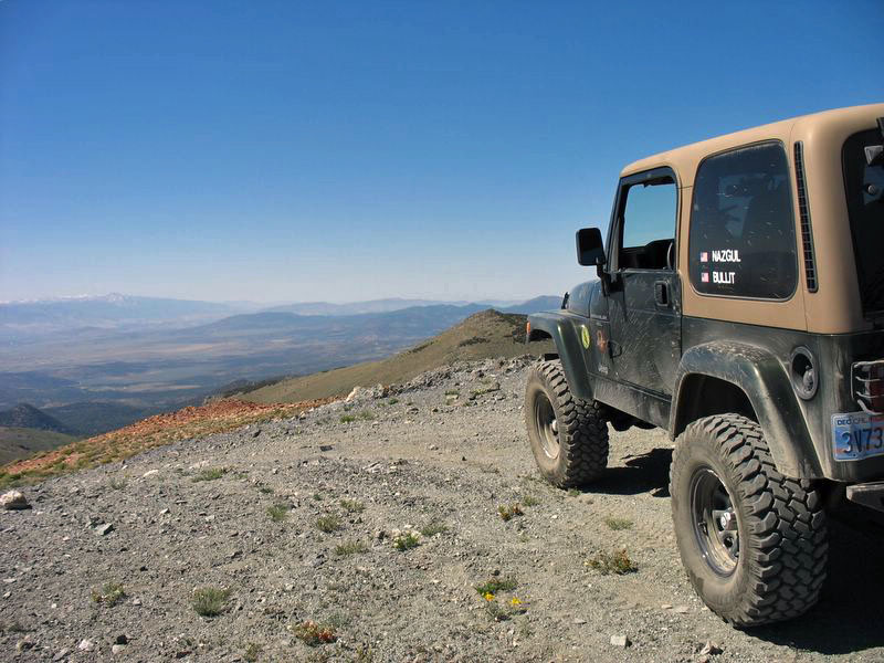
We really enjoyed driving in and around this course, and envied the nearby home owners who we saw hopping onto dirt bikes or quads in their driveways and being able to be up on these trails in just a few minutes. There were wide open dirt roads in the flats, and more technical trails – with amazing views – up in the mountains.
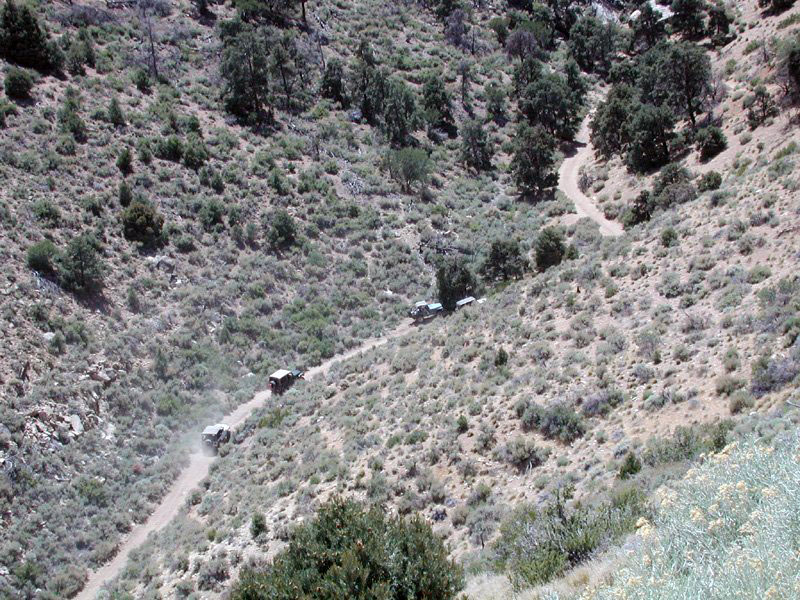
A shot of us making the climb up Rickey Canyon
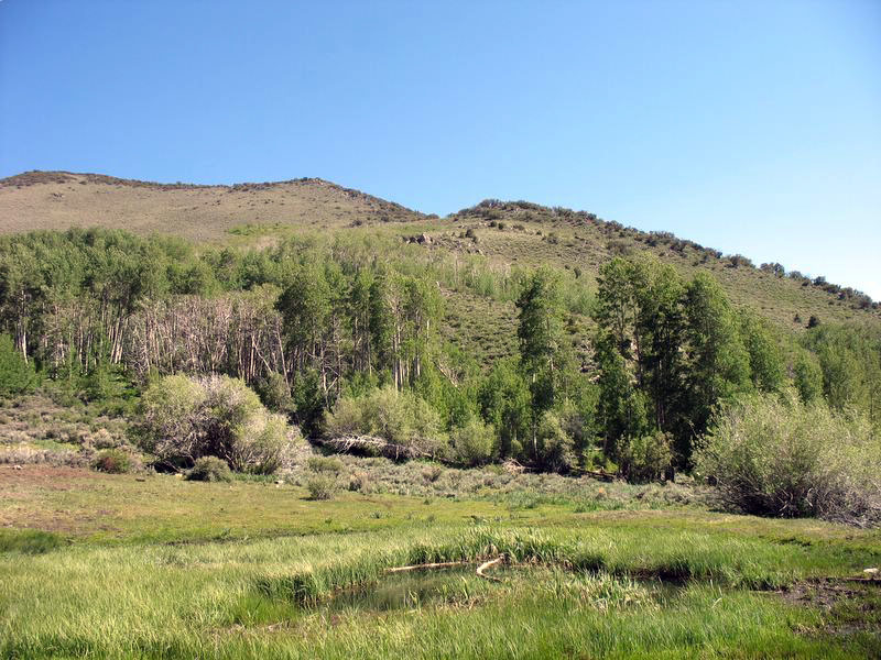
For the most part the course was typical Nevada desert, but we also encountered a high grove of aspens and a beautiful and lush mountain glade. In the mountains we passed some old mine shafts and other curiosities.
Most of the trails were mild dirt roads, fire roads, etc. but there were some steep sections with loose dirt, big ruts, etc. that required high clearance and/or 4WD. At one big washed-out rut, a Suzuki Samurai was unable to pass on its own power. Also, even in June the upper mountain trails had only just had the snow melt enough to be passable.
I cleaned up the track slightly, to correct an error and the associated backtrack we had to make. I may have deviated from the official course in places, but that’s the nature of these things.
Here’s the photo gallery from the rally.
Disclaimer – This information is provided from the best of my recollection and is necessarily subjective. GPS data is from a personal device inside my vehicle, so coordinates will not be exact. Use of any of this information is at your own risk and responsibility – period. Conditions change (especially in winter), vehicles and driver skills vary, etc. and I have no control over these things. Don’t let anything written here override your own personal common sense or safety.