Drive #15: Slate Mountain
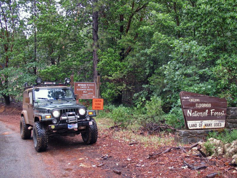
Drive #15: Slate Mountain
Date Driven: 5/24/08
Length: 29.3 miles
My Drive Time: 2 hours 19 minutes
Start: Wentworth Springs Drive, N38º 56.163′ W120º 44.594′
End: Near Placerville, N38º 44.092′ W120º 47.144′
GPS Track: GPX or KMZ format. (right click -> Save As)
Source(s): Trail NS14 in Backcountry Adventures Northern California.
Summary: A fun drive through the woods of the Eldorado National Forest just outside Placerville, CA. Closed Nov. 10 to May 1st.
Description: An overall easy drive, you’ll still want a high-clearance vehicle here for some sections. The trail to the Slate Mountain peak is a narrow shelf road with encroaching brush and trees in places. Perhaps “encroaching” is an understatement, as you’ll see from this view looking out of my windshield:
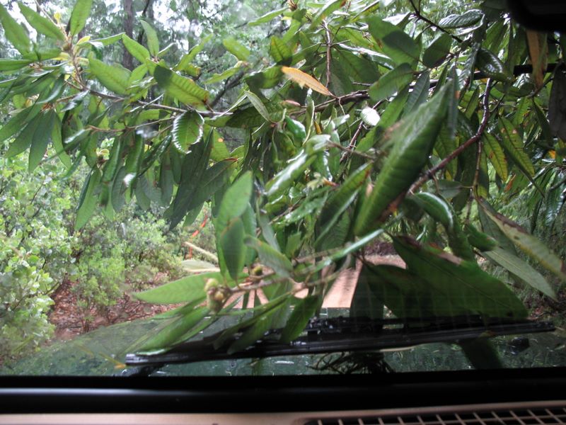
This is one of the few places I’ve been where limb risers would have been useful. Besides likely pinstriping, a friend had a side mirror pulled off of his truck here. Very wide vehicles will want to avoid this section.
The trail passes through the Rock Creek OHV area and is closed from November 10 to May 1st to help protect Pacific deer who winter there.
Slate Mountain peak used to have a fire lookout tower (it is shown in the Massey book) but it was torn down several years ago and only the foundations remain. The microwave repeater building and towers remain. The gate to the peak was closed when we visited, but we parked (off to one side so as not to block any possible traffic) and walked the short distance to the top. It was a rainy day so we didn’t have any views to speak of, but we had a good time anyway.
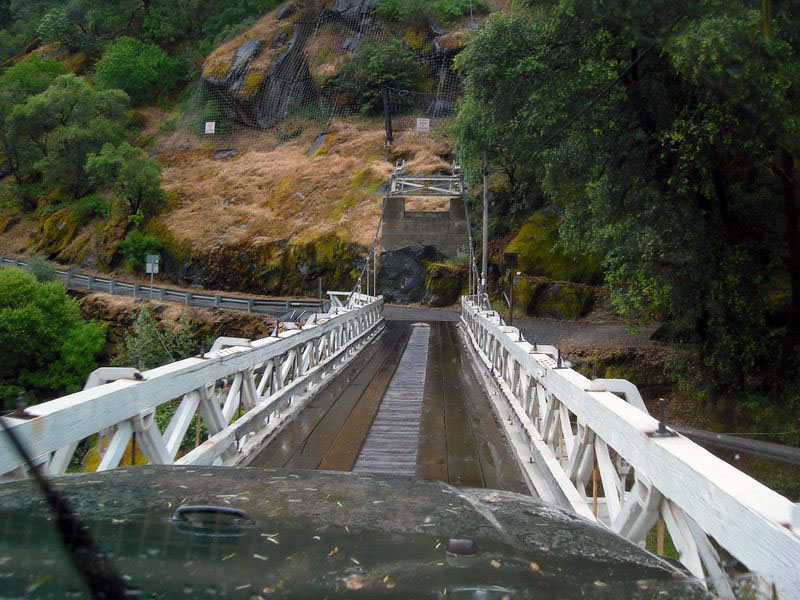
This track includes the waypoints I added from the coordinates in the Massey book. I corrected most of the ones we encountered to bring them closer to what my GPS was showing, but we didn’t get near several of the waypoints. Most of these corrections were very minor.
Here’s the Slate Mountain photo gallery.
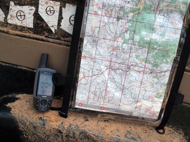
Disclaimer – This information is provided from the best of my recollection and is necessarily subjective. GPS data is from a personal device inside my vehicle, so coordinates will not be exact. Use of any of this information is at your own risk and responsibility – period. Conditions change (especially in winter), vehicles and driver skills vary, etc. and I have no control over these things. Don’t let anything written here override your own personal common sense or safety.
Drive #14: Yosemite via Old Coulterville Road
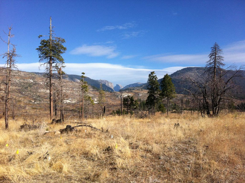
Yosemite via Old Coulterville Road
Date Driven: 1/15/12
Length: 31.9 miles
My Drive Time: 2 hours 24 minutes
Start: Old Coulterville Road, N37º 44.660′ W120º 01.932′
End: Intersection of Foresta Road and Big Oak Flat Road, N37º 42.810′ W119º 43.915′
GPS Track: GPX or KMZ format. (right click -> Save As)
Source(s): Old Coulterville Road is Trail HS28 in Backcountry Adventures Northern California.
Summary: The little-known original wagon road into Yosemite Valley. Mostly easy dirt mountain road, but high clearance 4WD needed in some stretches. Subject to seasonal closure.
Description: Of the literally millions of tourists and others that visit Yosemite National Park annually, it’s fair to say that very few indeed know anything about the Old Coulterville Road, much less have ever experienced it. In continuous operation since opened in 1874, it was the original road in Yosemite.
Now bypassed by the well-known paved highways, Old Coulterville Road still stands as the most interesting and adventurous road into the park, at least that I know of.
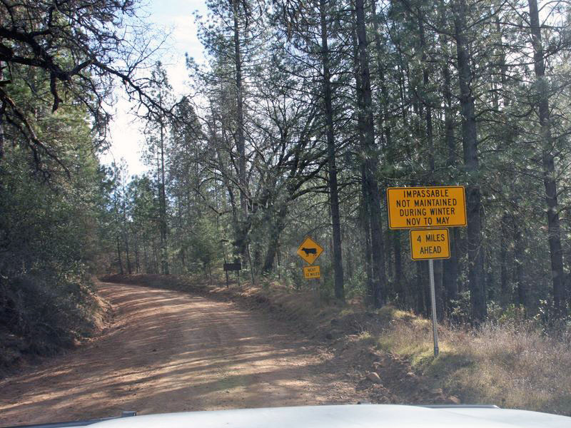
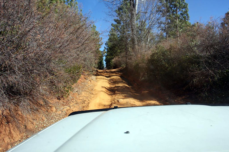
Beginning about 20 minutes from the small Sierra town of Coulterville on Highway 49, the dirt mountain road is an easy drive for the most part – when it is dry. There was a big chunk taken out of the road in one spot when we drove it (a tree had fallen and its root ball took half the trail with it) and I squeezed though with a good three inches to spare, I am told. I think I recall hearing that the trail has since been repaired there, but I can’t say for certain. There were also some rutted and overgrown uphill and downhills sections that you wouldn’t want to try in a low-clearance vehicle.
We drove the trail in mid-January, but typically it will be closed during that time because of snow. Signs suggest a typical closure time is from November to May. It also shows that the road is unmaintained over winter, so fallen trees may be an issue. We had to skirt around a couple on our drive.
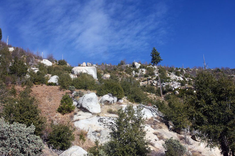
There are many side trails along the way, and several sights to see like caves and fire lookouts. When we drove it, pretty much every gate was closed for the season. It would be fun to explore these more during the dry season. For current road status, check with the Groveland Ranger District of the Stanislaus National Forest.
It was a pretty drive and felt very remote. We saw only a single pickup truck on the entire drive, and a few folks on foot by the Little Nellie Falls.
The road ends in the little community of Foresta, shortly after you get a nice peek at iconic Half Dome in the distance. At Foresta, the old creek bridge is rather broken, so we continued south just a bit and took the next road into Foresta, which then crossed the creek over a slightly larger and much more modern bridge. We officially end this Drive at Big Pine Flat Road, just a bit west of the Half Dome Viewpoint pullout. Of course we continued from there into Yosemite Valley for the rest of our weekend visit.
I wrote a full blog post about this trip to Yosemite, including a large photo gallery.
Disclaimer – This information is provided from the best of my recollection and is necessarily subjective. GPS data is from a personal device inside my vehicle, so coordinates will not be exact. Use of any of this information is at your own risk and responsibility – period. Conditions change (especially in winter), vehicles and driver skills vary, etc. and I have no control over these things. Don’t let anything written here override your own personal common sense or safety.
Drive #13: Old Coast Road
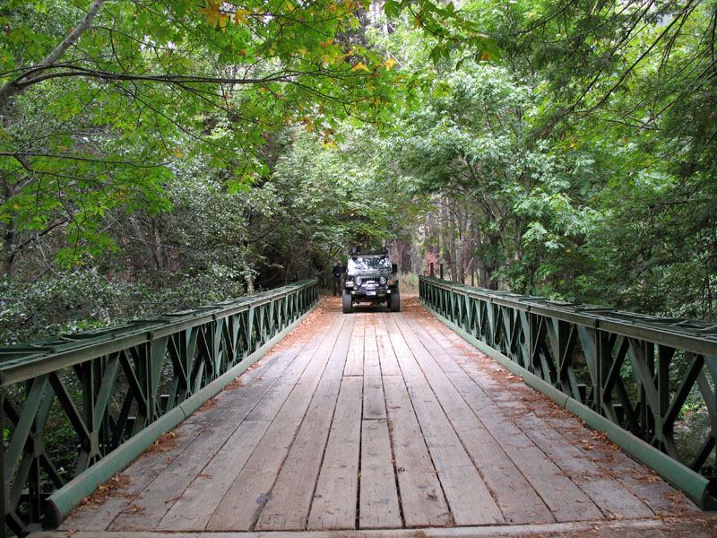
Bridge over the Little Sur river.
Old Coast Road
Dates Driven: 11/27/05, 9/21/07
Length: 10.8 miles
My Drive Time: 2 hours (including many stops)
Start: Intersection of Highway 1 and Old Coast Road, N36º 22.350′ W121º 54.154′
End: Intersection of Old Coast Road and Highway 1, N36º 17.311′ W121º 50.661′
GPS Track: GPX or KMZ format. (right click -> Save As)
Source(s): This drive is very well documented. It’s Trail #50 in Guide to Northern California Backroads & 4-Wheel Drive Trails, Tour #18 in California Coastal Byways and Trail CM51 in Backcountry Adventures Southern California.
Summary: A pleasant detour from paved Highway 1 along California’s beautiful Pacific coastline. Easy dirt road.
Description: At the northern end of the famous Bixby Bridge there is a dirt road that perhaps millions of drivers see – but never take – every year.
Old Coast Road dates back to around 1855. It used to be part of the route used by wagons and stagecoaches traveling up and down the coast, prior to the construction of modern Highway 1 and the bridge over Bixby Creek. In winter it became impassible due to mud.
Driving away from the bridge to the east, Old Coast Road ascends around a thousand feet, winding up the nearby ridge as a wide dirt road. There are some wonderful views along the way.
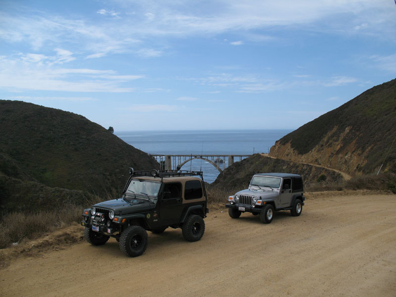
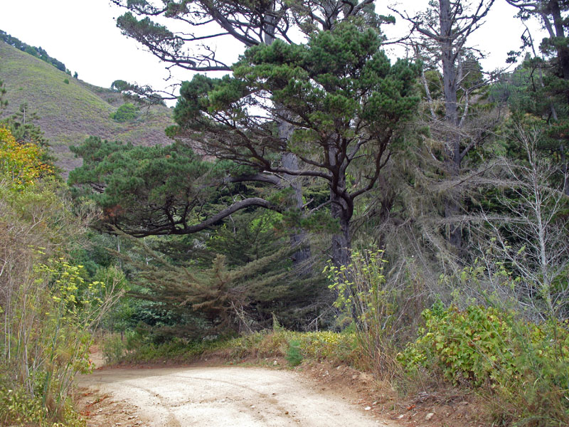
Before long, the road descends and narrows as it passes redwood groves, coastal woods and secluded rural homes. Eventually the road climbs up and down again, ending back at Highway 1.
About 2.5 miles south there is the attractive Big Sur River Inn, a nice spot for lunch. I like to eat on the large back deck by the stream. They also have a general store, and the closest gas stations for many miles. One is located outside the Inn, and the other is just down the street at the Ripplewood Resort. Be prepared to pay a premium for gas at either location, but I think Ripplewood is cheaper.
Here is a small photo gallery from our first drive on this road.
Disclaimer – This information is provided from the best of my recollection and is necessarily subjective. GPS data is from a personal device inside my vehicle, so coordinates will not be exact. Use of any of this information is at your own risk and responsibility – period. Conditions change (especially in winter), vehicles and driver skills vary, etc. and I have no control over these things. Don’t let anything written here override your own personal common sense or safety.
New – Google Map for the Drives category
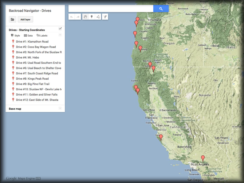
I’ve just added some new functionality to the site in the form of a custom Google Map for the Drives category. I’ve been meaning to do this for some time now. Whenever you want to access the map, you an do so via a link (and graphic) in the right-hand column of this blog. See? It’s just over there. —->
Using this map, you’ll be able to get a broad view of the various Drives I have here in my blog. As new Drives are added, I will also add them to the map so that it stays current.
This is “version 1.0” of the maps. They don’t have all the functionality I’d like. For example< I can’t add full tracks. That said, there are some things I can add like custom layers, so I may add a layer for “Points of Interest” (POIs).
If you have any feedback on the new map, please leave a comment below.


