New Drives, ExPo M&G and Upcoming Events
Site News
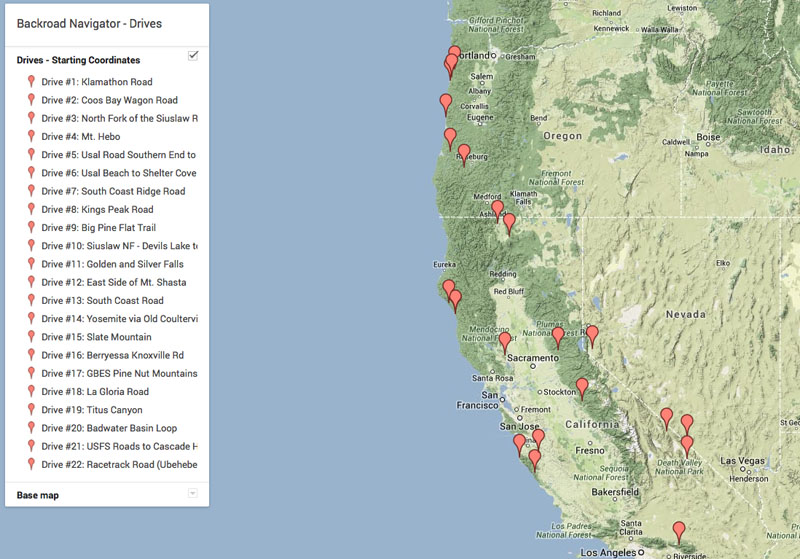
If you follow my blog you probably know I’ve been busy lately, adding a lot of new posts in the Drives category. If memory serves, I’ve gone from ten drives to now having 22 of them, in the last month or so. And with that many Drives, hopefully the new Google Map has made it easier to browse them by location.
I intend to keep adding more Drives, but at a reduced pace. Lately I’ve published them in pairs as well, to reduce the amount of notification emails that get sent out to subscribers.
Unfortunately, it seems that I can’t find my GPS tracks for a few good ones I had planned to add. One was my Mojave Road track, as well as the one from Desert Rendezvous 2012 in the Anza Borrego desert, but alas, both have vanished! Probably a dumb error on my part. In fact, all of my track data from the big Overland Expo road trip seems to have gone AWOL
Bummer.
In other site news, I’ve added several new items to my Amazon aStore, mostly in the guidebooks and gear categories. I only list gear that I have firsthand experience with and am comfortable recommending.
Events
In non-site news, I recently attended a small, informal meet and greet with ten other local folks from the Expedition Portal site. It’s fun to meet new people that share common interests, as you tend to “speak the same language.” The conversations centered around vehicles, ham radio, onboard air, local dirt road and trail options, Death Valley, offroad navigation, and so on.
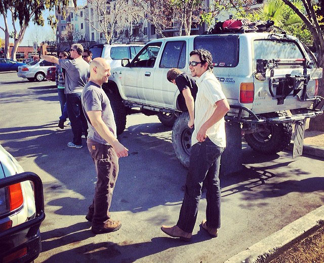
Our small group was diverse, ranging from offroading veterans to enthusiastic noobs, and there were Jeeps, Land Cruiser 80s and a 100 series, an FJ Cruiser and two generations of 4Runners. We hung out in the parking lot for awhile before heading inside and claiming a big table in the restaurant.
There’s talk of making the get-together a monthly event, which would be nice. If you’re local and interested, this is the thread to watch in the ExPo forums.
Things are also looking good for attending Desert Rendezvous in March. This one will be a little different as I’ll have my family with me. My daughter’s birthday falls on that Friday, but she was still eager to go, which I think is pretty cool. I also think she’s going to have a good time. And I’m hoping to run the entire Bradshaw Trail that weekend while we’re there.
I’m still not 100% sure we’ll make it to DR14 (work or budget could torpedo my plans) but things are looking good for now. Fingers crossed.
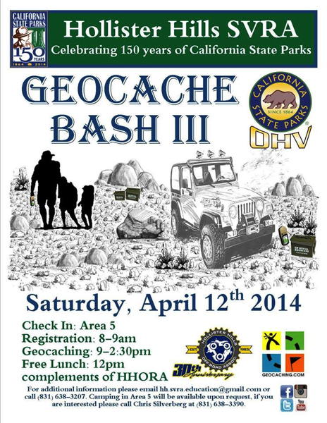
Another upcoming event is the Third Annual Hollister Hills Geocache Bash on Saturday, April 12th. I participated in this event last year and in 2012, and had a lot of fun both times. Besides a literal free lunch, you also get entry into Hollister Hills SVRA for free, and can drive the Hudner Expansion property, which is normally open only for specific paid events.
This year they are also allowing camping in Area 5, as long as you make the appropriate arrangements ahead of time. This is the same area where there was camping for the now-defunct Overland Rally & Workshop that was held here for a couple of years, and also the main staging area for the Geocache Bash.
You’ll need to bring at least one GPS to attend and to participate in the geocaching activities. There will also be a raffle, and tickets are given out based on how many of the specific geocaches you locate. Some of the raffle prizes in the past have been pretty good, so it’s definitely worth your while to participate.
Give me a shout if you’re going to be at any of these upcoming events.
Drive #22: Racetrack Road (Ubehebe Crater to Homestake Camp)
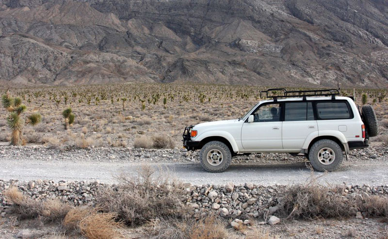
Small Joshua trees along Racetrack Road
Drive #22: Racetrack Road (Ubehebe Crater to Homestake Camp)
Date Driven: 12/28/11
Length: 29.4 miles
My Drive Time: 3 hours 5 minutes (includes stops)
Start: By Ubehebe Crater where dirt Racetrack Road begins, N37º 00.772′ W117º 27.482′
End: Homestake Camp, N36º 38.261′ W117º 34.438′
GPS Track: GPX or KMZ format. (right click -> Save As)
Source(s): Racetrack Road is popular and thoroughly-documented. It’s Tour 13 in California Desert Byways; Trail D51 in Backcountry Adventures Southern California; Parts are in both Excursion #15 and 28 in Death Valley SUV Trails; and it’s Trip Route NW-2 in The Explorer’s Guide to Death Valley National Park. It is also shown on the National Geographic map of Death Valley, and most (but not all) of Racetrack Road is shown on this NPS PDF map.
Summary: We started this Drive from inside Death Valley NP, after completing Drive #19: Titus Canyon. Starting by Ubehebe Crater, almost 30 miles of brain-scrambling washboard road brought us past legendary landmarks such as Teakettle Junction and The Racetrack before we reached Homestake Camp.
Description: On its northern end, dirt Racetrack Road begins off the paved road that makes a loop by Ubehebe Crater. The NPS describes the road this way: “The road to Racetrack Valley begins near Ubehebe Crater. Normally it is recommended for high-clearance vehicles as it can be rough and washboard. Off-road driving is prohibited as the desert is very fragile and vehicle tracks can remain for years.”
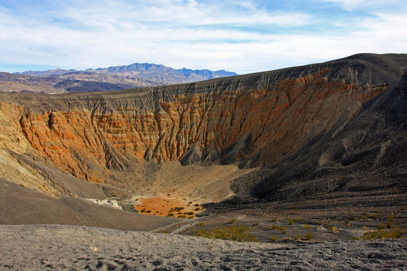
Ubehebe Crater
The rangers in the park also seem to discourage anyone from driving it. Between its sharp rocks (which also make up the berms on either side of the road in many places) and the heavy washboarding, Racetrack Road has a reputation for breaking vehicles. Despite that, we saw everything from generic rental cars to big-dollar custom Jeeps driving Racetrack Road, which meant that there was a lot of two-way traffic.
When we drove it, the washboard was both severe and relentless. Every so often it would stop for a few seconds, just long enough for me to think “Oh my god, I hope that was the end of it,” which is of course when it started right up again. We made it to camp fine but the next day when we drove up the reverse direction, the positive battery cable was vibrated right off its post, causing a brief panic as I suddenly dealt with a dead vehicle. Fortunately, the problem was quickly spotted and corrected and we had no further issues on the road.
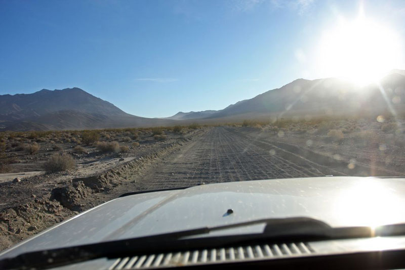
The low sun highlights the washboard on Racetrack Road
I do know a guy whose battery cable completely broke from the terminal clamp after enduring this road and some others in Death Valley. There are also a lot of stories of folks getting flat tires from the sharp rocks on Racetrack Road. It’s wise to be well-prepared before subjecting your vehicle to this area.
But enough on the rigors of this road. The scenery here is quite beautiful, including a small Joshua Tree forest. Of course there is the famous and mysterious Racetrack, where rocks slide across the playa when no one is looking. We also stopped at Teakettle Junction, a remote travel landmark that has drawn me since I first read of it many years ago. It was also one of the few places in the park where we inexplicably had 3G data reception on our AT&T cellular devices.
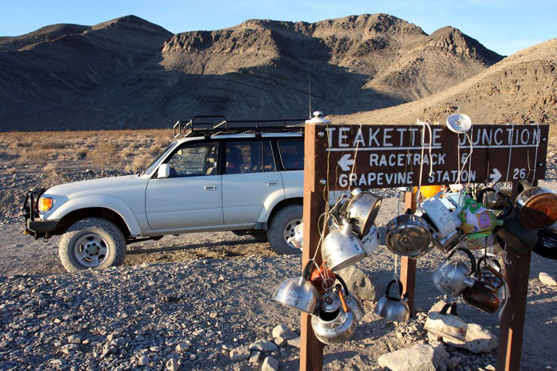
Backcountry travelers from around the globe have been leaving teakettles here for many years. When we were there, teakettles and signatures from Russia, England and Japan were just a few of the many hanging from the sign.
Near the southern end of the road, we camped overnight at Homestake Camp, a primitive campground area featuring a battered and unwelcoming porta-potty and a few cleared camp ares. There were a few other vehicles there that night, but it still felt quite far from civilization. By sheer coincidence, we ended up camping next to the guy whose description of this very campground had led me to seek it out. Small world! Just after dusk, we were also visited by a desert kitfox, which was a neat experience.
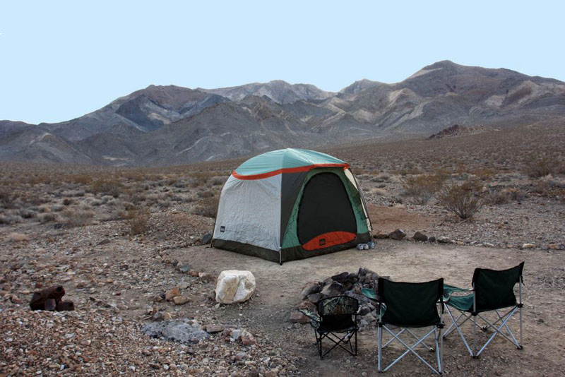
Homestake Camp
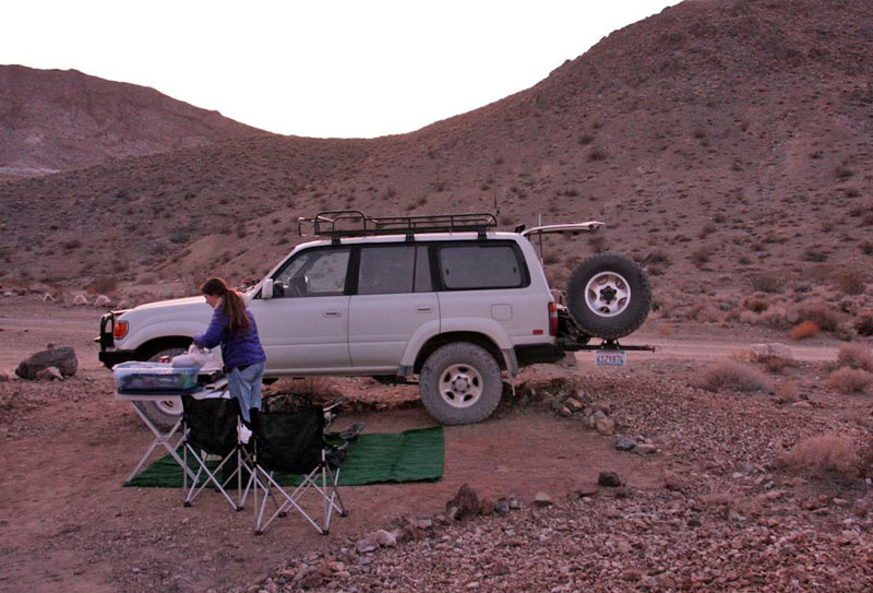
Dinner prep at Homestake Camp
The desert temperatures dropped sharply overnight, from a daytime high in the 70s down to about 27ºF! After some campfire time, we quickly retreated to our warm sleeping bags in the tent, which we supplemented with blankets to stay extra cozy.
This area was filled with wonders for the family and I, on a trip that we’ll never forget.
Here’s the blog post and the associated photo gallery from that day in Death Valley, including this Drive. These are the same ones associated with Drive #19: Titus Canyon. There’s another blog post and more photos of Homestake Camp, The Racetrack, Ubehebe Crater, etc. are included in the next day’s photo gallery as well, as we backtracked up Racetrack Road.
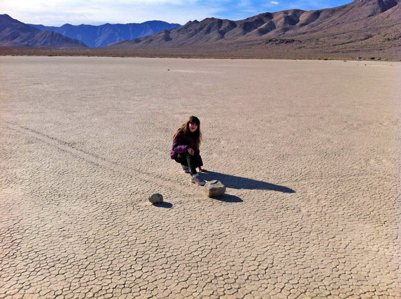
Allison examines some of the mysterious Racetrack rocks
Disclaimer – This information is provided from the best of my recollection and is necessarily subjective. GPS data is from a personal device inside my vehicle, so coordinates will not be exact. Typos are possible. Use of any of this information is at your own risk and responsibility – period. Conditions change (especially in winter), vehicles and driver skills vary, etc. and I have no control over these things. Don’t let anything written here override your own personal common sense or safety.
Drive #21: FS Roads to Cascade Head
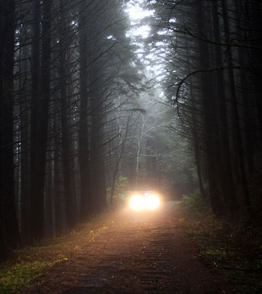
Drive #21: USFS Roads to Cascade Head
Date Driven: 11/22/11
Length: 9.8 miles
My Drive Time: 45 minutes (excluding my hike to Cascade Head and back)
Start: Highway 101 and Cascade Head Rd./NF-1861, N45º 03.945′ W123º 56.906′
End: Same
GPS Track: GPX or KMZ format. (right click -> Save As)
Source(s): These short access roads are not in any of my reference books.
Summary: I drove this route both to explore the National Forest roads here as well as to access some coastal hiking trailheads. The track reflects that, and also includes backtracking.
Description: This Drive begins as you pull off of Highway 101 onto dirt National Forest road NF-1861, which is also shown on some maps as Cascade Head Road. If memory serves, there was a gate but it was open when I visited, despite the fact that a fierce winter rainstorm was underway.
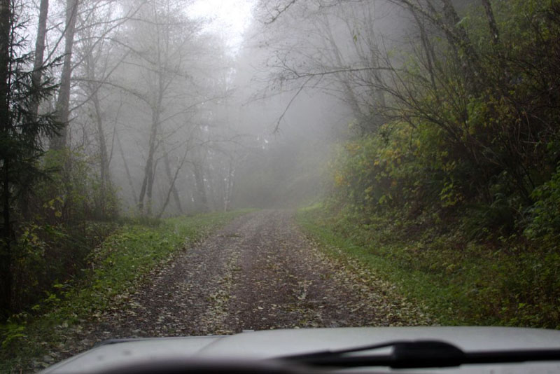
The roads here are well-graded and suited to pretty much any vehicle. They pass through the woods of the Cascade Head Experimental Forest, and provide access to a couple of hiking trails. I didn’t hike the Hart’s Cove Trail, but I did hike the trail out to Cascade Head.
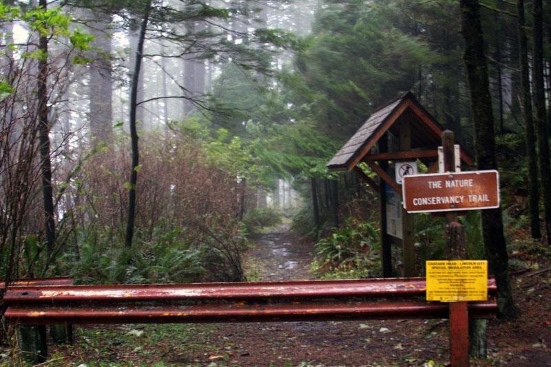
I had the trails to myself for the obvious reason that one of the fiercest winter storms on record was kind of passing through at the time. The woods provided some relief from the rain and driving winds, which were loudly howling through. Close to the head, the woods ended and suddenly there was nothing between me and winds that were gusting to 75mph. Walking – or even standing – required a concentrated effort here, where the winds swept in unobstructed from the Pacific.
I struggled along, and a short video I took of myself shows the wind stretching my face around like the astronauts undergoing high-G testing in those old documentary films from the 60s. When I wanted to stop to take a photo at one point, I had to brace myself against a steel pole. My beanie was ripped from my head and later recovered in tall grass about sixty feet away. The wind even peeled the screen protector off the LCD of my camera!
I had a blast.
Several photos from this drive are included in my Oregon 2011 Trip gallery starting here.
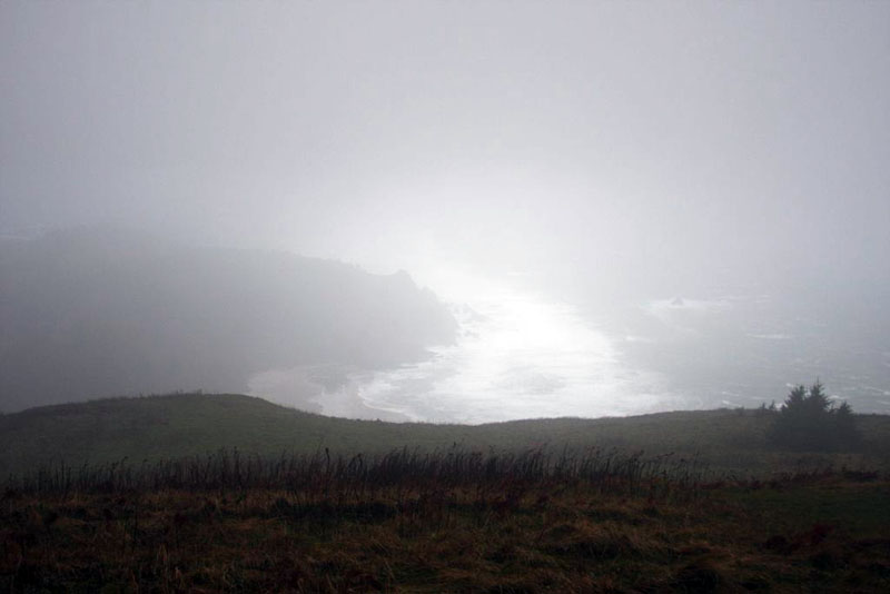
Storm-covered view of the coast from Cascade Head.
Disclaimer – This information is provided from the best of my recollection and is necessarily subjective. GPS data is from a personal device inside my vehicle, so coordinates will not be exact. Typos are possible. Use of any of this information is at your own risk and responsibility – period. Conditions change (especially in winter), vehicles and driver skills vary, etc. and I have no control over these things. Don’t let anything written here override your own personal common sense or safety.
Drive #20: Badwater Basin Loop
Drive #20: Badwater Basin Loop
Date Driven: 12/30/11
Length: 73.2 miles. Half-paved, half dirt.
My Drive Time: 2 hours 48 minutes (includes stops for lunch, walking, etc.)
Start: Badwater Road and West Side Road, N36º 21.837′ W116º 50.645′
End: Same as Start.
GPS Track: GPX or KMZ format. (right click -> Save As)
Source(s): West Side Road is Trail D32 in Backcountry Adventures Southern California. Much of this Drive is covered in Excursion #6 in Death Valley SUV Trails and Trip Route SC-1 and SC-3 in The Explorer’s Guide to Death Valley National Park. Of course it’s also on the National Geographic map of Death Valley.
Summary: Experience the lowest elevation in North America. Half this drive is on pavement, half is well-graded dirt road. All of it is cool.
Description: We reached this Drive from inside Death Valley NP, after topping up our fuel at Stovepipe Wells. Again. We also stopped to check out the shop at Furnace Creek before making the short drive south to where this Drive begins, heading south on Badwater Road.
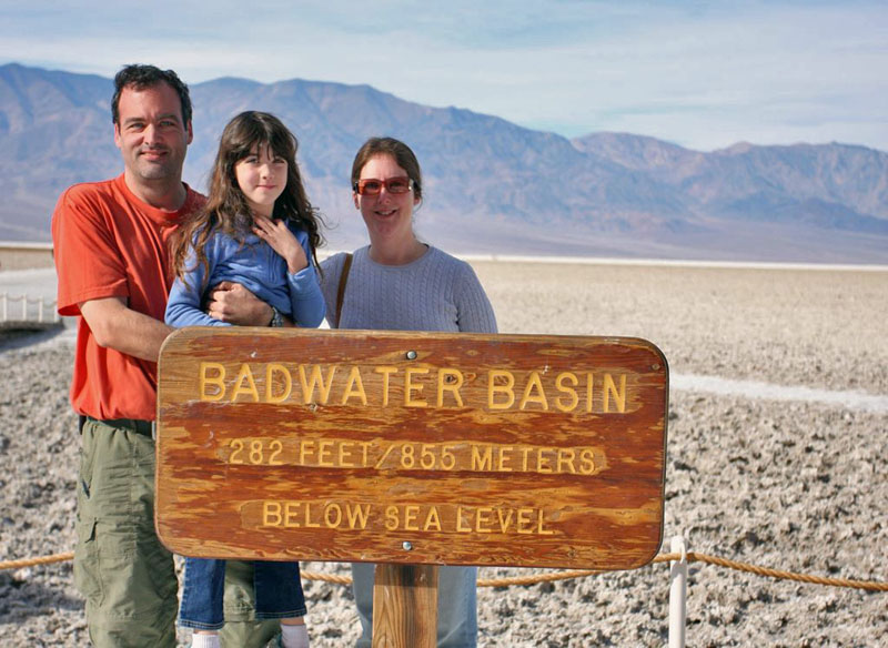
We stopped at the main Badwater Basin parking lot – which was nearly full – and walked a half mile out onto the salty flats to check it out. My GPS showed our elevation as low as -270′ here. We tasted the salty crust of the basin, marveled at the wonder of this place, and then walked back. There were lots of people here, and this is said to be one of the most popular places in the park.
From there we continued south, past a spectacular alluvial fan or two, until we reached the intersection with the southern end of West Side Road.
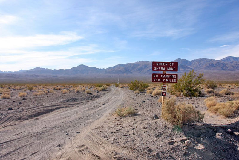
One of several side roads off of West Side Road
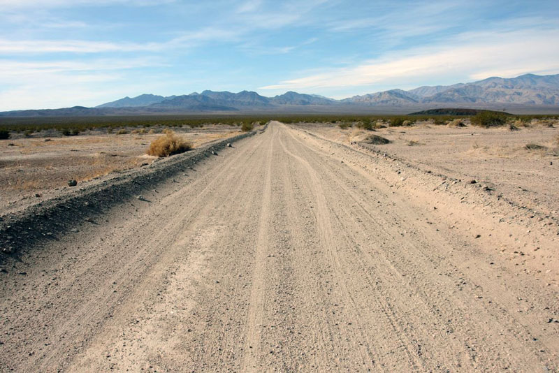
West Side Road is all dirt. There was a short stretch of mild washboard near the beginning, but it was nothing compared to Racetrack Road, thank the gods. The road had been very well graded sometime recently it seemed, and we were able to cruise along at the speed limit with no trouble, just being careful to watch for loose dirt in some corners and such. We saw other SUVs, some old Series Land Rovers, and a couple of vans on the road here.
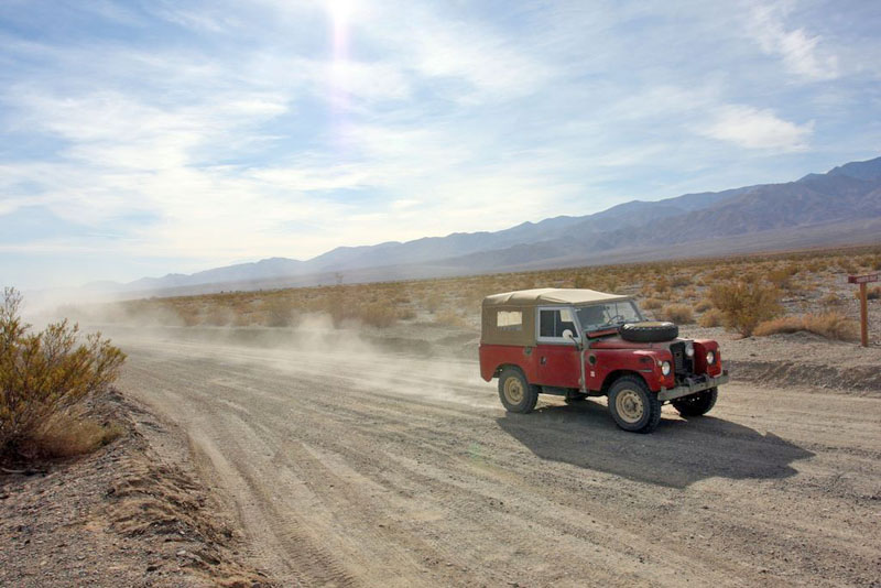
We drove out to Shorty’s Grave, which we checked out along with the two benchmarks here, which are the lowest ones in the NGS database, if you’re into that sort of thing. There are actually two graves here, that of old prospector “Shorty” Harris (who died aged 74 in 1934) and Jim Dayton, a fellow prospector. We ate lunch where we were parked on the side of the road, which is when the old Land Rovers came past, much to my excitement.
After lunch we cruised the rest of the way up West Side Road, which was a blast to drive. If only there were no speed limit, and I was in a WRC rally car… The road here crossed over the basin and there were more of the flats on both sides of the road. We soon arrived at the end of West Side Road where it meets Badwater Road, and where this Drive started.
Our adventures on that day were not done by a long shot, but that’s a story for another time.
Here’s the blog post and the associated photo gallery from that day in Death Valley, including this Drive.
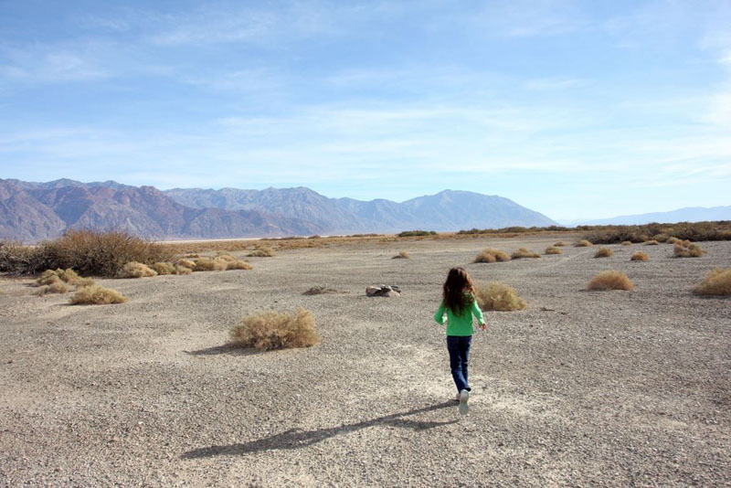
Allison jogs towards benchmark GS0206 near Shorty’s Grave
Disclaimer – This information is provided from the best of my recollection and is necessarily subjective. GPS data is from a personal device inside my vehicle, so coordinates will not be exact. Typos are possible. Use of any of this information is at your own risk and responsibility – period. Conditions change (especially in winter), vehicles and driver skills vary, etc. and I have no control over these things. Don’t let anything written here override your own personal common sense or safety.
