Death Valley: Crossing the Valley of Death
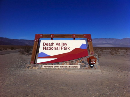
The western border of Death Valley National Park is not, it turns out, even in Death Valley. It’s in Panamint Valley, which is basically the next valley to the west of Death Valley. It was there that we reached the large Welcome to Death Valley monument/sign and stopped for a touristy photo op.
From there we cruised up to the intersection with Highway 190, which would take us into – and through – Death Valley proper. As we drove along it, it seemed that we had missed the most popular tourist pastime. There were a lot of cars parked randomly to the sides of the highway, and people were strolling out into the desert, and taking photos and such. I can only assume they were people that were just passing through and wanted a quick taste of the desert, but I don’t really know.
Before long Highway 190 climbs several thousand feet (about 5,000 if I’m remembering correctly) in short order. Towards the end of the climb, with lots of high RPMs, I saw Toyotie’s temperature gauge starting to head north of the mid-line (where it normally lives without fluctuation once warmed up) for the first time. Not a lot, but definitely some. It dropped back to where it belonged as soon as we reached the top. But I wondered what the effect was on most of the cars making the same climb in temperatures well above 100ºF in the summer heat.
The descent into Death Valley was nearly as rapid as the climb up had been. A short while later we found ourselves in Stovepipe Wells, which was to represent “civilization” during our time in the park. The general store was where we picked up our supplies and our gas, and there were serviceable public restrooms as well. It also was one of the better souvenir shops we’d seen. Stovepipe Wells is about a hundred miles from Ridgecrest where our day had begun.
Gas at Stovepipe Wells was about $4.19/gallon for regular. At the time, it ran about 40 cent less in Ridgecrest, and about a dollar more in nearby Furnace Creek. I was just relieved it wasn’t completely absurd… And that it was available at all, as it turned out. It seems they’d had a big power outage the weekend before we arrived, and hadn’t been able to run the pumps for three days. Toyotie holds a lot of gas, but not being able to fill up here would have made things challenging.
Safely fueled up, and snacks/cold drinks/trinkets acquired at the General Store, I walked to the ranger station about 200 yards to the east. I purchased our park entry ticket (20 bucks for a week) from the automated machine then checked in with the ranger inside regarding road and camp conditions. I was given what seems to be the most common treatment: the rangers, to be on the safe side, assume that everyone that walks in is utterly clueless.
I winced a little at this treatment, especially as I would bet money that Ms. Ranger wasn’t exactly fluent in offroad vehicles or the practical use of recovery gear and so on. But I understand why they might act this way, and having been at least assured that conditions in the campsites I inquired about were normal, I thanked her and returned to the Land Cruiser.
From Stovepipe wells we continued on 190, crossing through to the east side of the park. We passed the border into Nevada and a short time later turned onto the dirt road that leads through Titus Canyon. The 27-mile drive is one-way (east to west) and begins as a wide, flat and dusty dirt road through the desert. I passed several stock SUVs along this stretch. After several miles we reached the hills where the road narrows and climbs, twisting its way between jagged and colorful mountain peaks.
Those hills contain some rutted and rocky sections but when we drove it, the road was probably suitable for just about any stock SUV or truck if driven with appropriate care. In a proper offroad vehicle it was mostly a no-brainer and you could maintain a good speed if you wished. I did the drive with Toyotie unlocked and in the default High range the entire way.
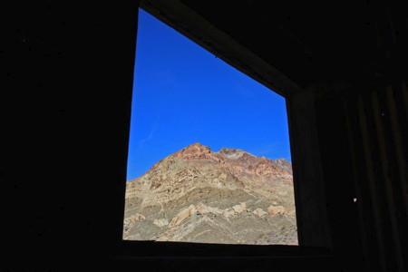
After winding through the hills for a few miles we reached the ghost town of Leadfield. We stopped to walk around what is left of the town, exploring the old corrugated buildings and the sealed mineshaft. We met some nice folks there: another geocacher who was trying to load up info on his tablet, and his wife and kid up at the mineshaft. The lady had a Canon dSLR with a 70-200-ish zoom lens (I was using the 17-40mm L lens on mine) and we took turns taking a few family snapshots for each other. After we finished exploring, we dropped the tailgate on the Land Cruiser and ate a quick lunch.
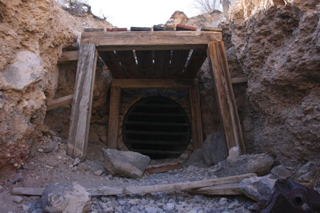
Continuing on, the scenery only became more spectacular as the canyon began to narrow. Soon the amazing displays of geology were almost close enough to reach out and touch as we passed by. The canyon got narrower and the walls got higher, and we made more and more “Wow!” exclamations. I was thrilled by this place. I had seen photos of Titus Canyon and they were why I chose this as our first DV destination after Stovepipe Wells. Happily, it lived up to my expectations. What a great drive it was, and I highly recommend it.
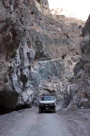
Exiting Titus Canyon and back in Death Valley now, we turned north onto the paved road and tried to make good time in order to make it to Homestake camp by sunset. Racetrack Valley road starts near Ubehebe Crater and with it began 30 miles of virtually non-stop washboard punishment. This road nearly shook the fillings out of my head at times, but thankfully it was a pretty drive. We passed numerous vehicles heading the opposite direction, sometimes having to squeak past each other on narrow stretches.
This road is a good test for vehicles, because anything you have that can be shaken loose will be, trust me! More on that later.
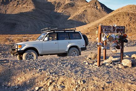
We stopped for photos at Teakettle Junction, which is one of those places that is inexplicably steeped in the magic of travel mythology. For whatever reason, I’d been drawn to this spot since I first learned about it many years ago, and I found it exhilarating to finally be there.
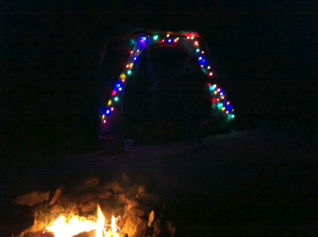
We passed by another of those mystic locations – The Racetrack – as we sped to Homestake, where we arrived just past sunset. Thankfully there was still some light left as I set up camp and Carrie cooked up fresh curry chicken and rice for our dinner. We ate besides a glorious campfire as the darkness and cold descended around us.
Shortly after dark we noticed a pair of eye sometimes reflecting in the light of our headlamps. This was “Foxy” (as immediately named by Allison), a sneaky and adorable little kit fox who was creeping around the camp area looking to bag some treats. We gently shooed him out of our camp a couple of times. His unexpected appearance was one of the highlights of our trip though. A raccoon in camp is a pretty common thing, but a kit fox was something entirely more special.
As the campfire died out and the cold desert night began to half-freeze the water in our bottles and cans, I turned off the Christmas lights on our tent and we hastily burrowed into our warm sleeping bags and blankets. It had been an exciting, 206-mile day and tomorrow would be another big day in Death Valley.
Great post Dave! Keep’m comin’!
January 8th, 2012 at 10:46 pmThanks! Work on the next part is underway…
January 8th, 2012 at 10:53 pm