Drive #21: FS Roads to Cascade Head

Drive #21: USFS Roads to Cascade Head
Date Driven: 11/22/11
Length: 9.8 miles
My Drive Time: 45 minutes (excluding my hike to Cascade Head and back)
Start: Highway 101 and Cascade Head Rd./NF-1861, N45º 03.945′ W123º 56.906′
End: Same
GPS Track: GPX or KMZ format. (right click -> Save As)
Source(s): These short access roads are not in any of my reference books.
Summary: I drove this route both to explore the National Forest roads here as well as to access some coastal hiking trailheads. The track reflects that, and also includes backtracking.
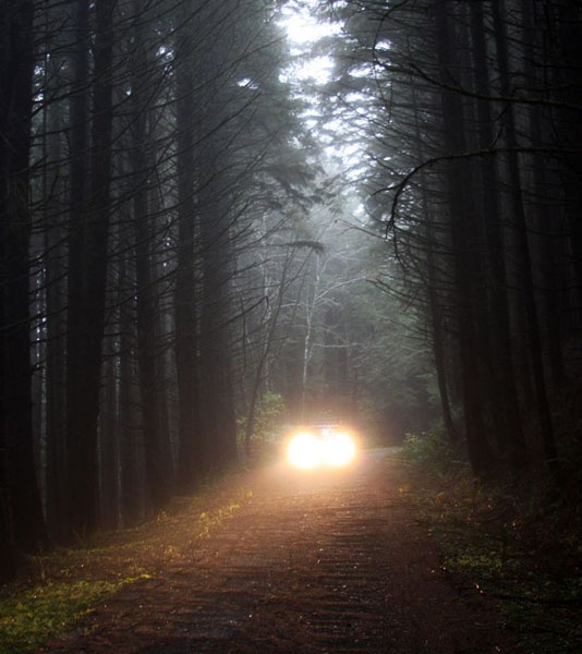
Description: This Drive begins as you pull off of Highway 101 onto dirt National Forest road NF-1861, which is also shown on some maps as Cascade Head Road. If memory serves, there was a gate but it was open when I visited, despite the fact that a fierce winter rainstorm was underway.
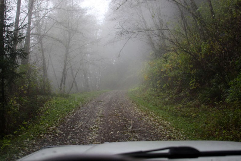
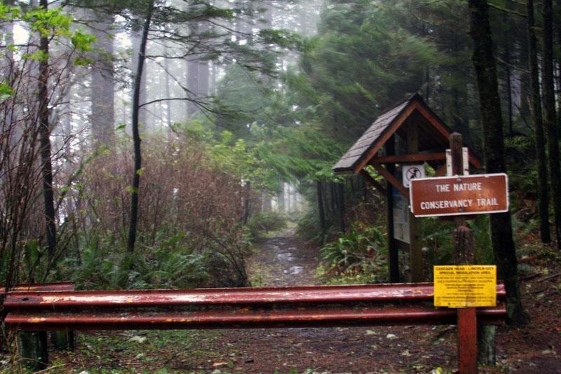
The roads here are well-graded and suited to pretty much any vehicle. They pass through the woods of the Cascade Head Experimental Forest, and provide access to a couple of hiking trails. I didn’t hike the Hart’s Cove Trail, but I did hike the trail out to Cascade Head.
I had the trails to myself for the obvious reason that one of the fiercest winter storms on record was kind of passing through at the time. The woods provided some relief from the rain and driving winds, which were loudly howling through. Close to the head, the woods ended and suddenly there was nothing between me and winds that were gusting to 75mph. Walking – or even standing – required a concentrated effort here, where the winds swept in unobstructed from the Pacific.
I struggled along, and a short video I took of myself shows the wind stretching my face around like the astronauts undergoing high-G testing in those old documentary films from the 60s. When I wanted to stop to take a photo at one point, I had to brace myself against a steel pole. My beanie was ripped from my head and later recovered in tall grass about sixty feet away. The wind even peeled the screen protector off the LCD of my camera!
I had a blast.
Several photos from this drive are included in my Oregon 2011 Trip gallery starting here.
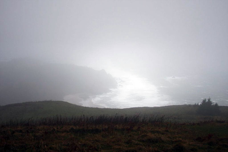
Storm-covered view of the coast from Cascade Head.
Disclaimer – This information is provided from the best of my recollection and is necessarily subjective. GPS data is from a personal device inside my vehicle, so coordinates will not be exact. Typos are possible. Use of any of this information is at your own risk and responsibility – period. Conditions change (especially in winter), vehicles and driver skills vary, etc. and I have no control over these things. Don’t let anything written here override your own personal common sense or safety.
Very nice. Great pictures and it looks like it was a fun time. I’ve lived in the Portland area for almost 9 years now and have never gotten down that way. I need to fix that.
February 26th, 2014 at 8:38 pmIt was a very fun time, Don, if not everyone’s cup of tea. 🙂
There’s lots to see and do along the Oregon coast, and this area is no exception. Plenty of offroad & forest road opportunities, lots of natural sights to see, and more. Newport is a favorite destination with its fun dockside area, nice aquarium, Rogue Ales brewery & restaurant, etc.
February 26th, 2014 at 8:58 pm