Drive #14: Yosemite via Old Coulterville Road

Yosemite via Old Coulterville Road
Date Driven: 1/15/12
Length: 31.9 miles
My Drive Time: 2 hours 24 minutes
Start: Old Coulterville Road, N37º 44.660′ W120º 01.932′
End: Intersection of Foresta Road and Big Oak Flat Road, N37º 42.810′ W119º 43.915′
GPS Track: GPX or KMZ format. (right click -> Save As)
Source(s): Old Coulterville Road is Trail HS28 in Backcountry Adventures Northern California.
Summary: The little-known original wagon road into Yosemite Valley. Mostly easy dirt mountain road, but high clearance 4WD needed in some stretches. Subject to seasonal closure.
Description: Of the literally millions of tourists and others that visit Yosemite National Park annually, it’s fair to say that very few indeed know anything about the Old Coulterville Road, much less have ever experienced it. In continuous operation since opened in 1874, it was the original road in Yosemite.
Now bypassed by the well-known paved highways, Old Coulterville Road still stands as the most interesting and adventurous road into the park, at least that I know of.

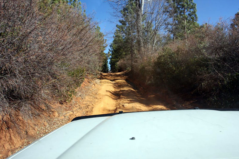
Beginning about 20 minutes from the small Sierra town of Coulterville on Highway 49, the dirt mountain road is an easy drive for the most part – when it is dry. There was a big chunk taken out of the road in one spot when we drove it (a tree had fallen and its root ball took half the trail with it) and I squeezed though with a good three inches to spare, I am told. I think I recall hearing that the trail has since been repaired there, but I can’t say for certain. There were also some rutted and overgrown uphill and downhills sections that you wouldn’t want to try in a low-clearance vehicle.

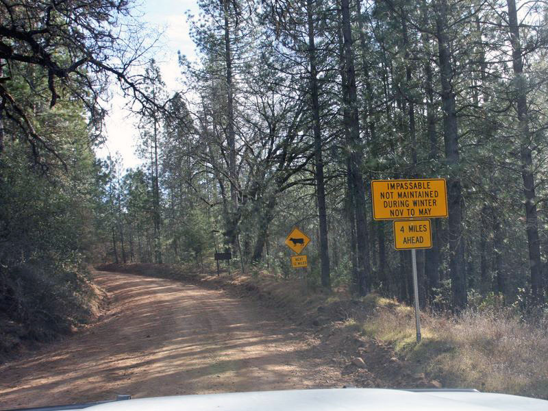
We drove the trail in mid-January, but typically it will be closed during that time because of snow. Signs suggest a typical closure time is from November to May. It also shows that the road is unmaintained over winter, so fallen trees may be an issue. We had to skirt around a couple on our drive.
There are many side trails along the way, and several sights to see like caves and fire lookouts. When we drove it, pretty much every gate was closed for the season. It would be fun to explore these more during the dry season. For current road status, check with the Groveland Ranger District of the Stanislaus National Forest.
It was a pretty drive and felt very remote. We saw only a single pickup truck on the entire drive, and a few folks on foot by the Little Nellie Falls.
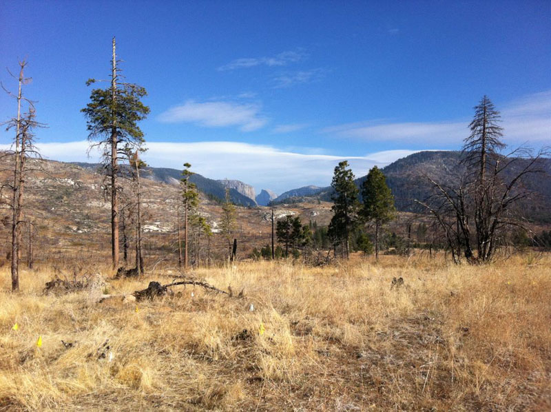
The road ends in the little community of Foresta, shortly after you get a nice peek at iconic Half Dome in the distance. At Foresta, the old creek bridge is rather broken, so we continued south just a bit and took the next road into Foresta, which then crossed the creek over a slightly larger and much more modern bridge. We officially end this Drive at Big Pine Flat Road, just a bit west of the Half Dome Viewpoint pullout. Of course we continued from there into Yosemite Valley for the rest of our weekend visit.
I wrote a full blog post about this trip to Yosemite, including a large photo gallery.

Disclaimer – This information is provided from the best of my recollection and is necessarily subjective. GPS data is from a personal device inside my vehicle, so coordinates will not be exact. Use of any of this information is at your own risk and responsibility – period. Conditions change (especially in winter), vehicles and driver skills vary, etc. and I have no control over these things. Don’t let anything written here override your own personal common sense or safety.

nice description and map… I am hoping to drive that road out there next weekend! Thanks for the info
September 21st, 2015 at 2:17 pmActually it’s older than you said. This road was originally constructed as a free toll trail in 1857, around the same time as Big Oak Flat Road and just 2 years after the first tourist party visit to Yosemite Valley. It was made into a toll wagon road in 1870.
Both this road and the Big Oak Flat road originally ended at the valley rim; both roads were extended to the valley floor in 1874. The park commissioners actually only gave permission for one road (this one) to reach the valley floor because it was so expensive to build that nobody would have been willing to do so if they couldn’t be assured of getting a monopoly. Business interests in Mariposa decided to make the extension anyway because their town was dependent on Yosemite tourism, and they knew they would lose all the tourist traffic if their road didn’t connect to the valley bottom as well. The two roads were in direct competition with each other, against the wishes of the park commissioners.
The state of California (Yosemite was originally a state park, not a national park) and later the federal government wanted to eliminate tolls on the roads so that travelers could reach the park without having to pay extremely expensive tolls. California bought parts of both roads within the valley in 1886, and the toll road companies were encouraged to make the roads free. Big Oak Flat Road agreed to let the state take over maintenance in exchange for eliminating the toll; Coulterville Road refused, so it was pretty much abandoned by 1890. Most people came to the park by stagecoach along either the Big Oak Flat or the Wawona Road until 1907 when the train came to Yosemite.
Coulterville Road was actually the first road into the park that was opened to automobiles in 1913, but it was so poorly maintained by that point that almost no one used it. The other roads were eventually purchased by the county, California, or the federal government, widened, and then paved in the 1920s, but Coulterville hadn’t seen much traffic so it was never paved. It was briefly taken over by the county in 1917 and its toll was eliminated, but it quickly reverted to its original owners, who basically ignored it and never maintained it or reinstated the toll. By now it’s almost completely forgotten & only used every once in a while by amazing people like you.
October 12th, 2015 at 1:42 amJosh, thanks very much for the additional history, and for the kind words. It’s fun to imagine how it must have felt to take this road in 1913 in a vehicle of that era; quite an adventure I’m sure! Let’s hope that these old roads are preserved for a long time for future generations.
October 12th, 2015 at 2:06 amThank you for this very informative blog post. I’ve been reading and re-reading this section for a couple years now and this has been a bucket list place for me since stumbling upon it. We love Yosemite and would love to find a new way in. Thank you!!
December 18th, 2021 at 12:39 am