Yosemite via Offroad… In January?
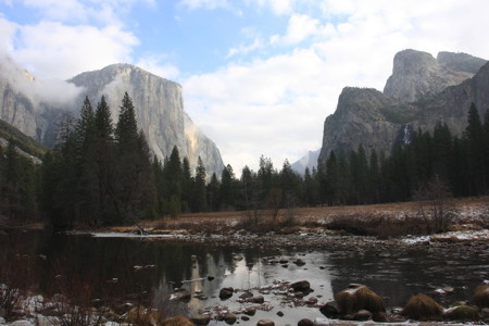
A week after our return home from Death Valley, I was still buzzing from the trip. It had been an adventure, and I had already starting thinking about “Where do we go next?”
I started making some notes on my calendar, updating the list of company holidays, and I noticed that one was just around the corner: MLK Day. That would give us a three-day weekend to do something with. I started thinking of where we might go, and browsing some of my guidebooks. A plan quickly formed.
If we stayed overnight on Sunday night (not a problem with the Monday holiday), there was room available at the Ahwahnee in Yosemite. Because of the cost(!) and the popularity of the hotel, we’d never stayed there. But it had been something that I’d wanted to do for several years and this seemed like a good opportunity.
The next step was looking through some of my trail reference books. From those, I was able to identify a 30-mile offroad route into Yosemite that looked promising. I had been into Yosemite via the three most common routes I was aware of: Highway 120 from the west, Highway 120 via Tioga pass from the east side, and Highway 41 from the southwest near Wawona. I knew of the Hwy 140 entrance as well, but had never heard of a dirt road into the park. That was something of a dream combination as far as I was concerned.
In the Northern California “Massey book” (starting on page 226) this road was described as a collection of various forest service roads, winding along wooded Sierra mountainsides, on the Old Coulterville-Yosemite toll road, which was the original road into Yosemite Valley. It would normally be closed this time of year due to snow, but with the unusual dry weather this year it might yet be open. Since even the road to Glacier Point was still open – which was pretty unheard of – it was worth a look.
There was another important consideration in this trip, and that could be summed up as compromise. That’s often a key factor in family outings. Carrie and Allison had enjoyed the Death Valley trip, although both of them are somewhat less enthusiastic about “roughing it” than I am. This trip would get me to Yosemite – maybe my favorite place on Earth – and also I’d get a few hours of offroading in too. Score! But from their perspective, we would get to stay in a luxury hotel for the first time, really. We’d have fun in Yosemite, and I’d intentionally avoid any big hikes or other physical challenges for a change. We’d do the tourist thing, browse the gift shops and visitor center, have a couple of nice meals and generally take it easy for once.
I wanted them to share my enthusiasm for our family road trips in Toyotie, and not dread them. So this short trip was designed to make everyone happy, and in the end it was a complete 100% success. It seems that compromises don’t always have to be painful, as ours have sometimes been in the past. Maybe I’m slowly getting smarter about these things.
We left Sunday morning and drove up to Coulterville, a historic little town right out of the Old West. I’d been there a few years back with Antony while we were on our way to the GBES Navigational & Geocaching Rally in Nevada. It’s not much more than a wide spot in the road but it’s packed with several historic old buildings, a pioneer cemetery, etc. From there it was something like seven miles to the start of the Old Coulterville Road, and the dirt.
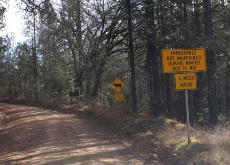
We reached the trail and I was happy to find the gates standing open, and no evidence of snow. There were warning signs about the trail being impassable and unmaintained starting in November, but that would be in a normal year, which this surely was not. My main concern throughout the 30-mile drive was that we could be halted at any time by gates, rockslides or washouts, or fallen trees. As it turned out, we saw evidence of all of these hazards along the way, but fortunately none that stopped us.
The road was a fun drive and very pretty along the entire route. As we were a solo vehicle in a remote area, I took it easy and paid extra care to avoid any hard hits that might cause a flat or other damage. The trail was mostly easy, but was sometimes rocky or badly rutted. There was one spot where a large tree had fallen on the downhill side of the trail, and its root ball had taken a very large bite from the trail. We’d have to winch ourselves out if we fell into that, and it would surely involve body damage. I had Carrie get out and spot me while I got the wheels up high on the uphill side of the trail. She said I squeaked past with about three inches to spare.
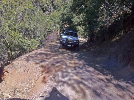
Along the way there were a few scattered fallen trees, but these had been cut by chainsaws or only covered part of the trail. The trail did narrow in places, with encroaching trees and brush that scraped at the roof rack and the CB antenna. At times I had to pick a line and squeeze through the brush while also accounting for the trail surface and ruts.
I navigated the numerous trail intersections and offshoots carefully, following the route I had created in my mapping software. Some of the side trails were gated, and most of those gates were closed. Some of them were ones I had identified as potential “alternate exits” back to civilization, so I was a little concerned to see our options dwindling as we went. I hoped that the main trail would remain open or we might face a lengthy backtrack.
We encountered only one other vehicle on the entire drive, an older Tacoma going the other direction from us. They may have been hunters. Nearing the end of the trail at Foresta, we encountered a group of hikers at the waterfall where I had to drive through about thirty feet of the waterfall’s runoff. Then as we reached the end of the dirt road in Foresta, we saw that the bridge there was closed! Dire signs warned against any attempt at driving over it. Thankfully, our luck held and we had a quick alternate road available to another bridge that was open.
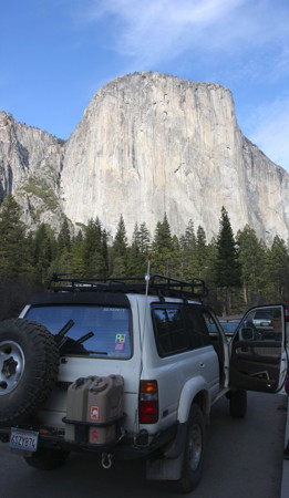
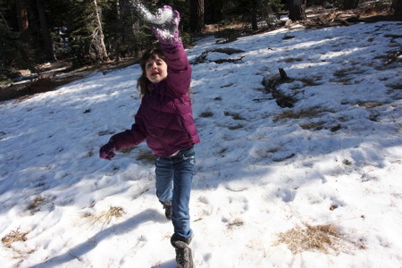
From there we quickly reached 120/Big Oak Flat Road, ate lunch at Half Dome View, and then drove into Yosemite Valley amid the usual “ooooh” and “WOW” sounds. It had been a few years since Carrie had been to Yosemite and I think it was Allison’s first time. She was thrilled to be able to play on some old snow and iced-up streams before we made our way to Yosemite Village and then finally to the Ahwahnee.
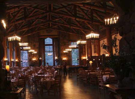
Our stay at the hotel was perfect and we enjoyed everything thoroughly. The Ahwahnee is a beautiful and large lodge, which also served as the inspiration to the large hotel in The Shining movie. I loved the old wood beams, fireplaces, and the grand lodge feel of the place. We ate dinner (and breakfast the next morning) at the hotel’s equally-expensive but very nice restaurant. The food was great and I actually enjoyed getting “dressed up” for it. Allison behaved perfectly, which is something of a rare thing when eating out, and that pleased us to no end.
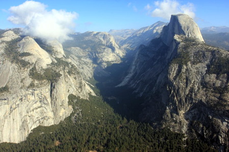
We reluctantly checked out after breakfast on Monday morning and drove through the valley, making the obligatory stop at Tunnel View before driving up to Glacier Point, a wonderful and unprecedented treat for mid-January. There was some snow around but not much and the road was almost completely clear, especially on our return trip where the sun had cleaned it off. Glacier Point was just a little brisk and fog blew through the southeastern end of the valley, but otherwise the weather was splendid and I marveled at our good fortune.
We drove back to the valley – stopping to photograph a roadside coyote – and had lunch at the deli before picking up an inexpensive print at the Ansel Adams gallery, and began the long drive home. Sometime close to sunset we stopped at the huge and wacky Bass Pro shop in Manteca, gawking at the high ceilings, waterfalls into a large fish tank, and other unusual wonders. It’s a bit like the “Red State” version of an REI crossed with a theme park. It was a great excuse to stretch our legs, and from there the rest of the drive home was certainly pretty dull in comparison.
We made it home without incident, covering 450-miles over the trip, nicely within Toyotie’s 500-mile range. It had been an absolutely perfect two-day family getaway, for which we were grateful.
The next weekend, the late snow finally arrived and closed Glacier Point Road and others, almost certainly including the Old Coulterville Road. We’d just squeaked by at the right time!
…..
Editorial note – As I worked on this post, I learned of a rockslide in Yosemite from the Yosemite Conservancy’s Facebook page:
“Due to an overnight rockslide, the Big Oak Flat Road is closed from the Foresta Road junction to the El Portal Road junction. There is currently no access to Yosemite Valley from Highway 120. The rockslide has caused major road structural problems; a complete assessment will be made later today and more information will be subsequently provided. The road is closed indefinitely.”
Happily, the damaged section of road is scheduled to re-open – with a temporary stretch of gravel – this weekend.
Awesome report Dave. I’ll have to check out that route sometime. Bass Pro is pretty cool… have you guys been to Scheel’s in Sparks NV? It’s basically a bigger version of Bass Pro, with a full sized ferris wheel inside.
February 5th, 2012 at 7:48 pmThanks, Atsushi. Hopefully the rains – if we ever get more – don’t make that one section of trail worse… I haven’t been to Scheel’s, but now I think I have to see it, sounds crazy!
February 5th, 2012 at 9:07 pmGreat report! Somehow I missed this when it came out, but now that a similar GBA trip is being considered, this was really informative. Thanks!
May 2nd, 2012 at 4:06 pmGlad you found it useful, Tom, and thanks for the kind words!
May 2nd, 2012 at 4:35 pmDave,
June 7th, 2012 at 6:09 pmI was thinking about taking this route with my son in July. How long did the trail take? Is the alternate bridge easy to find?
Thank you for your time and the great report!
Matt
Hey Matt,
Looking at my track, it took us 21 minutes to reach the trailhead from Coulterville. From there is was 2hrs 20min to reach pavement at Foresta.
The newer, open street bridge was about a half-mile drive from the bridge that was closed off. We just kept heading south into Foresta and then took the road over the bridge heading northeast until we were quickly back on Old Coulterville Rd. again.
The southernmost point we reached after the closed bridge was about N37 41.951′ W1119 45.406′, and we started to swing northeast from there.
This info is based off my GPS tracks so there’s going to be some +/- to those numbers. Use them with a little caution.
Hope the trip goes well and if you remember I’d be interested to here how the trail conditions are, including that one spot where the trail was damaged.
June 7th, 2012 at 9:03 pmNice trip report. Was looking for highway 141 on my maps. Can you give me more info on this route please? Do you have more pictures of this trip?
April 13th, 2018 at 7:07 pmDC, all the photos I have shared online are posted in the gallery. The link is above, but here is the URL: http://brnav.com/trips/yosemite0112/
Details on the drive are available in this post, included GPX/KMZ file download, and a map you can click on for a fully interactive map: http://brnav.com/wordpress/?p=2980
The reference in this post to the normal entrance near Wawona looks like a typo, as that would be on Hwy 41 and not 141. I’ll edit that. But it’s nowhere near this route anyway.
Cheers.
April 13th, 2018 at 8:11 pm