Drive #25: Snowslide Road (2N13)

Drive #25: Snowslide Road (2N13)
Date Driven: 9/19/14
Length: 19.6 miles
My Drive Time: 2 hours 10 minutes
Start: N34º 14.836′ W117º 05.203′
End: N34º 14.610′ W117º 03.382′
GPS Track: GPX or KMZ format. (right click -> Save As)
Source(s): A portion of Snowslide Road (2N13) is shown on Trail #36, Butler Peak, in Guide to Southern California Backroads & 4-Wheel Drive Trails. All of our driver here is covered by the Off-Highway Vehicle (OHV) Guide, San Bernardino National Forest map.
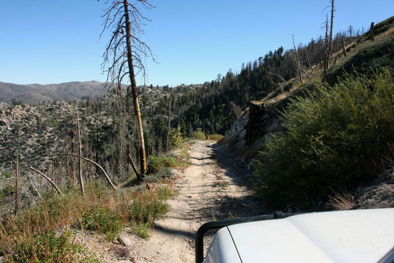
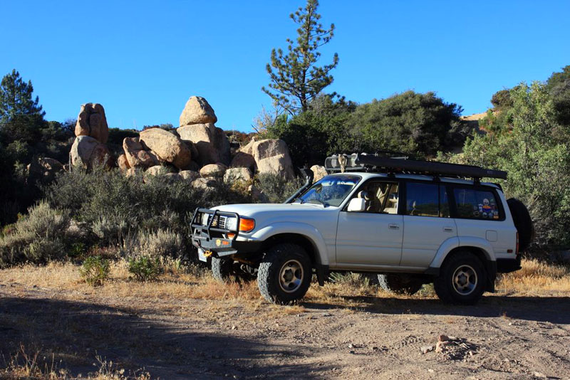
Summary: An exploratory drive along the ridge sides south of Holcomb Valley and northwest of Big Bear Lake. NOTE: Usually gated part way in.
Description: This drive begins near the spot where we camped overnight after completing Drive #23: Cleghorn Ridge and Drive #24: Pilot Rock Road. This is where FS road 2N54 begins at Crab Flats Road.
After breakfast that morning, I pulled out my map and examined the Forest Service roads to pick our first drive of the day as we would make our way over to Mountain Rendezvous. I thought I recalled Hans (offroad-travel.net), who I’d met in this spot last year, saying that he and his wife Bente were going to drive these roads the next day.
It occurred to me now that I never did discuss the details with him afterward at MR13, so I didn’t know if they’d actually done it or not. In fact, I now realized that I had no prior intel on this route at all. I’d be going in blind, other than what was on my topo map. » Continue Reading
Drive #24: Pilot Rock Road

Drive #24: Pilot Rock Road
Date Driven: 9/18/14
Length: 11.2 miles
My Drive Time: 1 hour 24 minutes
Start: West end, N34º 18.310′ W117º 18.586′
End: East end, N34º 17.137′ W117º 13.141′
GPS Track: GPX or KMZ format. (right click -> Save As)
Source(s): Pilot Rock Road can be found as Trail #30 in Guide to Southern California Backroads & 4-Wheel Drive Trails, although the route described there is different on the east side. It’s also shown on the Off-Highway Vehicle (OHV) Guide, San Bernardino National Forest map.
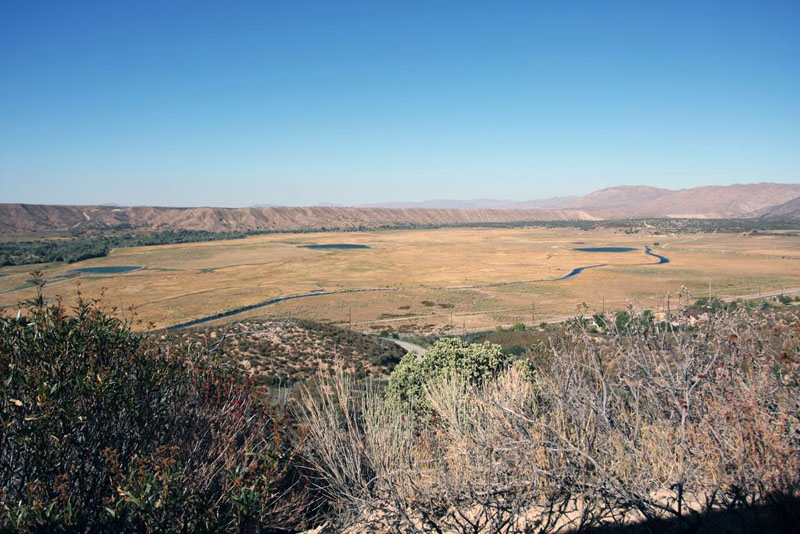
Summary: A scenic ridge trail near Silverwood Lake, north of San Bernardino.
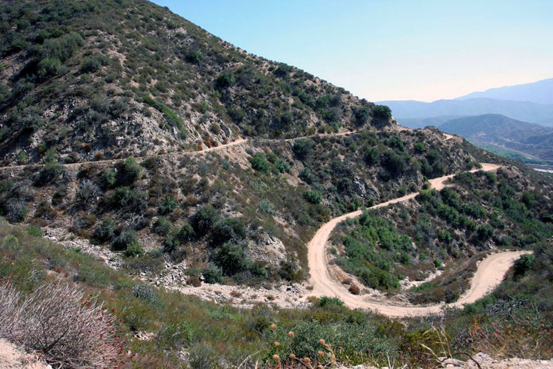
Description: After completing Drive #23: Cleghorn Ridge, it was a quick hop on paved roads over to the Silverwood Lake SRA area where we picked up the start of this trail, Pilot Rock Road.
Some lovely wetland-looking terrain just before starting the trail.
The trail starts climbing right away, mostly with moderate slopes but the trail was definitely rougher than Cleghorn Ridge. Not only was it rockier, but I soon learned that I had to remain vigilant for ever-present whoop-dee-doos. I soon became an expert in spotting these treacherous little dips and getting my foot on the brake as soon as possible. Sometimes I managed to stop the rear of the Land Cruiser from slamming down as much as the front had. It was definitely a time where lashing down the rear cargo contents could be fully appreciated.
Drive #23: Cleghorn Ridge

Drive #23: Cleghorn Ridge (2N47)
Date Driven: 9/18/14
Length: 14.5 miles
My Drive Time: 1 hour 15 minutes
Start: West end, N34º 17.976′ W117º 27.387′
End: East end, N34º 18.098′ W117º 20.223′
GPS Track: GPX or KMZ format. (right click -> Save As)
Source(s): The Cleghorn Ridge trail, also known as Cleghorn Road or 2N47, can be found as Trail #29 in Guide to Southern California Backroads & 4-Wheel Drive Trails and as trail South Coast #10 in Backcountry Adventures Southern California. It’s also shown on the Off-Highway Vehicle (OHV) Guide, San Bernardino National Forest map.
Summary: A popular offroad ridge trail close to San Bernardino.
Description: This Drive begins just off of Highway 15, at the Cleghorn Road exit. One minute you’re on a busy southern California highway, and the next instant you’re at pavement’s end, and the start of this trail. » Continue Reading
Gear Updates – Mountain Rendezvous 2014 Edition, Part Two
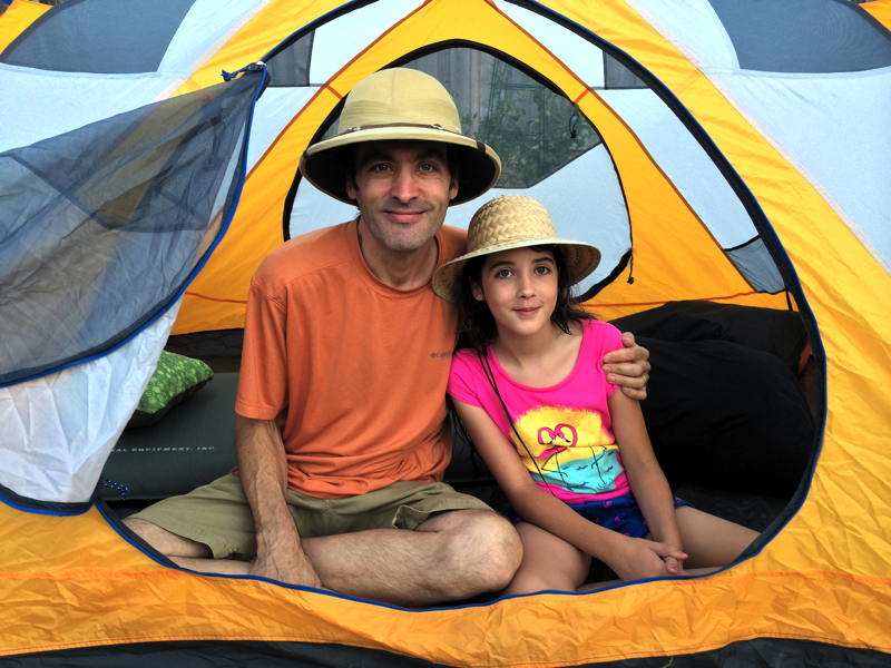
Intrepid adventurers in the Marmot Limelight 3P tent.
Part one of this gear update report ended with the Big Agnes Insulated Air Core sleeping pad, and I’ll begin part two with the other sleeping pad we used on our Mountain Rendezvous 2014 road trip.
REI Camp Bed 3.5 sleeping pad
We currently own a lot of sleeping pads. Over the years I’ve picked up some incredible deals on them, and a couple have even been free. I think I only paid full price for one. Among our vast collection, the REI Camp Bed 3.5 has been our sleeping pad of choice when car camping. We’ve even brought one on short overnight backpacking trips, although they’re rather big and heavy for that purpose.
These thick sleeping pads are of a self-inflating design, like a traditional Therm-A-Rest pad, where a sheet of open-cell foam is sandwiched between layers of air-tight nylon. Two valves are situated at one end to provide for inflation/deflation.
The relatively large size and weight are typically not an issue when car camping, which is where these sleeping pads really shine. With 3-1/2 inches of open cell foam, they provide all the cushion that most people would ever need, even if you’re set up on a rocky or otherwise less than ideal surface. And they’ll even do it without any air in the pad.
I know that because on our Mojave Road/Overland Expo 2012 road trip, » Continue Reading