12 of 11, er, 12… September, 2015.
My first 12 of 12 in some time… Thanks to Snuva for the timely reminder nudge!
Of course, the only problem was she reminded me on the 11th, before I’d had my coffee, so I merrily went and took all my photos… on the wrong day. Even though I knew it was the 11th, really. Sigh. Tough, here they are anyway. 🙂
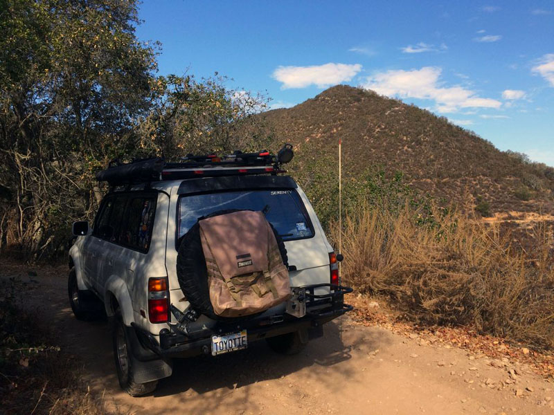
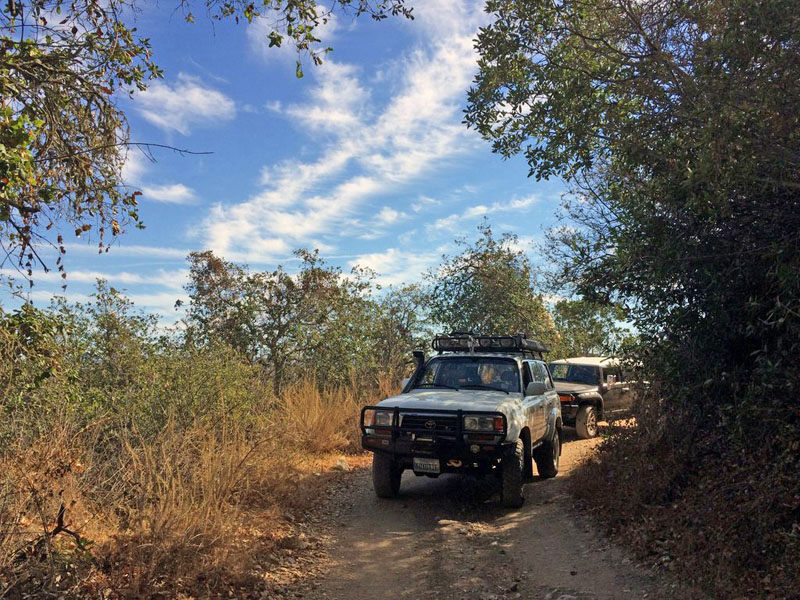
4th Annual Hollister Hills Geocache Bash
Since my last post, we have relocated to Manteca, California, about an hour east of our former city of San Jose where I lived for 24 years. It was The Move From Hell and boy are we glad it’s over! We like our new, much smaller town, and there’s a whole new area for me to explore. Our new house is much, much nicer than our old place and it costs less too. Of course, we’re now a lot more distant from the Bay Area job market and many friends, so the move has not been without it’s downsides.
Wait, did I mention that we’re now closer to Yosemite? Tahoe too, and the Sierra. I’m stoked
I’ve done some early exploration around town, and a couple of neighboring towns, but have barely scratched the surface. Manteca has no shortage of murals, that’s for sure. I’ve been posting photos to Facebook, but look for some to show up here including an overdue 12 of 12 post Real Soon Now.
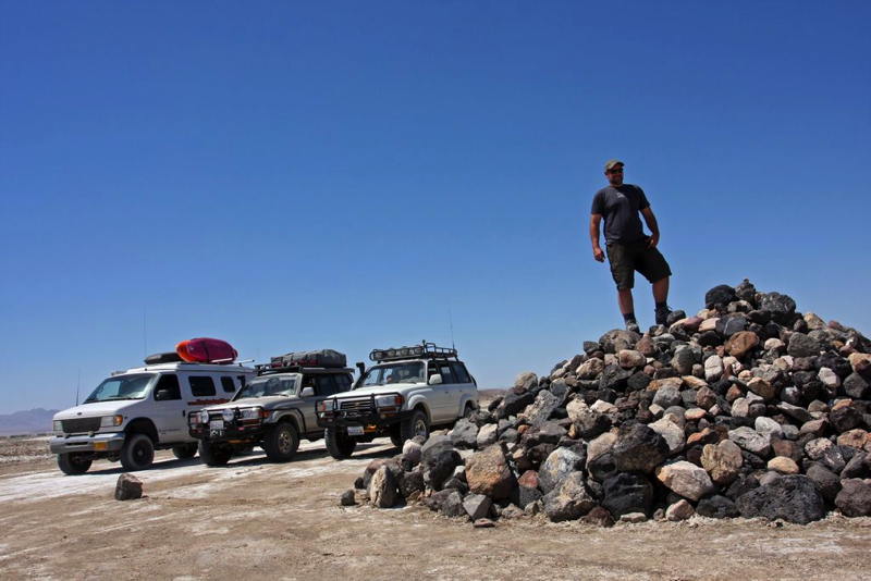
But enough of the status report, let’s get on to this year’s Geocache Bash, the 4th annual one at Hollister Hills SVRA. This year, the offroad & geocaching event was moved from spring to the tail end of September, when there are fewer conflicting events on the park’s schedule. Unlike last year, we opted against camping overnight after the event, which was in retrospect a good idea, as we were all tired and toasty from the long hot day. We all slept very well in our own beds that night, and used Sunday as a lazy recovery day.
The event followed the pattern of previous ones, with registration and welcome in the morning, followed by the participants being set loose until lunch was provided at noon. Then there was more time for wheeling and caching until 2:30 when we turned in our answer booklets and received raffle tickets in exchange. The raffle – with some nice donated prizes as always – concluded the event.
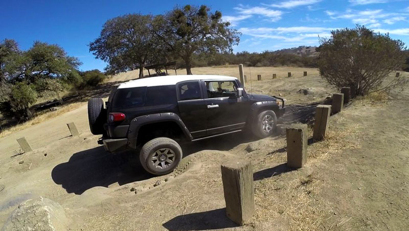
This year, a new section of the park was available for participants on foot. It’d going to only be open to hikers, bicyclists and equestrians when it opens to the general public in the near future.
We met up with friends Bill and Dave on the drive down to the park. It’s always nice to see a Land Rover at an event, particularly on those rare occasions when they don’t require a tow to make it. ;^) At the park, I was able to see the new JKs of my friends Tom and Richard in person for the first time, and Thomas’s FJ Cruiser that teamed up with us throughout the day.
The family had a good time again and it was great seeing a lot of geocaching friends as always. Allison was always on point, eager to be the first in our small group to spot a geocache, and she was almost always successful. We took it a bit easier than earlier years but still got some challenging geocache hunts, as well as some tricky sections of trails, both in the Upper Ranch and Hudner sections.
It was good fun and it only cost us some time and a tank of gas to attend. Thanks again to the Hollister Hills SVRA staff for putting on this fun family event, the Geocachers of the Bay Area volunteers, and HHORA for their continued support. I’m looking forward to next year’s event.
Hollister Hills Geocache Bash IV Gallery
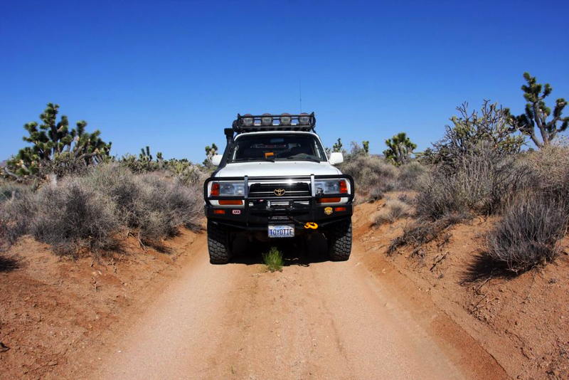
Drive #30: Mojave Road
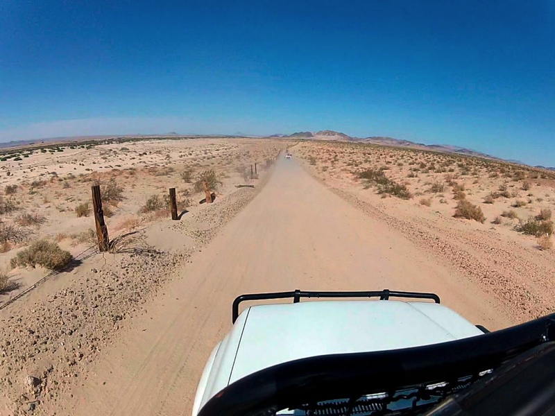

Drive #30: Mojave Road
Date Driven: 5/14-16/12
Length: 175 miles
My Drive Time: We were on the trail for almost exactly two days, including stops, sleeping, etc.
Start: Newberry Road exit on Highway 40, N34º 49.949′ W114º 38.202′
End: Farm road running along the Colorado River, N35º 02.725′ W116º 39.830′
GPS Track: GPX or KMZ format. (right click -> Save As)
Source(s): My primary source of information was Dennis Casebier’s classic Mojave Road Guide – An Adventure Through Time. Mojave Road is shown as trails 98, 99, and 100 in the Guide to California Backroads & 4-Wheel-Drive Trails; as Tour 31 (Afton Canyon) and Tour 33 (Mojave Road) in California Desert Byways; and as Desert #13 in Backcountry Adventures Southern California. Other sources included several websites with GPS tracks and waypoints, Secret Places in the Mojave Desert volumes 1-4, and the National Geographic Mojave National Preserve map.
Summary: The historic Mojave Road trail – more or less – driven from west to east on our way to Overland Expo in 2012.
Description: This is an epic southwestern desert drive. I made it in 2012 along with Anthony Sicola of Overland Nomads and Bryon Dorr of Exploring Elements.
Unlike most of the Drives tracks I share, this one has only been edited at the beginning and end of the drive. All of the other warts – side explorations, wrong turns, flailing about for which route to take – are still there. And we mad a lot of “errors” as we explored the area, trying out various approaches and checking out various interesting features and landmarks. We could have spent a lot more time exploring the area, but we had to balance other factors like getting to Overland Expo, the weather (hot!), vehicle troubles, etc.
So my track here (which is actually a combination of four different track recordings) is presented to show our full experience. Anyone following our paths should obviously take that into account, as well as other changing factors like weather, the variable paths through the river washes, the lake bed surface conditions, etc.
Some of the waypoint included are mine while a few are not. Many points of interest along the way – the so-called Travelers’ Monument, the mailbox, the school bus, the penny can tree, etc. – are not included here. These can be located with many sources, including Dennis’s book.
Here are the detailed blog posts covering our Mojave Road experience on the way to OX12:
- Overland Expo Road Trip: Day One
- Overland Expo Road Trip: Day One Photo Gallery
- Overland Expo Road Trip: Day Two
- Overland Expo Road Trip: Day Two Photo Gallery
- Overland Expo Road Trip: Day Three
- Overland Expo Road Trip: Day Three Photo Gallery
- Overland Expo Road Trip: Day Epilogue
- Overland Expo Road Trip: 5 Minutes of GoPro Video
- Overland Expo Road Trip: Bryon of Exploring Elements Report
Disclaimer – This information is provided from the best of my recollection and is necessarily subjective. GPS data is from a personal device inside my vehicle, so coordinates will not be exact. Typos are possible. Use of any of this information is at your own risk and responsibility – period. Conditions change (especially in winter), vehicles and driver skills vary, etc. and I have no control over these things. Don’t let anything written here override your own personal common sense or safety.
Hawaii Trip Video
I finally out together a 5-minute video of our family vacation to the Big Island of Hawaii in April:
I’ll go through my still photos next and see about putting together a small photo gallery as well.