Drive #29: Kekaha Kai

Drive #29: Kekaha Kai
Date Driven: 4/12/15
Length: 1.7 miles, each way.
My Drive Time: Around 13 minutes.
Start: Unmarked turnoff along Queen Kaahumanu Highway, N19º 46.171′ W156º 01.303′
End: Parking area at Kaelehuluhulu Beach on Mahaiula Bay, N19º 46.811′ W156º 02.491′
GPS Track: GPX or KMZ format. (right click -> Save As)
Source(s): I read about this area and drive in Hawaii the Big Island Revealed guidebook, 7th edition.
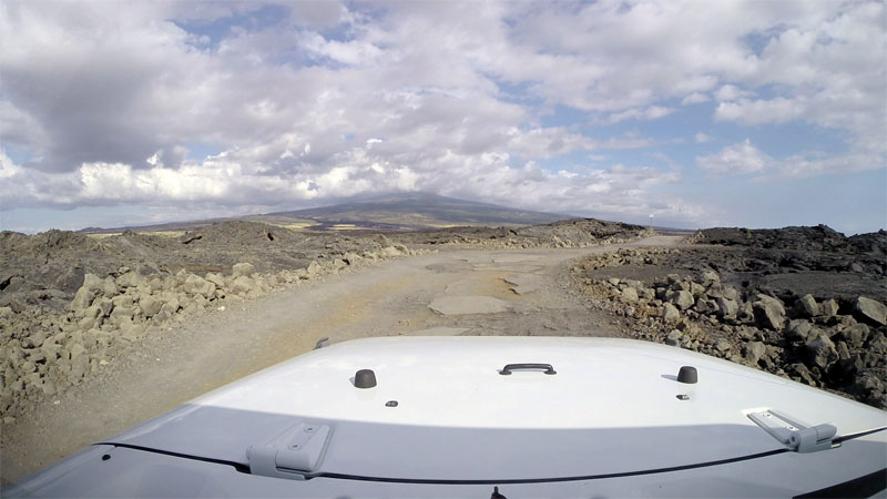
Summary: A very rough road through a field of lava rock, ending near nice beaches on the Big Island of Hawaii.
Description: This bumpy road will take you from the highway to some parking areas close to several beach areas on Mahaiulu Bay.
The road here was once paved and presumably a proper road, but now it has deteriorated to the point that we never even hit 15mph along it in our Rental Jeep Wrangler JK. Locals are out here mostly in pickups, SUVs and Jeeps, but there are also the inevitable tourists and regular passenger cars, both of which will tend to drive really slowly. But it’s a short drive and going fast just isn’t a good option here, so settle in and take it easy. You’re in Hawaii. Enjoy.
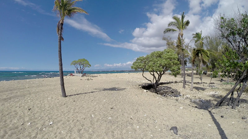
The first parking area is best for access to Mahai’ula Beach, a short walk just to the north. The second (and final) parking area is right by Kaelehuluhulu Beach and features restrooms and such. We spent our time at this small beach, which isn’t a great one for swimming or snorkeling but it was lightly-populated and we enjoyed wading and lounging on the white sands.
At the beach we spotted all kinds of the usual colorful sea life swimming among the lava rock. The occasional plane heading in to Kona International passed overhead, but otherwise the beach was secluded and quiet.
Further north is Makalewena Beach, which is often referred to as the finest beach on the island. There’s supposed to be a 4WD road out to it but it’s reported as being even rougher than the road we drove. Most people walk to that beach, which is said to take about 20 minutes in each direction, through the lava fields. We didn’t have time to explore that beach or the other road.
Disclaimer – This information is provided from the best of my recollection and is necessarily subjective. GPS data is from a personal device inside my vehicle, so coordinates will not be exact. Typos are possible. Use of any of this information is at your own risk and responsibility – period. Conditions change (especially in winter), vehicles and driver skills vary, etc. and I have no control over these things. Don’t let anything written here override your own personal common sense or safety.
Desert Rendezvous 2015 – Social Media
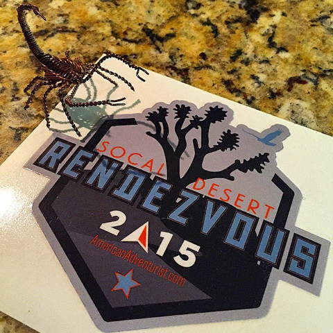
Photo courtesy of @AmericanAdventurist on Instagram
I’m missing Desert Rendezvous again this year, argh! If you are too, the next best thing is to follow along with the people that are attending. While many of these have a Twitter and/or Facebook presence, these Instagram accounts are probably your best bet for keeping up with what’s going on at the event.
@slyrpa Apryl is my go-to account for DR15. She’ll post several updates and always has great photos.
@AmericanAdventurist is an obvious choice to follow. We’ll see how many photos Dave can post though since he’s going to be a very busy guy!
@blkwgn Cris is a regular Rendezvous volunteer and attendee, and often leads a run during the event.
@brenthaywoodphotography hasn’t posted as of this writing, but he’s there so I expect that he will.
@noriannder Mrs. Rendezvous!
@tripleaughtdesign is on the way.
I’ll update this list as I confirm additional accounts with boots on the ground for the event.
Oregon 2015 Road Trip and Photo Gallery
With our Oregon 2015 Road Trip completed, all of our gear put away, and all of the photo and video work done, it’s time to wrap things up with a trip blog post, don’t you think?
The trip covered nine days and probably around 2,000 miles of vehicle travel, mostly in the Land Cruiser. About 45 miles were done offroad, almost entirely on the Valsetz Route on the second day of our trip.
I’m going to break things down in chronological order, because that’s what my brain wants me to do.
Day One
Drive #28: The Valsetz Route – I-5 to the Oregon Coast
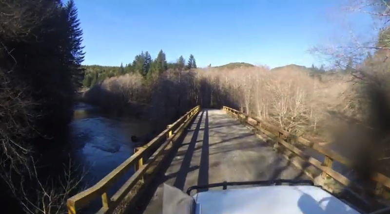

Drive #28: The Valsetz Route – I-5 to the Oregon Coast
Date Driven: 2/15/15
Length: 77 miles. 41 miles of dirt.
My Drive Time: 4 hours, including lunch stop.
Start: Talbot Road exit, I-5, N44º 45.479′ W123º 02.962′
End: End of Highway 229 at Highway 101, N44º 54.117′ W124º 00.428′
GPS Track: GPX or KMZ format. (right click -> Save As)
Source(s): This drive was inspired by Drive 13, Valsetz, in Art Bernstein’s Oregon Byways guidebook.
Summary: I-5 to the Oregon coast via backroads, car ferry, and dirt roads through the Siuslaw National Forest.
Description: Driving the old Valsetz Road has been on my radar for a few years now, since I read about it in Oregon Byways. That book discussed the approach to the site of the former town of Valsetz from the east. The author wrote that he believed that the route could be continued west from there to the Oregon coast, but he hadn’t been able to confirm it.
I’d wanted to explore the area for some time, but was hampered by not only our limited time when visiting relatives in Oregon, but also by the fact that the logging roads through the Siuslaw National Forest are closed to public traffic on weekdays, when logging and other work trucks busily buzz back and forth through the area.
I’d done some research online, and discovered some useful trip reports over at the ExPo Portal and the ADVrider sites. I’d also read about the history of the town of Valsetz at Jerry Blackwell’s Valsetz memorial website, and found other useful references here and there. I’d looked over my mapping software as well, and decided that the route appeared to be possible, but there was only one way to find out for sure.