Overland Expo Road Trip: Day Two
The sun rose far too early in the morning, waking me up with light that flooded my tent. I considered going back to sleep but I could hear Anthony rustling around in his rooftop tent, and Bryon was already up and going. I reluctantly dragged my butt out of the sleeping bag and got dressed.
As Anthony & I had breakfast, Bryon did a few laps around the campground in his wounded Sportsmobile. We hoped that with the transmission fluid having cooled overnight that it might miraculously start working normally, and sure enough Bryon reported that everything seemed to be behaving. That seemed promising so we packed up camp and moved out, wondering what fresh challenges this day might bring.
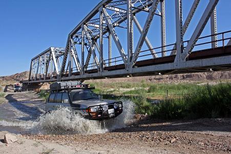
As we headed through Afton Canyon heading east, we passed a couple of other railroad bridges. The first one had an adjacent water crossing, which was fun to blast through in our vehicles. We sure could have used a crossing like that at the far end of the trail, to wash off some of the accumulated dust, but no such luck.
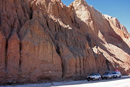
We then entered the deepest part of Afton Canyon, where we drove along some spectacular and vertical cliff faces. It seemed like we’d only been out of camp for 15 minutes and here we were hopping out again like kids on Christmas morning to take more photos.
Passing under the last rail bridge, we came out in a large wash area and began hunting for the proper trail to continue on. There were numerous options, including dead ends and the Mojave River bed itself again, this time featuring some short shelves & a reasonably large rock garden section. One of the tracks I’d downloaded before the trip went up the river bed, while another passed to the north too far. We drove back & forth a couple of times doing our recon when Anthony spotted a rock cairn along one of the middle paths.
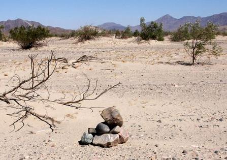
A subtle rock cairn
We knew from our copies of the Mojave Road Guide that the route was often marked with rock cairns, and it seems that we spotted this one just when we needed it. Encouraged, we followed the marked trail and soon were driving from cairn to cairn, weaving around among the maze of intersecting & diverging paths. The going was pretty easy here, but fun, with only a few sections of sand where momentum was the driver’s greatest ally.
I could see that our path would eventually rejoin the tracks on my GPS, and sure enough they converged. This simplified my life as it allowed me to predict upcoming terrain and course changes, and it put me back into my navigational happy place. We drove on through the wash area until we veered northeast and up through a pass onto firmer ground.
Here we encountered our first “whoopdy-doos”, which are large undulations in the trail. It was important to keep our speed down through these, otherwise the suspension was rocked into a greater and greater up-and-down seesaw motion, bottoming out and throwing any unsecured cargo up into the air. After maybe 10 minutes of these the trail again leveled out and we passed through the open gate into the Mojave Preserve area.
Here we found ourselves on the edge of the next potential challenge: the flat playa of Soda Lake. We’d read that when it was wet from recent rains, it could be one of the more challenging parts of the trail, but in our case it had been dry for two or three weeks. We sailed across the smooth playa at about 35-40mph, braking hard when an undulation in the trail suddenly appeared. These bumps were often hard to spot because they were camouflaged by the color of the dried mud and white mineral deposits.
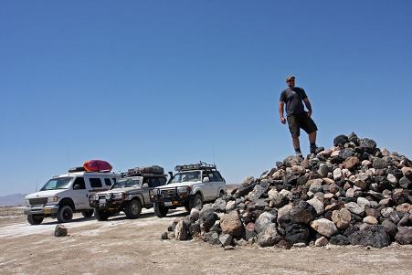
We paused at the Traveler’s Monument to partake in the ritual adding of rocks to the pile, and then flew across the rest of the dry lakebed, enjoying the smooth ride and comfortable weather.
On the other side of the lake, we came upon stretches of black lava beds on the north side of the trail, and we rounded Seventeenmile Point on the southern border of the trail. We continued along until about 1pm when we found ourselves at some wonderful natural campsites, and decided to stop for a quick lunch.
Bryon’s transmission had started acting up again about 90 minutes into the day’s drive, and 3rd and 4th gear had decided to stop cooperating. Luckily our pace now was such that 2nd gear was entirely suitable for most conditions and he was able to continue along without much grief. Still, he knew he’d have to get it checked & repaired, and when we had 3G signal he managed to use Yelp on his iPhone to locate a shop in Laughlin, where the Mojave Road trail ended to the east.
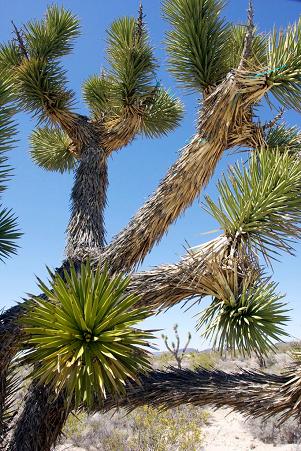
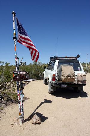
After lunch we quickly found ourselves in our first Joshua tree “forest”, which we enjoyed. We all liked these cool trees. Then we reached the Mojave Road Mailbox, where we signed in on the large logbook. We marveled at the mailbox and the countless stickers that had been applied to it and the support pole. Then I noticed the strange “frog memorial” collection off in the brush, and a few gnomes hanging out on a log a distance behind that. Funny how desert and mountain areas seem to generate these types of eclectic and odd things!
The trail continued east and climbed until we reached one of the two highpoints at around 4,500′ elevation, and then it was a two mile downhill descent to Marl Springs, one of the important year-round water sources in this stretch of desert. The water was flowing but there wasn’t much in the basin, although I did fill up an empty one-gallon water jug that I later filtered. The water has an earthy, slightly mineral flavor to it.
After that stop we were treated to the biggest stretch of whoopdy-doos on the trail, and we discovered that dusty desert trails can feel an awful lot like deep sea swells! We almost needed Dramamine after a while, as we cruised through at a leisurely 10mph. At one stop along the way I smelled gas – shades of Death Valley – and sure enough I discovered that my auxiliary tank’s exposed fuel filter seemed to have taken a beating from thrown-up rocks on the long offroad drive. It was leaking slowly now, so I quickly clamped-off the aux tank fuel hose and was able to proceed normally.
We continued east and crossed the Kelso-Cima Road, and were treated to a couple of miles of pavement on the other side. That quickly faded back to dirt, although here it was very wide and recently graded. We cruised along to the setting sun behind us, and pulled into the Pleasant View School campsite with daylight to spare.
As we started to set up camp, a few trucks passing along the main trail veered off and drove up to us. We’d seen them earlier as we ate our lunch, and there’s not a lot of traffic on the Mojave Road so we easily remembered them. They got out and introduced themselves as the owners of the Mojave Ranch property which we’d heard about. Then they also introduced Dennis Casebier – the guy who wrote the Mojave Road Guide book that we’d been following! That was pretty random!
I enjoyed a chat with Dennis about the campsite location and the old one-room schoolhouse for the children of the homesteaders that had been built here back in the 1920s. Dennis suggested that he should sign our books for us, which was nice of him. He signed my book but unfortunately Anthony’s copy had gotten nuked just that morning by a water spill inside his Land Cruiser. Bad luck!
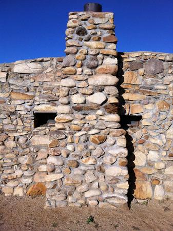
After the other group had departed we made ourselves dinner, enjoyed the nice weather and the blessed lack of howling winds this time. We also visited the nearby Bert Smith homestead, which was a stone house with an interesting story. Smith had badly-scarred lungs from mustard gas attacks in the trenches of WWI, and was told he hadn’t long to live. His doctors suggested that the dry desert air could help, so he moved out to the Mojave and defied the odds by living another 25 years, finally passing away in the 1950s. His sturdy rock house looks like it could have been built last year.
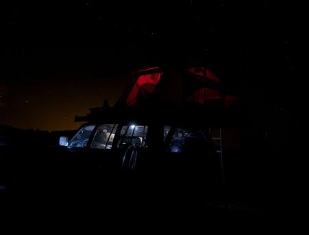
At our wonderful campsite, we relaxed, had a few cold beers and played around with some night photography after darkness had fallen. It was a perfect way to end what had been a great day on the Mojave Road, free of any great drama and with one interesting sight after another. In the middle of the night, coyotes again yipped in the distance, and I slept well.
- Day Two Miles: 73
- Day Three Miles offroad: 71.4
- Trip Miles: 555
- Trip Miles offroad: 107.9
- Days without a shower:
As amazing as these trips are to read about, I don’t know nearly enough about cars to ever do one! Too much could go wrong that I cannot fix. But it does seem to take you to some amazing places!!!
May 31st, 2012 at 3:14 pmThat’s what passenger seats are for! 😀
May 31st, 2012 at 4:16 pm