Overland Expo Road Trip: Day Three
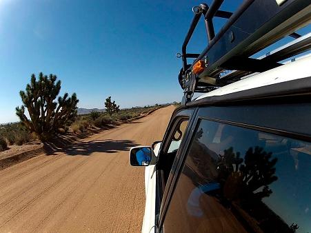
Another morning dawned on the Mojave Road and the early light lent even more color to the nearby mountains. And they’re interesting mountains too, between Table Top to the south and the corkscrew peak of Pinto Mountain just to the northeast of our camp.
Bryon was up extra-early, ready to make a determined blitz to the transmission shop just beyond the end of the trail. We wished him well and told him that we’d keep an eye out for him along the way, in case he ran into more trouble. As it turned out, he did have some when he ripped off his roof rack on an encroaching Joshua tree branch, but he was still able to make it into town.
Anthony & I made up breakfast and then after the daily packing-up we hit the Mojave Road again. Sort of. We got back on the wide graded road we were on the previous evening, but quickly realized that this road was now paralleling the actual Mojave Road. We took a 90-degree turn north onto one of the many side trails and that brought us back to the proper Mojave Road trail, where we turned east again.
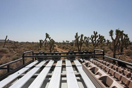
The trail here returns to a pretty narrow width for the most part, and is somewhat sunken in some stretches. The going was pretty easy, and enjoyable, but you did have to pay close attention and use moderate speeds. Ruts, rocks and whoopdy-doos awaited the unwary, as did the spiky plants that often lined the trail. Just before our road trip, I’d seen a photo online of someone who’d gotten a little careless and one tough spike of a leaf had speared right through a tire sidewall.
As we cruised along we encountered several Mojave Road landmarks to stop and check out. There was the Penny Can Tree, where passing travelers add a penny to the can before proceeding. I’m not sure what major road improvements this toll is funding but I’m sure they are worthwhile! There was also a nice monument and plaque for the Nevada Southern Railway (incorporated in 1892) which thoughtfully included railroad tracks and ties.
I got a photo op of a different kind as I passed a large snake on the trail. Happy to be in a large, well-defended vehicle I bravely backed up to get some photos of it. I had expected to see a Mojave rattler but this turned out to be a red racer, a thin whip-like snake with a orange-tan body and a green head. They are said to be the most commonly seen snakes in the Mojave, and they are very fast. While they are happily not poisonous, they have a reputation for being mean-tempered & will bite if toyed with. I left it alone.
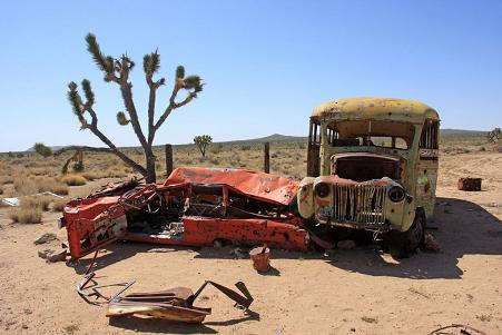
We then came across a shot-up old yellow school bus, which turned out to have a shot-up old station wagon behind it. We took photos and read the various graffiti written along it, and Anthony seemed hurt by the large “CHIP SUCKS” spraypainted on the side of the bus. “Poor Chip,” he said, but I tried to reassure him that perhaps Chip really was a big jerk after all.
Driving on, we reached the end of another long valley. We’d reached the Piute Range which provided a spectacular overlook to the lower lands to the east, as well as a looooong view back to the west from where we’d come. After enjoying the view we headed down the rocky, rutted and steep trail which was probably the most technical terrain we’d driven. It wasn’t bad but it was slow going on the narrow shelf road, being careful to pick the correct line. A couple of older 4x4s with equally old drivers passed us going the opposite direction here, but thankfully at a wide spot in the trail.
We descended the steep trail and once again found ourselves on the desert flats, back to pretty typical trail. We stopped at an intersection & Anthony (Verizon) was able to reach Bryon, who confirmed that he’d made it safely to the shop and was staring at a $1600 repair bill. He was hoping the work would be completed the next day after the parts arrived in the morning and that he’d catch up to us at the Expo.
At this point we again turned 90-degrees north and sped along a well-graded power line access road, until we reached the intersection to Fort Piute, which we took west to the old Fort ruins. This part of the trail was narrow and very rocky and it was slow going to the fort.
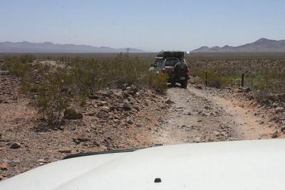
The old fort foundations were interesting to see, and we noted that the horses had a much bigger room than the troops did. The fort had a very short service life of about seven months back in 1867-8, but was built to last and remained mostly intact until the 1930s. The base walls still look solid and the nearby oasis of green trees and plants that led to the fort’s construction are still apparent.
We picked our way back along the rocky trail until we were back on the main route again, with more whoopdy-doos waiting for us but with generally easy going. We eventually reached the side trail to the last official campsite on this eastern end of the Mojave Road, which was Balancing Rock camp. The side road had some steep gullies to cross, but we soon found ourselves at the camp. There wasn’t really any shade but the balancing rock(s) were a great sight. We had lunch here and pondered our next step.
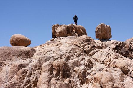
We had originally penciled-in a stay at this camp for the night, but we’d pushed through quickly and arrived ahead of our anticipated schedule. We could cool our heels here and veg, camp overnight and proceed the next morning as planned, or we could just continue on from here and arrive at the Expo location around sunset. Weighing those options, we decided to continue on our way.
We dropped a lot of elevation over the next half hour, zipping downhill at around 25mph until we reached and crossed the Needles Highway. On the other side of the highway we found that the Mojave Road changed character one last time, becoming farmland access road. We passed farm workers who paid no attention to us, as if dust-covered Land Cruisers with snorkels, roof racks and lights were something they saw every day. Perhaps they did.
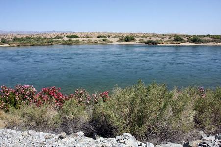
After a couple of miles the Mojave Road ended abruptly at a T-intersection and the mighty, fast-running Colorado River. This is a proper, wide river moving along a lot of water. We got out and stared longingly at it because all that water looked so inviting. But it would have been a nasty rock scramble down from the trail, and after a brief celebration we instead aired up our tires as the sweat dripped off our heads and arms. We’d successfully completed the Mojave Road, and were eager to hit a gas station to pick up our reward – some cold drinks!
We did just that at the first gas station we came across in Laughlin, which happily had a large market inside. The station’s bathroom was an unbelievable luxury, with all the hot running water I wanted and I did my best to wash the days of trail dust, sweat, oil and grime off my very filthy hands. We got our cold drinks and ingested them pretty much as fast as we could.
We were eager to hit the road again as we both had pretty miserable first impressions of Laughlin. Perhaps it was the advertisements on the gas pumps, which in most places would be for energy drinks or such, but here they were for meth recovery programs! We then had a brief scare as Anthony’s engine wouldn’t fire up again, and we had visions of joining Bryon for hours at the repair shop somewhere here in hot Methville.
After repeated cranking, Anthony’s engine finally fired up, recovering from a probable case of vapor-lock. We happily fled Laughlin, although it still proved to be tougher than expected, with long, steep hill climbs where we again regained many of the thousands of feet of elevation we’d lost coming into town. We climbed slowly, for what seemed like an eternity, passing colorful, jagged and tortured red hills, half expecting to cross the river Styx in our escape.
Eventually we settled into a pretty pleasant highway drive, with pleasant southwestern scenery drifting by. The flat blacktop and the air conditioning were a nice change of pace after a few days of being jostled around offroad. We ate up the miles for the next four hours, passing through Flagstaff and taking the road southeast to Mormon Lake. The sun was beginning to set and we cruised along Lake Mary and then Mormon Lake, finally arriving at our destination and weary as usual.
We located the camping area and staked out our spots, saving room for Bryon. Registration didn’t open until the following afternoon so there were only about a dozen vehicles parked at this point. One of the camp hosts rode up on her bike to greet us, pointing out that we were early but that it wasn’t a problem. We set up camp and decided to be lazy and have a well-deserved sit-down meal at the restaurant, but by the time we got there at 8:30 the kitchen had been closed for half an hour! We were a bit crushed but managed to fend for ourselves at our camp, with the help of a few cold brews from our fridges.
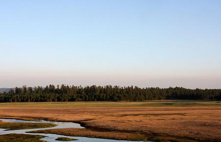
Another long day was done, and we crashed out pretty early. It was another windy night, although not nearly as bad as it had been in Afton Canyon. Those kind of winds were waiting another day before returning…
- Day Three Miles: 275
- Day Three Miles offroad: 54.3
- Trip Miles: 860
- Trip Miles offroad: 163.8
- Days without a shower: 3
Mission Accomplished! Now we need to go back and see all the things we missed! Great report and fantastic photos, Dave!
June 2nd, 2012 at 7:24 amThanks! I’m looking forward to visiting many of the places I see on the map now that we missed this time through. Lava tubes, the desert phone booth, other springs, mines…
June 2nd, 2012 at 7:51 amI need to get away! Some great photos, but the snake was ugly. Bizarrely whippy. Must have been disappointing to think you’d be treating yourself to a back-in-civilisation restaurant dinner only to find it closed so early!
June 2nd, 2012 at 4:40 pmThe snake was kinda ugly but it was still nice to see a local critter I’d not seen before, even if it was a snake… Good luck with your getting away, I’m looking forward to the pictures!
June 2nd, 2012 at 8:52 pmSo great to get to know you on this trip David! Love the report and pics. Looking forward to sharing more adventures in the future.
Finally got my report up:
July 11th, 2012 at 12:31 pmhttp://www.exploringelements.com/the-mojave-road-the-desert-by-sportsmobile/
[…] 3 Reports: David, […]
October 16th, 2012 at 2:08 pm