Drive #26: Skyline and Radford Truck Roads

Drive #26: Skyline and Radford Truck Roads
Date Driven: 9/19/14
Length: 15.7 miles
My Drive Time: 1 hour 21 minutes
Start: N34º 13.541′ W116º 56.034′
End: N34º 11.572′ W116º 54.627′
GPS Track: GPX or KMZ format. (right click -> Save As)
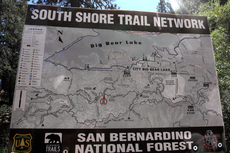
Source(s): Skyline Road is shown on Trail #41, and Radford Truck Road as part of Trail #40 (Clark’s Grade) in Guide to Southern California Backroads & 4-Wheel Drive Trails. Both are also covered by the Off-Highway Vehicle (OHV) Guide, San Bernardino National Forest map.
Summary: This drive took us from Big Bear to Mountain Rendezvous 2014 via dirt trails. From Big Bear we ascended and drove along the ridge to the south before descending into the valley that Highway 38 runs through.
Description: After completing our adventures along Snowslide Road, we eased into Big Bear with about a quarter tank of remaining fuel. After checking prices with the Gas Buddy app on my iPhone, I filled up the main tank, we took a quick restroom break, and we grabbed some food for lunch from the same small market I’d visited the previous year.
Then it was time to find the trailhead for what was to be our last offroading of the trip. Looking over my maps, it wasn’t clear where we could best access the trail system from town, so I decided we’d start with the nearest possible route and work our way east until we hit one that worked.
We headed up Summit Blvd. which quickly ended in the parking lot of Snow Summit Mountain Resort. It seemed unlikely that they would look favorably on a big 4×4 bouncing along their slopes, so (as was the norm for this trip) I called up Plan B. We headed west to where there was an “Aspen Glen” campsite shown on the map. As soon as we departed the city road we were greeted by Forest Service signs and it quickly became clear that we’d found the start of the trail system.
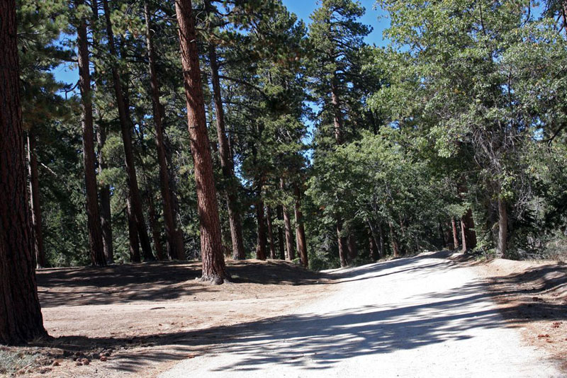
Start of the trail system… We’ve got dirt!
The road quickly dirt to well-graded dirt, and we passed by some oncoming vehicles and hikers that were out enjoying the wonderful weather. There were many intersecting trails here winding through each other, some multi-use and some just for hiking. We climbed up the ridge among beautiful trees and many cool rock formations that were common in this area. We were making a counter-clockwise transit of the Skyline loop, and as we reached the turnoff for Clarks Grade the day’s bad luck decided to spring another surprise on us in the form of yet another closed gate!
This was getting seriously irritating. I pulled out the map case and verified that we were in the right place. I looked down the turnoff again, and the damn gate was definitely closed. Some mountain bikers had just rolled out of there, but they could get around the gate and that wasn’t an option for me. Damn. Looking at my maps, I decided to continue east along Skyline and then take 2N06 as an alternate route, if there weren’t anymore pesky gates to contend with.
(As it turned out, that gate at Clarks Grade was wide open the next day when Cris Mateski led a small group from MR14 up that trail. Whether it was inexplicably closed for just the day, or perhaps it was swung closed and not locked, I couldn’t say.)
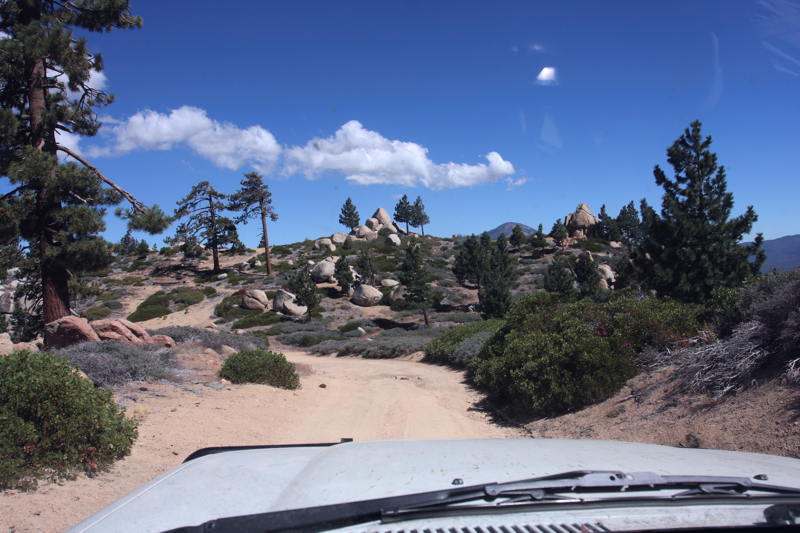
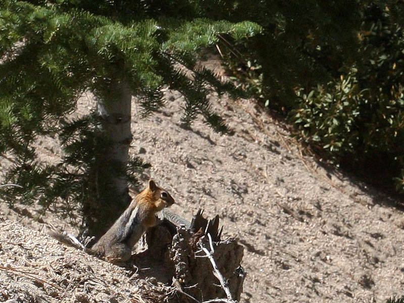
We continued along Skyline, enjoying the drive and the wonderful scenery. The boulders and rock formations and woods were appealing to me, but they couldn’t compete with the real attraction as far as Allison was concerned. She was completely obsessed with the many little chipmunks along the way, and would squeal with delight whenever she spotted another one. As we drove, we passed only one other vehicle, but several people on bikes or jogging. There seemed to be some sort of event underway, perhaps a trail run of some kind. But everyone we saw were on nearby foot trails, so there was no issue with the foot traffic.
We reach the mercifully ungated turn onto 2N06, also known as Radford Truck Road. Soon we were out of the woods and onto a narrow hillside trail, descending off the ridge. The bumpy, rocky trail was rough and called for a slow pace, but even so we soon found ourselves behind a newer model pickup truck that was going even slower than us. Perhaps it was because the owner wanted to spare his chrome wheels! I paused to photograph the valley spread out below us, but was soon caught up to them again, and eventually they were kind enough to pull over and let us by. We resumed a faster (but still careful) pace and before long found ourselves at the bottom of the hill near a wooded private campsite.
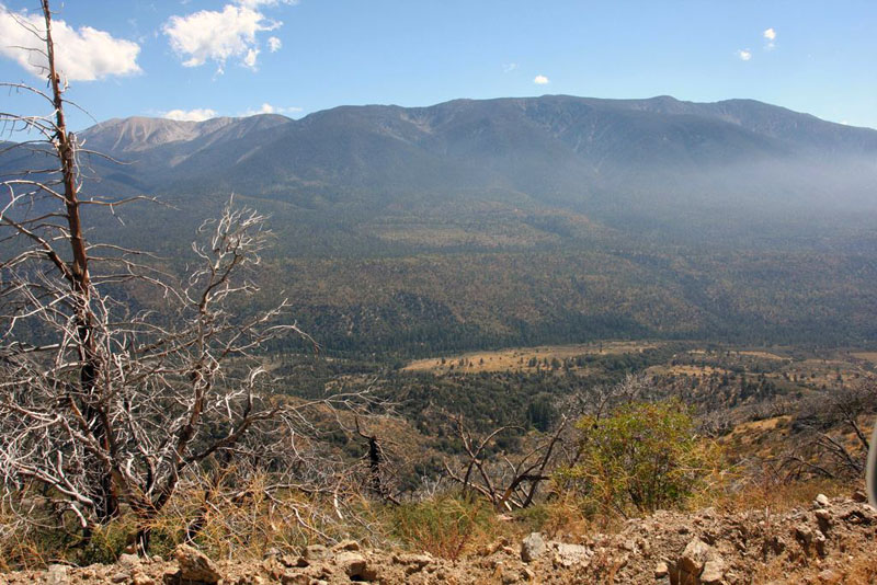
Valley view from Radford Truck Road.
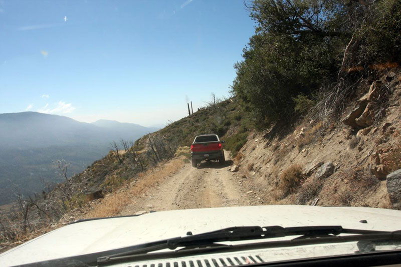
Southern California traffic is bad everywhere…
There was a CDF crew here working on cutting and/or trimming trees, and we found ourselves back on pavement. From there it was a mere 10 or 15 minutes before we rolled through the gate of Camp Tahquitz for Mountain Rendezvous 2014. It had been a good day!
The full story and more photos from this drive can be found in the second installment of our Mountain Rendezvous 2014 Road Trip report.
Disclaimer – This information is provided from the best of my recollection and is necessarily subjective. GPS data is from a personal device inside my vehicle, so coordinates will not be exact. Typos are possible. Use of any of this information is at your own risk and responsibility – period. Conditions change (especially in winter), vehicles and driver skills vary, etc. and I have no control over these things. Don’t let anything written here override your own personal common sense or safety.