Drive #3: North Fork of the Siuslaw River

North Fork of the Siuslaw River
Date Driven: 11/24/12
Length: 35.5 miles (11.7 miles of dirt)
My drive time: 1 hour 25 minutes
Start: N44º 11.5585′ W124º 06.801′.
End: N43º 58.596′ W124º 05.046′.
GPS Track: GPX or KMZ format. (right click -> Save As)
Source(s): Coos Bay Wagon Road is Drive #14 in Oregon Byways. I drove it in reverse direction from the book.
Summary: A combination of farmland backroads and both paved and dirt Forest Service roads, providing a scenic alternative to the highway along the Oregon coast.
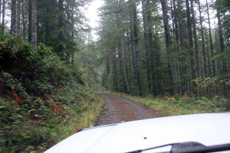
Description: Beginning from a wooded section of coastal Highway 101, take Fairview Mountain Road heading east. You head uphill and quickly lose the pavement. A sign on the drive up reminds you to keep the forests free of trash, a sentiment I completely endorse. Soon you’re in the trees as you continue to climb to the top of this coastal ridge.
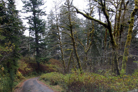
The dirt road was an easy drive when we did it, with the usual ruts, rocks, and bumps here and there. Because a big winter storm had just recently blown through, the forest roads here were littered with small downed branches, but anything big had been cleared away before we passed through.

Eventually you reach the top of the ridge and start a descent down the eastern side. There are numerous side roads to choose from, and to explore if you’re so inclined. I had previously mapped out our route (in reverse direction from how it is shown in Oregon Byways) and picking the roads was not easy. I did my best to stay true to what I believed was the route laid out in the book, but whether or not I succeeded is probably open to interpretation.

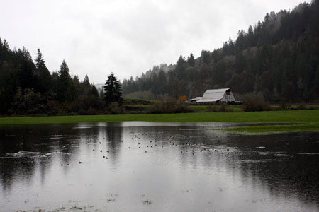
Descending through the forest, soon the pavement returns (unfortunately) although the road remains narrow. It slowly widens to two lanes, and some remote houses and farms appear as you reach the flatlands again. 15 miles of the paved North Fork Siuslaw Road wind though low farmlands and wide curves as you make your way towards Highway 126 on the east side of Florence. Many of the open valley farm fields were flooded when we drove through, and flocks of ducks swam around them.
There’s a parking lot for Bender Landing County Park at N44º 00.243′ W124º 04.271′, where there is a permanent and public vault restroom and water fountain available.
From there it’s just a few minutes to Highway 126 and the end of this drive. From there, we headed into old town Florence which has several restaurants, bakeries, coffee shops and other destinations. The ranger station/visitors center for Oregon Dunes is on the right side if you drive south across the bridge over the Siuslaw River.
This drive, like Coos Bay Wagon Road before it, was exactly wanted I wanted: a scenic dirt and backroad experience that spiced up an otherwise routine homeward drive, without adding a lot of time to an already long day. Mission accomplished!
North Fork of the Siuslaw River Photo Gallery
Disclaimer – This information is provided from the best of my recollection and is necessarily subjective. GPS data is from a personal device inside my vehicle, so coordinates will not be exact. Use of any of this information is at your own risk and responsibility – period. Conditions change (especially in winter), vehicles and driver skills vary, etc. and I have no control over these things. Don’t let anything written here override your own personal common sense or safety.
