Drive #2: Coos Bay Wagon Road

Drive #2 – Coos Bay Wagon Road
Date Driven: 11/18/12
Length: 51 miles (14 miles of dirt)
My drive time: 1 hour 45 minutes
Start: N43º 05.598′ W123º 34.114′.
End: N43º 18.075′ W124º 12.656′.
GPS Track: GPX or KMZ format. (right click -> Save As)
Source(s): Coos Bay Wagon Road is Drive #15 in Oregon Byways.
Summary: A combination of rural and wooded backroads and well-maintained dirt forest roads, providing an alternative and scenic drive to the Oregon coast.
Description: I found this drive in Oregon Byways while researching potential routes on our 2012 Oregon road trip. It had all of the attributes I was looking for in drive for this trip: it was scenic, a fairly long drive, not far out of our way, and not a difficult technical route. I’d be traveling solo on these unfamiliar side routes, with the family, so I didn’t want to do anything too hardcore or that would frighten them. 🙂 I also didn’t want these side excursions to add too much time to our already-long daily drives.
I mapped out the route ahead of time in MapSource, which was a little tricky with the various turns and side roads, but not too bad. I also created key waypoints to download to my MotionX apps on my iPad 2. All of that worked out well and I was able to navigate through the entire drive with confidence, only having to pause on a couple of occasions when my GPS lost its fix near or at an intersection.
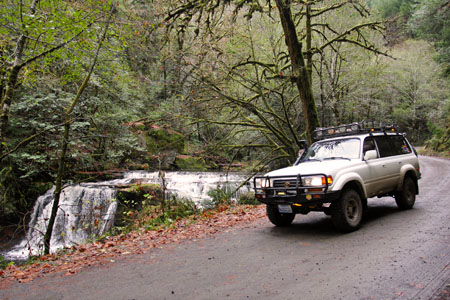
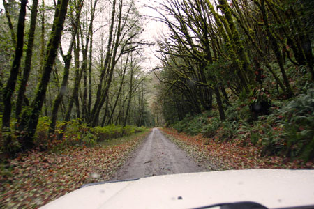
The drive starts off on a pleasant, paved rural backroad, then climbs up the wooded hills until you finally reach dirt around N43º 08.508′ W123º 42.140′ at Brewster Canyon. For the next 11 miles or so, you follow alongside the small, east fork of the Coquille River. There’s a spectacular waterfall along the way at N43º 08.912′ W123º 47.297′, and the Oregon Byways book says there was another nice one that we missed. There were some ruts and potholes but no real need for high clearance or 4WD when we were there. That might change later in winter and it could get a lot muddier, I don’t know.

From there we emerged onto more paved backroads through some pretty rural country. Traffic here – and throughout the drive – remained sparse. Eventually we reached another short dirt stretch, then were back onto tarmac for the final segment where we eventually reached Highway 101, just south of Coos Bay.
For the offroader, Oregon Dunes is located between Coos Bay and Florence, which is the start/end of my next drive.
This was a very pleasant drive that offered a scenic, mildly-adventurous alternative to a section of our road trip drive that we’d already driven in the past. It met all of the criteria I was looking for, and was a wonderful way to add some fun to an otherwise routine drive.
Drives like this one are out there waiting, if you just make the effort to seek them out.
Coos Bay Wagon Road Photo Gallery
Video
This video begins just after the dirt started, and ends at the bridge where the drive ends at Highway 101. It’s comprised of one-per-minute snapshots along the way.
Disclaimer – This information is provided from the best of my recollection and is necessarily subjective. GPS data is from a personal device inside my vehicle, so coordinates will not be exact. Use of any of this information is at your own risk and responsibility – period. Conditions change (especially in winter), vehicles and driver skills vary, etc. and I have no control over these things. Don’t let anything written here override your own personal common sense or safety.

I just took this road in a 1989 Honda Accord a couple of days ago. Beautiful drive from Myrtle Point to 10 Mile. Lots of awesome waterfalls this time of year. 🙂
December 24th, 2015 at 2:57 am