N37° 02.160' W121° 05.721'
Our afternoon trip to the enormous San Luis reservoir yesterday was nice, but a dead end as far as my mission was concerned. I was there to scout out the areas just south of the reservoir… MapSource and Google Earth both showed a lot of dirt roads, but there was an ominous lack of geocaches, online information, or other clues that might indicate that some fun might be had there.
We drove out right after lunch, and did fine until we were caught in stop-and-go traffic for perhaps 45 minutes along Hwy 152. The reason for the delay was the much-publicized (although apparently not enough) reason that the new 152-156 interchange north of Hollister was being built. The problem is that people driving from 152 to 156 northbound would stop and yield their right-of-way to traffic heading south on 156 into Hollister. They apparently did this to be nice to the southbound drivers that had to wait there. Unfortunately, while they were being nice to those folks, they created a hellish and unnecessary traffic jam behind them that often extended for several miles, as it did on this day.
Once we got past that infamous logjam, it was peddle to the floor and back up to a reasonable speed for the rest of the drive. After heading up through Pacheco Pass, our first stop was at the reservoir’s visitor center. I’d heard it was nice, but I was unable to verify this as it was closed and gated. Luckily a nearby trailhead had a portapotty, since my bladder was full, but it was by far the creepiest one I’d ever been in. (You don’t want to know.)
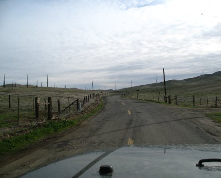
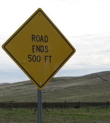
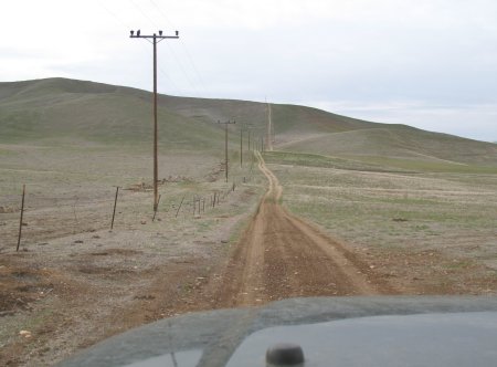
From there, it was off to check on those dirt roads I’d seen. We were on fun backroads (one of them quite rough) as soon as we got off the highway, and in a nice rural area. Unfortunately, every access point turned out to be a dead end. Most were gated, a few were signed, and the remaining few probably should have been signed (or used to be.) Even the unsigned ones looked to dead end quickly, which was later confirmed via Google Earth.
So the network of dirt roads that had drawn me here appears to be basically inaccessible. That’s unfortunate, as it’s a nice area and I bet it would be a fun place to drive.
One place I was hoping to reach (which looked simple enough if not for those pesky gates) was N37° 00.000′ W121° 00.000′ but it was not to be. It may be accessible from one of the roads heading west from I-5, but that would be a full day trip in itself to investigate.
I completed my reconnaissance around the southern edge of the reservoir, and then up to the park area on the other side of the highway to the north, but other than the occasional and very brief patch of dirt road, I simply struck out. There are a lot of dirt roads around here that are signed for official vehicles only, which was a bummer. Speaking of which, there were plenty of ranger vehicles on patrol, although almost all of the ones I saw were on paved roads.
So the mission was unsuccessful in finding any new places to offroad, but it was still a nice trip (other than the traffic jam) and an interesting area. There are much worse ways to spend an afternoon.
Someone once asked Jeff Cooper, who had just returned from a full day of hunting, if he’d had any luck while he was out. Jeff replied “Oh yes, I had wonderful luck. I was hunting all day!”