Hawaii, the Big Island – Part 8
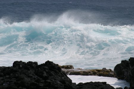
Amazing color of a South Point Wave
After the long drive, we’d finally reached the start of South Point Road. With all of the stops along the way, it had taken us nearly 3½ hours to cover the 90 miles to get there.
It was clear now that not only was Green Sand Beach not an option, now we’d not have anywhere near enough time for Volcanoes National Park. That was OK with Allison, who was over-dramatically expressing her wide-eyed fear of “hot lava”. In the end, Carrie and I were bummed about not making it to the volcano park, while Allison looked quite smug about the outcome.
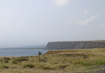
Driving south on South Point Road, we noticed that the jungle had pretty much given way to pastures, fields, and trees. There were small houses and a few large ones along the narrow 2-lane road. Apparently you used to need to drive the road very carefully, or bring a vehicle with good ground clearance, but it had been repaved sometime in the relatively recent past.
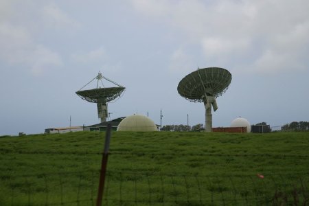
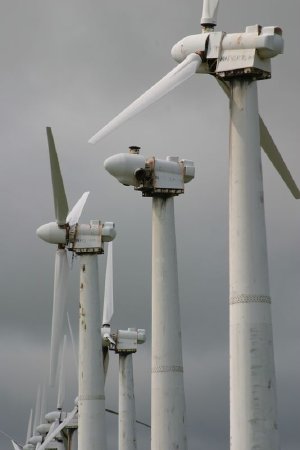
“Can you get the Formula 1 race on those things?“
The houses grew more spread apart as we got closer to the south coast, and the properties looked increasingly like small ranches. The trees grew less frequent as well, and the landscape started to look more windswept. Some large dish antennas appeared on one side, apparently part of a commercial space telemetry company. As we passed the last residences and the enormous windmills of a wind farm, the good pavement ended and the rutted, potholed road narrowed to about one lane.
I drove past the abandoned old USN/USAF radar tracking station, noting to check on some benchmark opportunities there on the way back, and soon took the turnoff to the official South Point. A few minutes later, we’d reached the end of the road for normal cars. We parked out of the way and climbed out into the windy, southernmost point of the United States.
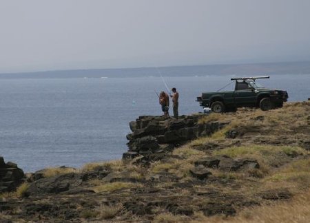
We walked west about a hundred feet to a sort of cliffside central parking area for locals in their pickups and some SUVs. They were all here for the fishing, which was reported to be spectacular, if unusual, due to the unimpeded approach of the Pacific to this part of the island. There were platforms on the cliff which are/were used to lower boats. Some of the fishermen here used large plastic bags to float their lines out to the deep waters, while they remained on the cliff tops. All were using the longest fishing lines I’d ever seen.
It is thought that this area – called Ka Lae – is where the first Polynesians landed on the Hawaiian islands, back around the time of Christ. It was an interesting exercise to wonder what motivated those brave early explorers, and what their reactions were to finding this large island.
We walked south to a prominent local landmark, a large black and white checkered sign and light beacon on top of a white pole. This was the southernmost benchmark in the entire United States, and being the benchmarking geek that I am, I got a thrill from seeing, photographing, and actually touching the thing.
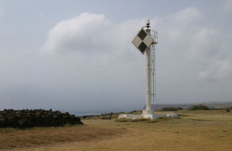
Ka Lae Light Beacon, aka NGS benchmark TU2077
Just south of the beacon was the rocky coastline itself, which was being pounded with waves of a spectacular light blue color. Here, safely away from the waves, was the southernmost geocache in the US as well. After a brief search by the family among the many rocks, Carrie spotted the cache which was soon opened and the logbook signed. Yes!
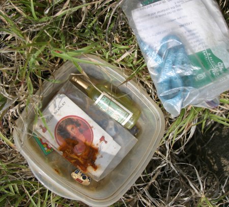
I can’t believe I’m happy to see some skunky tupperware.
We spent some time hopping on the rocks, admiring the waves, ocean and shoreline, and taking pictures. It was a wonderful area, and warm enough to offset the chill from the moderate wind. Another couple appeared and I wondered if they were geocachers as well, or merely enjoying this unique location.
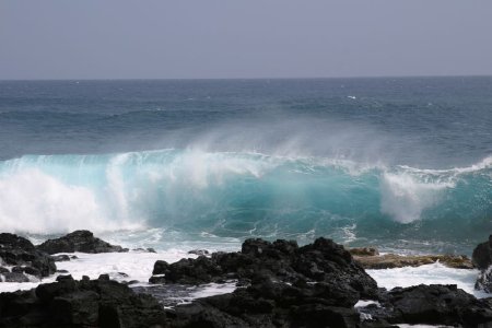
There’s nothing but ocean between these rocks and Antarctica.
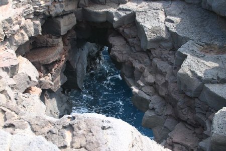
We poked around the area and generally enjoyed ourselves before heading back to the car. I found another geocache and a benchmark disk along the way, and then back near the locals I spotted a pair of large, rough holes in the rocky ground, each of which led to the crashing surf below. I think the Hawaiian people used to tie their boats up below and access them this way, and one source said that these holes were made by those ancient Hawaiian people, so they could more easily access the water in the lava tubes below.
We drove north again, taking our time to look at the derelict old tracking station buildings, and the old Kamoa wind farm. Many of its turbines are in a poor state, with missing and/or broken blades, and sit silent and still. A newer wind farm is just beyond it.
We took in all of the scenery and houses again on the drive back up to the main highway, and then soon stopped for a geocache and historical marker which marked where lava had destroyed the home of one Captain Robert Brown in 1868.
From there it was mostly smooth sailing (driving) back to base. There were more stops though, not the least of which was for Allison, whose stomach wasn’t feeling well. At a restroom break she lost her suspect lunch while in the bathroom with mommy, while I meandered about the store and procured a pound of Kona coffee beans. Happily, she soon felt better, and was able to avoid any further ailments.
Finally after a long day we made it back to the lanai. Tomorrow would be another big day… Mauna Kea!