Drive #4: Mt. Hebo

Drive #4 – Mt. Hebo
Dates Driven: 12/26/05 and 11/21/12
Length: 16.8 miles round trip
My drive time: 50 minutes
Start: N45º 13.817′ W123º 51.676′.
End: Same as start.
<GPS Track: GPX or KMZ format. (right click -> Save As)
Source(s): N/A
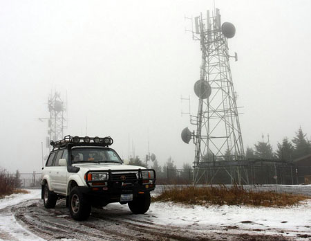
Summary: This paved backroad drive takes you from the tiny town of Hebo (elevation about 64 feet) to the top of Mt. Hebo at 3200′. The peak offers either extreme weather or long-distance views.
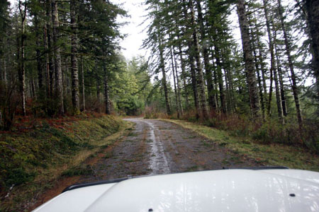
Description: The drive to Mt. Hebo is a simple backroad drive, although in winter the weather can make things a little challenging with snow, ice and fallen branches. Or fallen trees, for that matter! I’ve been to the peak twice, and have been hailed on both times. That’s what I get for going in winter…
When we went up this year, I knew from the ham radio folks that have a repeater station at the summit (including several webcams) that a fallen tree had been cleared the day before, just after a big winter storm had hit. There were small branches everywhere on the drive up, and a few larger ones to avoid, but nothing major. The snow level was well under 2,000′ but there wasn’t much accumulation or ice. I drove slowly & had no issues at all.

There is a seasonal campground at Lake Hebo along the drive up. Mt. Hebo is part of the Siuslaw National Forest and they have a full web page dedicated to the recreational opportunities in the area, including hiking and horseback riding. There are geocaches and benchmarks for those like me who enjoy that sort of thing.
Mount Hebo Air Force Station (AFS) used to be located on the summit. Check out the great photos and information at the radomes.org site, which give an idea of what it was like to winter-over up there!
When the weather cooperates, the views from the top can be pretty impressive. Even without them, I have enjoyed our visits here, and the chance to spend time in the snow and woods.
Disclaimer – This information is provided from the best of my recollection and is necessarily subjective. GPS data is from a personal device inside my vehicle, so coordinates will not be exact. Use of any of this information is at your own risk and responsibility – period. Conditions change (especially in winter), vehicles and driver skills vary, etc. and I have no control over these things. Don’t let anything written here override your own personal common sense or safety.

I like the new ‘Drives’ category! Too bad I can’t take any of them.
December 12th, 2012 at 6:27 pmThanks! I’m Glad that someone likes it… I’ll be adding more soon, which will be in California at least. 🙂
December 13th, 2012 at 8:33 am