Drive #1: Klamathon Road
Welcome to the first installment of my new Drives category. These will offer basic information, photos, and GPS tracks which I hope readers will find useful.
Klamathon Road
Date Driven: 11/17/12
Length: 5 miles
My drive time: 17 minutes
Start: N41º 51.327′ W122º 34.239′.
End: N41º 53.901′ W122º 30.550′.
GPS Track: GPX or KMZ format. (right click -> Save As)
Summary: A quick and easy scenic dirt road right off I-5 and the Klamath River. Suitable for most any vehicle that can handle a bumpy dirt road. There are some narrow stretches.
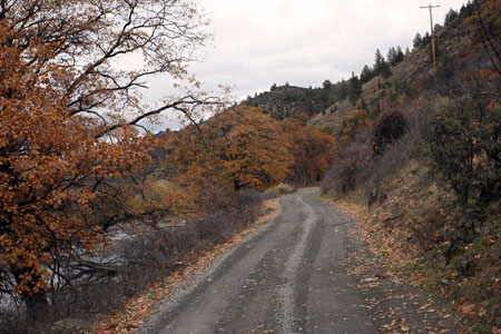
Description: I’ve driven on I-5 past here many times and had always looked across the Klamath River and seen this little dirt road. It always looked so enticing, being something of a shelf road as it closely followed the river, past a ramshackle old house with a few dilapidated outbuildings. I’d wondered if it was a private road, and occasionally spotted vehicles on it, or parked along the river.
The exit off I-5 can be taken in either direction. There is a rest area off of the same exit, also adjacent to the river, and it’s arguably the nicest rest area location on I-5. Klamathon Road actually runs under I-5 here and is paved. It’s unpaved – and much more interesting, where my track begins on the east side of the highway.
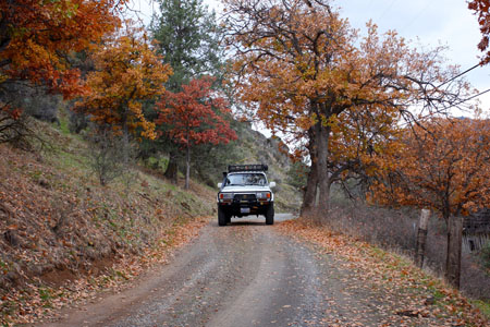
When we drove it, the dirt road was well-maintained with few potholes or rocks. Early on, the road is narrow and generally one lane. Before long it gets wider as it gets a bit further from the river banks. Soon we were passing the odd house, and parked pickups belonging to fishermen. At one house, several dogs went into a barking frenzy and ran into the roadway, but we just drove past them.
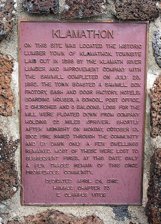
At the northeast end of the drive is the monument and plaque to the old town of Klamathon. After that, you’re back at pavement at the intersection with Ager Road. We took that road a short distance north, over the river, and then returned to I-5 via a short drive on Cr-A28 (Copco Road).
All in all, this is a quick and pleasant dirt road drive. The southern section which is closest to the river, with several apparent places you could park a 4×4 for a picnic, is the more interesting part of the drive. This absolutely isn’t a drive you’d want to go out of your way for, but it’s there as a welcome (and brief) diversion from a long haul on I-5. It pays to keep your eyes open for opportunities like this one, since you never know when you’ll find something interesting or downright wonderful.
Disclaimer – This information is provided from the best of my recollection and is necessarily subjective. GPS data is from a personal device inside my vehicle, so coordinates will not be exact. Use of any of this information is at your own risk and responsibility – period. Conditions change (especially in winter), vehicles and driver skills vary, etc. and I have no control over these things. Don’t let anything written here override your own personal common sense or safety.


