N37° 11.510′ W121° 59.355′
Yesterday afternoon, I dragged Allison out on a short little adventure to revisit the former town of Lexington, or what remains of it anyway.
I have two geocaches hidden there to help point out these ruins to those that are interested in such things. Yesterday morning, someone logged a find on one and noted that the Lexington road bridge was surfacing, although they didn’t include any photos with their log. Still, having enjoyed my visits to two other bridges which have been submerged by reservoirs (Uvas and Chesbro) for several decades now, I was eager to add this one to the list. And since one of the key rules of these bridges is to visit while you can!, we did just that.
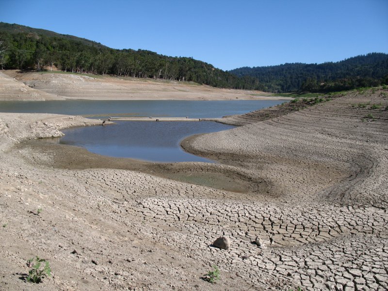
The former town of Lexington has been underwater since the construction of Lexington Reservoir was completed over fifty years ago, in 1952. Like the other reservoir bridges in the area, this one makes a rare appearance during especially dry seasons. In this case, the reservoir has been intentionally maintained at a very low water level while a spillway upgrade is underway. That work is scheduled to be completed in the fall of 2009.
According to several sources (including Ghost Towns of the Santa Cruz Mountains), one of the main roads from Los Gatos to Santa Cruz originally crossed St. Joseph’s Hill to the north and then passed through the small towns of Lexington (here) and Alma (a short distance south.) The road followed the route taken by the De Anza party, which scouted the region for the Spanish missions of the era.
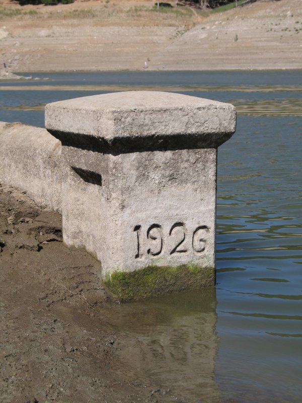
Today, the remains of the paved roadway can be seen in several places. Last year, the roadway at the north was one of the first old remnants to surface as the waters receded. Soon, several stone and/or concrete foundations appeared. Now, the old road bridge – built in 1926 – is the latest revelation. Like the other submerged bridges, this one has spent more of its life under water than above.
First glimpse of the bridge.
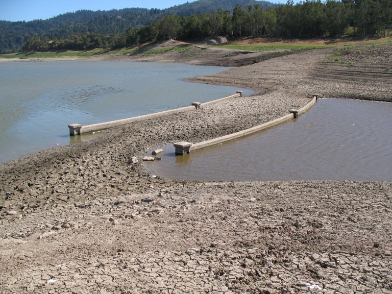
The bridge has a slight curve. Remains of the old roadway can be seen in the background.
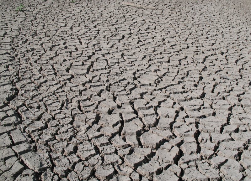
Dried lake bed.
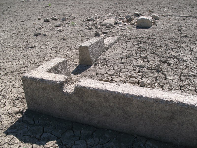
The newest foundation to appear, one of several here.
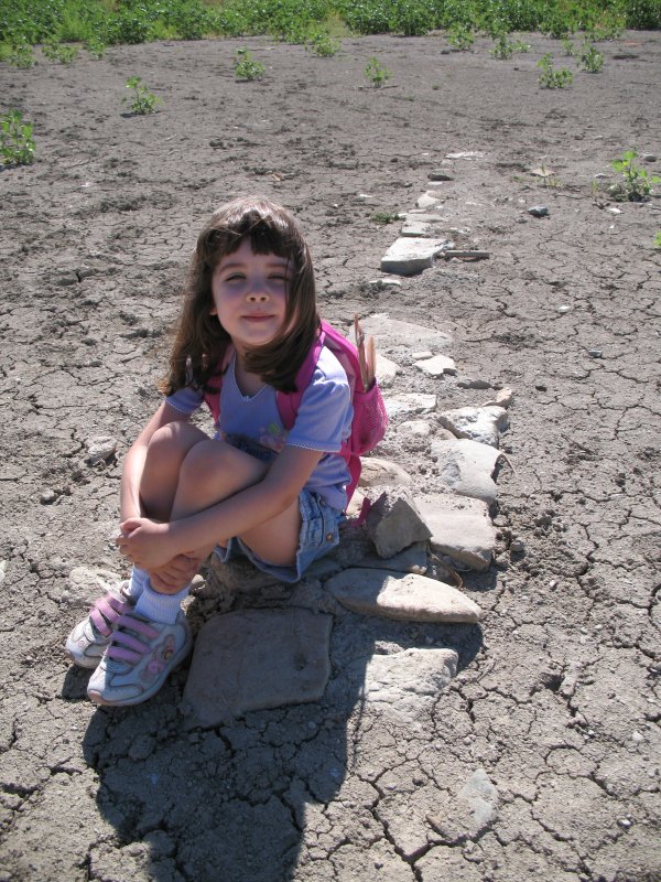
Adventurer Allison at one of the larger, stone foundations.
The coordinates in the title were taken at the center of the old road bridge. Check it out – while you can.