First |

The only one of my many offroad guidebooks that had information on Tassajara Road was "Backcountry Adventures: Southern California" by Massey and Wilson. I'm a big fan of the series but it does have some flaws:
1. The waypoint coordinates they give (and I'm very glad they do give them) are in the format of degrees, minutes, and seconds, which gives pretty poor granularity. In very rough and rounded terms, every second is about 80 feet. Had they used degrees, minutes, and decimal then you'd be taling about closer to five feet per increment.
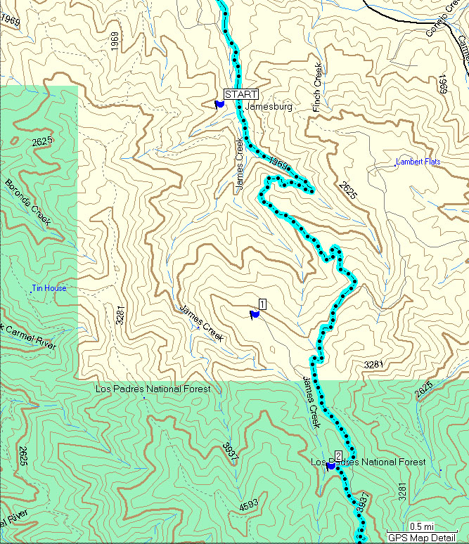
2. Even that chosen standard was not maintained in the book, as most of the waypoints were much further off than they might have been. As you see on the image, all of the listed waypoints from the book were west of the actual road. The one marked as "START" is roughly 600' off, while "2" is 275' west of the road. I didn't check the waypoints for north/south accuracy.
3. Waypoint "1" has a typo in the book that I didn't even notice at first, containing 79(!) minutes in the coordinate, which is impossible. My mapping program helpfully converted it by treating it as 1.19 minutes, which was of course was still not correct, so it's well over half a mile west of the road.
4. I dont know anyone that considers Monterey and Carmel as part of "Southern California." They're included in a sub-region there as a convenience for the books, but I'd hate to have bought the Northern California book via the web, only to have it arrive and not have the trails that are closest to me in the San Francisco Bay area.
Overall, these are minor complaints that only slightly detract from the tremendous value in those books and I still would highly recommend them.